
01 Feb INSAT 3DR
This article covers ‘Daily Current Affairs’ and the “topic details of INSAT 3DR” .This topic is relevant in the “Science & Technology” section of the UPSC CSE exam.
Why in the News?
The India Meteorological Department (IMD) has warned that there is a good chance of “very dense fog” in Delhi, Chandigarh, and Haryana. Additionally, maps from the INSAT 3D and occasionally the INSAT 3DR satellites have been included with IMD notifications.
About INSAT 3DR
- The IMD forecasts and monitors the weather using INSAT-3D and INSAT-3DR satellite data.
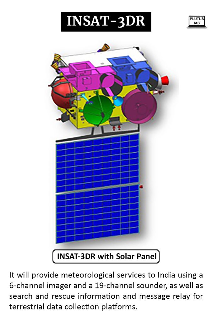
- Like INSAT-3D, INSAT-3DR is a sophisticated meteorological satellite from India that is outfitted with an atmospheric sounder and an image system.
- An atmospheric sounder records the changes in an air column’s physical characteristics with height.
- It has one visible band and multiple infrared channels ranging from longwave to shortwave wavelengths.
- The noteworthy enhancements integrated into INSAT-3DR are:
- Middle Infrared imaging to provide images of low clouds and fog at night.
- Two thermal infrared bands can be imaged to improve the accuracy of sea surface temperature (SST) estimation.
Payloads in INSAT 3DR
- Multi-Spectral Imager: It would take pictures of the planet every 26 minutes to give data on a range of factors, such as winds, cloud motion, and sea surface temperature.
- Sounder: It will provide you data on humidity and temperature.
- Data-Relay Transponder: It is intended to receive data related to oceanography, hydrology, and meteorology.
- Satellite-assisted search and rescue transponder: It will be utilised to receive and transmit alarm signals from aviation and maritime distress beacons, among other sources.
Imaging Process:
- Light capture: Sunlight and infrared radiation emitted from Earth are captured by the mirror and focused by the telescope.
- Spectral separation: Dichroic filters separate the incoming light into different wavelength bands (visible, infrared) and direct them to specific detectors.
- Detection: Each detector converts the incoming radiation into electrical signals according to its sensitivity.
- Signal processing: The electrical signals are amplified, digitized, and processed onboard the satellite.
- Data transmission: The processed data is transmitted to Earth receiving stations for further analysis and interpretation
Key Features:
- Multispectral imaging: INSAT-3DR captures images in six wavelength bands, providing information on various atmospheric and surface features.
- High resolution: The imager offers spatial resolutions ranging from 1 km (visible band) to 4 km (infrared bands), capturing detailed information.
- Rapid scanning: The scanning mechanism allows for frequent observations of the Earth, with an image of the entire disk generated every 26 minutes.
- Advanced capabilities: The imager includes features like:
- Middle Infrared band: Provides night-time images of low clouds and fog.
- Dual Thermal Infrared bands: Enhances accuracy in estimating sea surface temperature (SST).
- Rapid scan mode: Offers even faster observations over specific regions for tracking severe weather events.
Applications:
The data gathered by INSAT-3DR’s imaging system has numerous applications, including:
- Weather forecasting: Predicting weather patterns, cyclones, and other severe events.
- Climate monitoring: Tracking changes in global temperatures, cloud cover, and other climate indicators.
- Ocean monitoring: Monitoring sea surface temperature, currents, and potential fishing zones.
- Disaster management: Providing crucial information for disaster preparedness and response efforts.
About India Meteorological Department
Established in 1875, the India Meteorological Department (IMD) serves as the nation’s primary weather authority. Its responsibilities are vast and crucial, encompassing:
- Observing and Monitoring: IMD operates a vast network of observatories, radars, and satellites, constantly gathering data on temperature, rainfall, wind, and other atmospheric conditions. This real-time monitoring helps understand weather patterns and predict future events.
- Forecasting and Warnings: From daily weather forecasts to issuing timely warnings about cyclones, heatwaves, and floods, IMD plays a critical role in safeguarding lives and livelihoods. Their accurate predictions enable proactive measures, minimizing weather-related damage.
- Climate Services: IMD provides long-term climate data that’s vital for agriculture, water management, and disaster preparedness. Understanding past and present trends helps predict future climate scenarios and mitigate potential risks.
- Research and Development: IMD actively researches advancements in weather forecasting techniques, satellite technology, and climate modeling. This continuous innovation improves the accuracy and scope of their services.
- International Collaboration: IMD actively participates in global weather organizations, sharing data and expertise, contributing to global weather prediction models, and benefiting from international knowledge exchange.
- Impact on daily Life: From farmers planning their crops to airlines optimizing flight routes, IMD’s services touch every aspect of life in India. Their work ensures informed decision-making, promotes economic activity, and protects lives in the face of nature’s fury
Download plutus ias current affairs eng med 1st Feb 2024
Prelims practice questions
Q1) Consider the following statements:
1) Ministry of Earth Sciences is responsible for the administration of IMD
2) INSAT satellites operate in Geostationary Orbit
3) C-band is commonly used by INSAT satellites for telecommunications services
How many statements given above are correct?
a) One
b) Two
c) Three
d) None
ANSWER: C
Q2) What is the purpose of the Doppler Weather Radar used by IMD?
a) Air traffic control
b) Earthquake prediction
c) Cyclone tracking and precipitation estimation
d) Solar radiation measurement
Answer: C
Mains practice questions
Q1) Explain the role of INSAT satellites in disaster management. How do they contribute to early warning systems and emergency response?

No Comments