
04 May Lipulekh Row: Unraveling the India–Nepal Boundary Puzzle
This article covers “Daily Current Affairs”
SYLLABUS MAPPING : GS Paper 2 : IR , GS Paper 3 : Security;
FOR PRELIMS : Nepal Border Details, Treaty of Sugauli, etc.
FOR MAINS : Examine the strategic significance of the India–Nepal border and suggest measures to resolve disputes without affecting bilateral relations.
Context
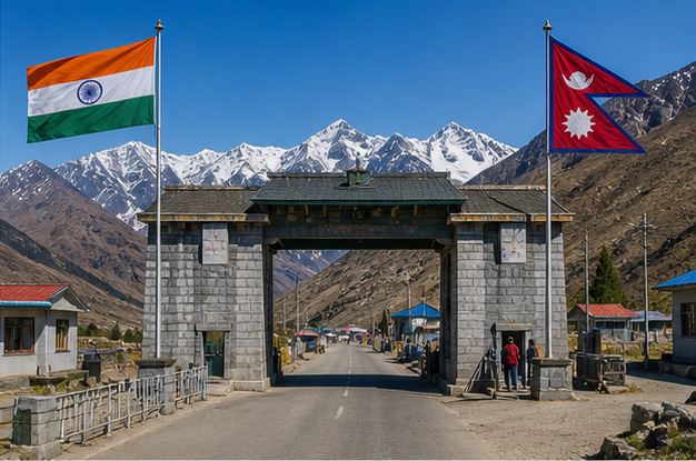
Nepal recently objected to India’s use of the Lipulekh Pass for facilitating the Kailash Mansarovar Yatra, arguing that the area falls within its sovereign territory. India, however, rejected this claim, reiterating that Lipulekh lies within its jurisdiction based on historical control and administrative presence. This disagreement has once again brought attention to the unresolved boundary issues between India and Nepal, which periodically surface despite otherwise close diplomatic, cultural, and economic relations.
Understanding the India–Nepal Border
The India–Nepal boundary extends over ~1,751 km, making it one of the longest open international borders in the world. Under the 1950 Treaty of Peace and Friendship, citizens of both countries enjoy visa-free movement, leading to deep socio-economic integration, cross-border employment, and cultural interlinkages.
This openness, while beneficial, creates administrative and security challenges such as informal migration, smuggling, and border ambiguity, especially in sensitive regions. Additionally, the border’s proximity to China’s Tibet region adds a strategic and geopolitical dimension, meaning even localized disputes can have wider regional implications.
Nature of the Border Dispute
The dispute originates from the interpretation of the Treaty of Sugauli, which defined the Kali River as Nepal’s western boundary. However, the treaty did not clearly define the river’s origin, creating a foundational ambiguity.
India and Nepal rely on different colonial-era maps and cartographic records, many of which are inconsistent. As a result, the dispute is not merely territorial but involves legal interpretation, historical geography, and competing national narratives, making resolution complex.
Key Disputed Areas
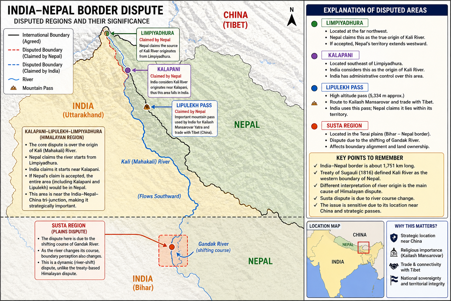
- The core dispute lies in the Kalapani–Lipulekh–Limpiyadhura region, where disagreement exists over the origin of the Kali River. India considers the source near Kalapani, placing the region within its territory, while Nepal claims Limpiyadhura as the origin, thereby extending its boundary westward.
- The Lipulekh Pass is particularly significant as it serves as a strategic corridor connecting India to Tibet, and is used for trade and pilgrimage. Its growing importance due to infrastructure development has heightened tensions.
- In contrast, the Susta region (Terai plains) represents a riverine dispute, where the shifting course of the Gandak River alters boundary perception. Unlike the Himalayan dispute, Susta is a dynamic geographical issue, not purely treaty-based.
Recent Developments
- The dispute intensified in 2020, when India constructed a road to Lipulekh to facilitate the Kailash Mansarovar Yatra. Nepal perceived this as a unilateral action in disputed territory and strongly protested.
- Subsequently, Nepal released a new political map (2020) incorporating Kalapani, Lipulekh, and Limpiyadhura, and further amended its Constitution to formalize these claims—significantly escalating the issue.
- Although diplomatic dialogue resumed afterward, the issue has re-emerged recently, indicating that it remains unresolved and politically sensitive.
India’s Position
India asserts that the disputed regions are part of its territory based on historical administrative control, continuous governance, and ground presence (including security forces). It also emphasizes the long-standing use of Lipulekh for pilgrimage and trade, arguing that current activities are not new assertions.
At the diplomatic level, India promotes bilateral dialogue and peaceful resolution, ensuring that the dispute does not derail broader ties under its “Neighbourhood First” policy.
Nepal’s Perspective
Nepal bases its claim on the argument that the Kali River originates from Limpiyadhura, thereby expanding its territorial boundary westward. This interpretation is supported by select historical maps and documents.
The issue holds strong domestic political significance in Nepal, often linked to national sovereignty and territorial integrity, which reduces negotiation flexibility. Nepal has also raised concerns about being excluded from India–China agreements, particularly those involving Lipulekh.
Strategic Importance of Lipulekh
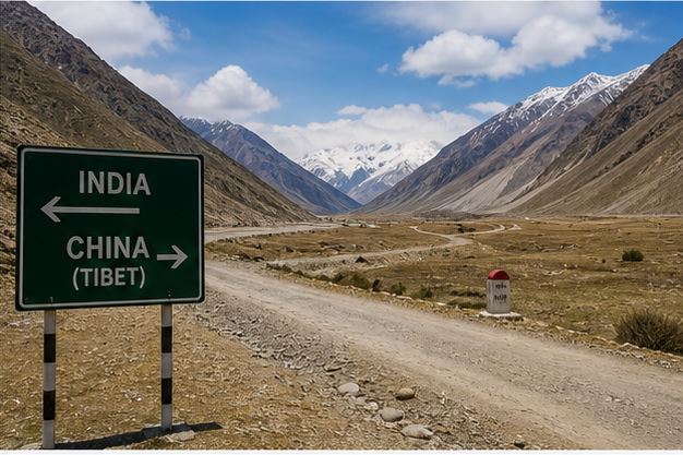
- The Lipulekh Pass is strategically crucial due to its location at the India–Nepal–China tri-junction, making it important for border security and surveillance.
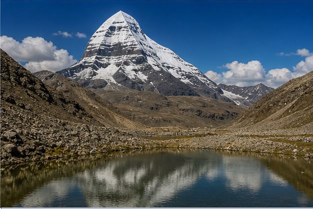
- It is also a key route for the Kailash Mansarovar Yatra, providing access to Mount Kailash, a site of religious importance for Hindus, Buddhists, and Jains.
- Additionally, it serves as a trade corridor with Tibet, enhancing regional connectivity and economic activity.
Challenges in Resolution
- The dispute persists due to ambiguities in historical treaties, especially the lack of clarity regarding the river’s origin. Colonial-era mapping inconsistencies further complicate claims.
- The rugged Himalayan terrain makes accurate demarcation difficult, while political sensitivities and nationalism, particularly in Nepal, reduce compromise space.
- The presence of a tri-junction with China adds a geopolitical dimension, making the issue more complex than a bilateral dispute.
Way Forward
- Resolving the dispute requires sustained diplomatic engagement through mechanisms like Joint Boundary Committees, ensuring continuous dialogue and trust-building.
- Both countries should undertake joint technical surveys using GIS and satellite mapping, which can provide objective and scientific clarity on boundary alignment.
- Maintaining status quo and avoiding unilateral actions is essential to prevent escalation. At the same time, strengthening economic cooperation, connectivity, and cultural ties can create a positive environment for resolution.
- Ultimately, a pragmatic and balanced approach, combining legal claims with ground realities and mutual interests, is necessary for a long-term sustainable solution.
Prelims Question
Q. With reference to the India–Nepal boundary dispute, consider the following statements:
- The Treaty of Sugauli defined the Kali River as the western boundary of Nepal.
- The Lipulekh dispute arises due to differing interpretations of the origin of the Kali River.
- The Susta dispute is mainly due to disagreement over the origin of the river.
Which of the statements given above is/are correct?
(a) 1 and 2 only
(b) 2 and 3 only
(c) 1 and 3 only
(d) 1, 2 and 3
Answer: (a) 1 and 2 only
Explanation:
Statements 1 and 2 are correct. Statement 3 is incorrect because the Susta dispute arises due to the shifting course of the Gandak River, not its origin.
Mains Questions
Discuss the historical basis and contemporary relevance of the India–Nepal boundary dispute, with special reference to the Lipulekh issue. (15 M).
- India’s Push Beyond E20 Fuel: Reasons, Pitfalls, and the Flex Fuel Future - June 15, 2026
- RBI’s Reviving of FCNR(B) Swap Scheme again in 2026 - June 15, 2026
- Modi’s France Visit & the 52nd G7 Summit - June 13, 2026

No Comments