


02 Sep LiDAR Survey to Uncover Hidden Monuments in Lakkundi for UPSC Exam
✎ LiDAR and geospatial technologies enable non-invasive archaeological surveys by penetrating vegetation and subsurface layers to reveal concealed structures, enhancing precision in heritage documentation and conservation.
Subject Relevance — Where This Topic Fits
- GS Paper I — History and Culture: Ancient Indian Architecture and Archaeological Methods | GS Paper III — Science and Technology: Applications of Remote Sensing and GIS
- Prelims: LiDAR, Ground Penetrating Radar (GPR), GIS mapping, remote sensing, photogrammetry, Kalyana-Chalukya architecture, Vesara style, cultural heritage conservation
- Essay: The Role of Technology in Preserving India’s Cultural Heritage, Sustainable Management of Archaeological Sites: Balancing Conservation and Development
Quick Revision: LiDAR and geospatial technologies enable non-invasive archaeological surveys by penetrating vegetation and subsurface layers to reveal concealed structures, enhancing precision in heritage documentation and conservation.
Why is this in the news?
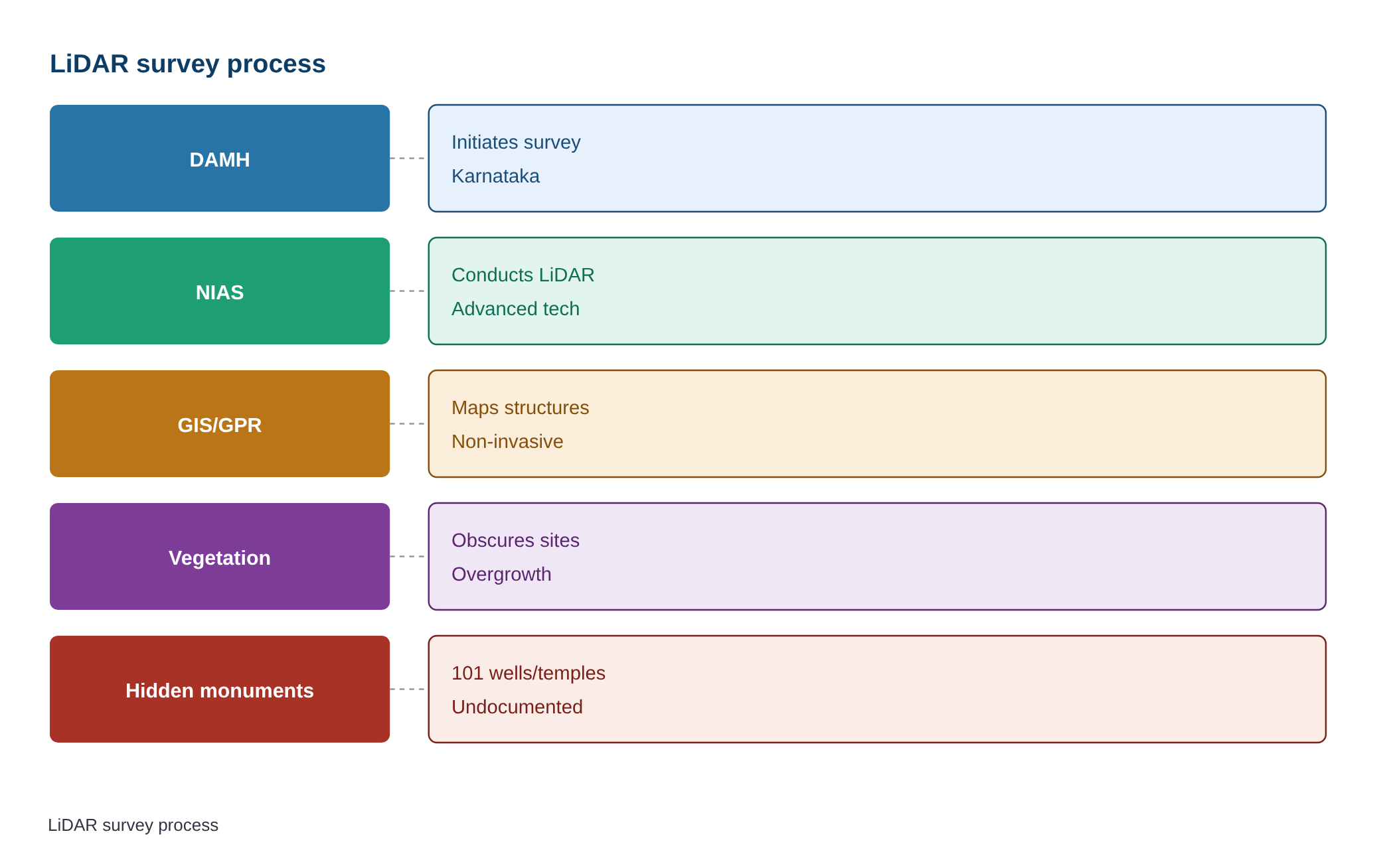
The Department of Archaeology Museums and Heritage (DAMH), Karnataka, has initiated a LiDAR survey in Lakkundi, Gadag district, to uncover concealed monuments from the Kalyana-Chalukya period (10th–12th centuries CE). Signed on August 27, 2026, the MoU with the National Institute of Advanced Studies (NIAS) aims to employ advanced geospatial technologies—including LiDAR, GIS mapping, remote sensing, and Ground Penetrating Radar (GPR)—to document and map hidden structures obscured by vegetation or time. This initiative seeks to refine archaeological understanding and inform conservation strategies for a site of significant architectural and historical importance.
Background
- Lakkundi, historically known as Lokki, was a prominent urban centre during the Kalyana-Chalukya dynasty (10th–12th centuries CE), a period marked by architectural innovation in Deccan and southern India.
- Local traditions assert the existence of 101 wells and 101 temples, most of which remain concealed due to vegetation overgrowth or burial, suggesting a broader archaeological landscape than currently documented.
- The use of LiDAR and geospatial technologies in archaeological surveys has gained prominence globally, enabling non-invasive detection of subsurface features and efficient documentation of heritage sites.
What are LiDAR, GIS, and Related Technologies in Archaeology?
- Light Detection and Ranging (LiDAR): A remote sensing method that uses laser pulses to create high-resolution 3D maps of terrain, capable of penetrating dense vegetation to reveal buried structures, earthworks, or micro-topography.
- Ground Penetrating Radar (GPR): A geophysical method that uses radar pulses to image subsurface structures, detecting anomalies such as buried walls, foundations, or cavities without excavation.
- Geographic Information System (GIS): A framework for collecting, storing, analysing, and visualising spatial and geographic data, enabling layered mapping of archaeological features, land use, and environmental contexts.
- Remote Sensing: The acquisition of information about an object or phenomenon without physical contact, typically using satellite or aerial imagery to monitor changes over time or identify hidden features.
- Photogrammetry: The science of making measurements from photographs, used to create detailed 3D models of archaeological sites or artefacts from drone or aerial imagery.
- These technologies collectively enhance the precision, efficiency, and non-destructive nature of archaeological surveys, reducing reliance on conventional, labour-intensive methods.
- Their application in Lakkundi exemplifies how modern tools can augment traditional archaeological practices to uncover and conserve India’s rich cultural heritage.
Key Features
| Feature | Significance |
|---|---|
| LiDAR survey | Enables high-resolution topographic mapping through vegetation cover, revealing buried or concealed structures without physical excavation. |
| GIS mapping | Integrates spatial data for layered analysis, aiding in the precise documentation and management of archaeological sites. |
| Remote sensing | Utilises satellite or aerial data to detect anomalies in terrain, vegetation, or moisture that may indicate hidden monuments. |
| Ground Penetrating Radar (GPR) | Employs electromagnetic pulses to identify subsurface features, such as foundations or buried artefacts, with minimal disturbance. |
| Drone documentation | Facilitates rapid, high-resolution aerial imagery for surveying inaccessible or dense vegetation-covered areas. |
Why it Matters
Archaeological and Historical
- Expands the known archaeological inventory of Lakkundi, a key urban centre of the Kalyana-Chalukya dynasty (10th–12th centuries CE), potentially uncovering structures that redefine its historical narrative.
- Provides empirical evidence to validate local traditions, such as the existence of 101 wells and 101 temples, which have remained unverified due to overgrowth and time.
- Enhances understanding of the Vesara architectural style, a hybrid of Nagara, Dravida, and Bhumija traditions, by revealing previously unrecorded structures.
Technological and Methodological
- Demonstrates the application of advanced geospatial technologies in heritage conservation, setting a precedent for similar initiatives in India.
- Reduces reliance on conventional, labour-intensive surveys by narrowing excavation sites through non-invasive techniques, improving efficiency and reducing costs.
- Establishes a model for interdisciplinary collaboration between government departments (DAMH) and academic institutions (NIAS), integrating archaeology with cutting-edge science.
Conservation and Management
- Supports the preparation of a Detailed Project Report (DPR) for Lakkundi’s inclusion in heritage conservation frameworks, aligning with the State government’s objectives.
- Enables evidence-based decision-making for the sustainable preservation of monuments, balancing conservation with public access and tourism development.
- Facilitates long-term monitoring of archaeological sites through digital documentation, aiding in the mitigation of threats such as encroachment or environmental degradation.
Challenges
1. Interpretation of Geospatial Data
- Requires expert analysis to distinguish between natural terrain features and archaeological remains, avoiding false positives or misinterpretation.
- Demands collaboration between archaeologists, geospatial scientists, and historians to contextualise findings within historical and cultural frameworks.
UPSC Link: GS Paper 1: Indian Heritage and Culture
2. Ethical and Cultural Sensitivity
- Ensures that survey methods do not disturb sacred or culturally sensitive sites, particularly in a region with deep-rooted traditions and religious significance.
- Balances the pursuit of archaeological discovery with the preservation of local beliefs and community sentiments regarding hidden structures.
UPSC Link: GS Paper 1: Indian Heritage and Culture
3. Resource and Capacity Constraints
- Limited availability of trained personnel in advanced geospatial technologies within government archaeological departments may hinder implementation.
- High costs associated with LiDAR surveys, drone operations, and data processing require sustained funding and resource allocation.
UPSC Link: GS Paper 2: Government Policies and Interventions
4. Data Privacy and Security
- Ensures that high-resolution imagery and spatial data do not compromise the security of sensitive archaeological sites or facilitate illegal activities such as looting.
- Implements protocols for data storage, sharing, and access to prevent misuse or unauthorised dissemination of cultural heritage information.
UPSC Link: GS Paper 3: Security Challenges
5. Sustainability of Conservation Efforts
- Post-survey, the conservation of newly discovered structures requires long-term funding, skilled labour, and community engagement to prevent deterioration.
- Balances the need for preservation with the potential for tourism, ensuring that increased visibility does not lead to over-exploitation or damage.
UPSC Link: GS Paper 3: Environmental Conservation
Challenges — UPSC Perspective
| Issue | Concern |
|---|---|
| Data interpretation | Risk of misidentifying natural terrain features as archaeological remains due to lack of expert analysis. |
| Community engagement | Potential resistance or scepticism from local communities regarding the survey’s objectives and outcomes. |
| Resource allocation | High operational costs and limited institutional capacity to sustain long-term conservation efforts. |
| Ethical considerations | Need to ensure that survey methods do not disturb sacred sites or violate cultural sensitivities. |
| Data security | Risk of unauthorised access to high-resolution spatial data, leading to potential misuse or looting. |
Way Forward
- Constitute the Joint Coordination Committee (JCC) as stipulated in the MoU to oversee the survey’s implementation and ensure inter-institutional synergy.
- Develop a phased action plan for the six-month survey, prioritising areas with the highest potential for concealed structures based on preliminary remote sensing data.
- Train archaeological staff in geospatial technologies, including LiDAR, GIS, and GPR, to build in-house capacity for future heritage documentation.
- Engage local communities through awareness programmes to explain the survey’s objectives, address concerns, and foster ownership of heritage conservation efforts.
- Establish a digital repository for survey data, ensuring secure storage, metadata documentation, and accessibility for researchers and policymakers.
- Collaborate with ISRO and other scientific institutions to explore funding opportunities and technological advancements for heritage conservation.
- Integrate survey findings into the Detailed Project Report (DPR) for Lakkundi’s heritage conservation, aligning with national and state-level heritage management frameworks.
- Formulate a post-survey conservation strategy, including structural stabilisation, vegetation management, and community-based monitoring mechanisms.
UPSC Value Addition
Keywords for Mains Answer-Writing
LiDAR survey in archaeology · Light Detection and Ranging (LiDAR) · GIS mapping and remote sensing · Ground Penetrating Radar (GPR) · Kalyana-Chalukya architecture · Vesara style of temple architecture · Archaeological documentation and conservation · Cultural heritage management · Digital archaeology · Lakkundi heritage landscape · National Institute of Advanced Studies (NIAS) · Department of Archaeology Museums and Heritage (DAMH) · UNESCO heritage site nomination
Concept Flow
Local tradition and historical records suggest the existence of concealed monuments in Lakkundi. → Department of Archaeology Museums and Heritage (DAMH) initiates a survey to validate these claims using advanced geospatial technologies. → MoU signed with National Institute of Advanced Studies (NIAS) for LiDAR, GIS, remote sensing, and GPR surveys. → Data collected is analysed to identify potential sites for hidden structures, reducing reliance on conventional excavation. → Findings are documented and integrated into heritage conservation frameworks, including the DPR for Lakkundi’s preservation. → Survey outcomes inform sustainable management practices, balancing conservation, tourism, and community engagement.
Prelims Practice Questions
Q1. Consider the following statements regarding the Kalyana-Chalukya dynasty:
1. The Kalyana-Chalukyas ruled between the 10th and 12th centuries CE.
2. Their architectural style is known as the Vesara style, which is a blend of Nagara, Dravida, and Bhumija styles.
3. The Lakkundi monuments are exclusively Dravidian in style.
4. The Kalyana-Chalukyas were contemporary to the Rashtrakutas.
How many of the above statements are correct?
- Only one
- Only two
- Only three
- All
Answer: Only three — Statements 1, 2, and 4 are correct. Statement 3 is incorrect as the Lakkundi monuments exhibit a hybrid Vesara style, not exclusively Dravidian.
Q2. Assertion (A): Light Detection and Ranging (LiDAR) technology is primarily used for mapping surface topography.
Reason (R): LiDAR can penetrate dense vegetation and detect subsurface structures, making it valuable for archaeological surveys.
Options:
A. Both A and R are true, and R is the correct explanation of A.
B. Both A and R are true, but R is not the correct explanation of A.
C. A is true, but R is false.
D. A is false, but R is true.
Answer: ? — Assertion (A) is true but incomplete; LiDAR is used for surface topography but its primary archaeological value lies in penetrating vegetation to detect subsurface structures. Reason (R) is true and correctly explains the broader application of LiDAR in archaeology.
Q3. Match the following pairs related to archaeological survey technologies with their primary applications:
Column I
1. LiDAR
2. GIS Mapping
3. Ground Penetrating Radar (GPR)
4. Remote Sensing
Column II
A. Creating layered maps of archaeological sites
B. Detecting subsurface anomalies using electromagnetic waves
C. Mapping surface topography using laser pulses
D. Capturing data from a distance using satellites or aircraft
Options:
A. 1-C, 2-A, 3-B, 4-D
B. 1-A, 2-C, 3-D, 4-B
C. 1-D, 2-B, 3-A, 4-C
D. 1-B, 2-D, 3-C, 4-A
- A
- B
- C
- D
Answer: A — 1-C (LiDAR maps surface topography using laser pulses), 2-A (GIS Mapping creates layered maps), 3-B (GPR detects subsurface anomalies), 4-D (Remote Sensing captures data from a distance).
Mains Practice Question
✍ The integration of advanced digital technologies such as LiDAR, GIS mapping, and remote sensing is transforming archaeological surveys in India. Critically examine the role of these technologies in the documentation, conservation, and sustainable management of cultural heritage sites like Lakkundi. Also, assess their potential to enhance India’s prospects in UNESCO World Heritage Site nominations. (15 Marks)
Approach: MODEL-ANSWER SKELETON:
1. Introduction (2 marks):
– Define LiDAR, GIS mapping, remote sensing, and GPR.
– State their growing relevance in archaeological surveys and conservation.
2. Role in Documentation (3 marks):
– LiDAR: Penetrates vegetation to create high-resolution 3D maps of surface and subsurface structures (e.g., Lakkundi’s concealed monuments).
– GIS Mapping: Integrates spatial data for layered analysis of heritage landscapes.
– Remote Sensing: Captures multi-spectral imagery to identify archaeological features.
– GPR: Detects buried structures (e.g., foundations, walls) without excavation.
3. Role in Conservation and Management (4 marks):
– Precision in identifying conservation priorities (e.g., erosion-prone areas).
– Reduces time and cost of conventional surveys by narrowing excavation sites.
– Enables digital archiving for future research and public engagement.
– Facilitates risk assessment (e.g., climate change impacts on monuments).
4. Sustainable Development and Heritage Governance (3 marks):
– Aligns with the National Mission on Monuments and Antiquities (NMMA).
– Supports the National Heritage City Development and Augmentation Yojana (HRIDAY).
– Enhances community participation via digital heritage trails.
– Complements the Archaeological Survey of India (ASI) guidelines for sustainable tourism.
5. UNESCO World Heritage Site Nominations (3 marks):
– Strengthens nomination dossiers with scientific evidence (e.g., Lakkundi’s Vesara architecture).
– Demonstrates India’s commitment to global heritage standards (e.g., UNESCO Operational Guidelines).
– Potential case study: Lakkundi as a serial nomination under the Kalyana-Chalukya ensemble.
6. Challenges and Limitations (2 marks):
– High initial costs and technical expertise requirements.
– Data privacy concerns in digital documentation.
– Need for interdisciplinary collaboration (archaeologists, technologists, policymakers).
7. Conclusion (2 marks):
– Summarize the transformative potential of digital archaeology.
– Emphasize the need for policy integration and capacity building.
Source: The Hindu
Generated by AanyaAi for educational purpose.
Related guides on our sites
- Current affairs for upsc 2026
- Best PSIR optional coaching for upsc
- Best economics optional coaching for upsc
- Best PSIR optional teacher for upsc

- लक्कुंडी के छिपे स्मारकों की खोज करेगा LiDAR सर्वेक्षण, जानिए पूरी प्रक्रिया - September 2, 2026
- लक्कुंडी के छिपे स्मारकों की खोज करेगा LiDAR सर्वेक्षण, जानें पूरा मामला - September 2, 2026
- LiDAR Survey to Uncover Hidden Monuments in Lakkundi for UPSC Exam - September 2, 2026

No Comments