


02 Sep LiDAR Survey to Uncover Hidden Monuments in Lakkundi for UPSC Exam
✎ LiDAR and geospatial technologies enable non-invasive, high-precision archaeological surveys by penetrating vegetation and mapping subsurface features, revolutionising heritage documentation and conservation planning.
Subject Relevance — Where This Topic Fits
- GS Paper I — Indian Heritage and Culture | GS Paper III — Science and Technology
- Prelims: LiDAR, GIS mapping, remote sensing, ground penetrating radar (GPR), photogrammetry, drone documentation, Kalyana-Chalukya architecture, Vesara style, cultural heritage conservation, DPR (Detailed Project Report), Archaeological Survey of India, National Institute of Advanced Studies (NIAS), Department of Archaeology Museums and Heritage (DAMH), Deccan region, Karnataka heritage sites
- Essay: Technology as an enabler of cultural heritage preservation, Bridging tradition and modernity in archaeological science
Quick Revision: LiDAR and geospatial technologies enable non-invasive, high-precision archaeological surveys by penetrating vegetation and mapping subsurface features, revolutionising heritage documentation and conservation planning.
Why is this in the news?
The Department of Archaeology Museums and Heritage (DAMH), Karnataka, in collaboration with the National Institute of Advanced Studies (NIAS), Bengaluru, has initiated a six-month LiDAR survey and geospatial mapping project in Lakkundi, Gadag district, to uncover concealed monuments from the Kalyana-Chalukya period (10th–12th centuries CE). The initiative, formalised through an MoU signed on 27 August, aims to systematically document and map hidden structures, including temples and wells, using advanced technologies such as LiDAR, GIS, remote sensing, and ground-penetrating radar (GPR). This project is significant as it represents a shift from conventional archaeological surveys to data-driven, non-invasive methods, potentially redefining the understanding of Lakkundi’s historical landscape and aiding in sustainable heritage conservation.
Background
- Lakkundi, historically known as Lokki-Gundi, was a prominent urban centre during the Kalyana-Chalukya dynasty (10th–12th centuries CE), which ruled over parts of the Deccan and South India.
- The region is renowned for its architectural heritage, particularly temples that exhibit a hybrid Vesara style, blending Nagara, Dravida, and Bhumija elements, reflecting the syncretic cultural ethos of the period.
- Local tradition asserts the existence of 101 temples and 101 wells, most of which remain concealed due to vegetation overgrowth, time, or sediment accumulation.
- The Archaeological Survey of India (ASI) and state departments have previously conserved select monuments, but large portions of the landscape remain undocumented or unexplored.
- The use of LiDAR and geospatial technologies in archaeology has gained prominence globally, enabling high-resolution mapping of terrain and subsurface structures without physical excavation.
- The Karnataka government is preparing a Detailed Project Report (DPR) to propose Lakkundi’s inclusion in a heritage conservation initiative, underscoring the urgency of systematic documentation.
What are the key technologies and methodologies being employed in the Lakkundi project?
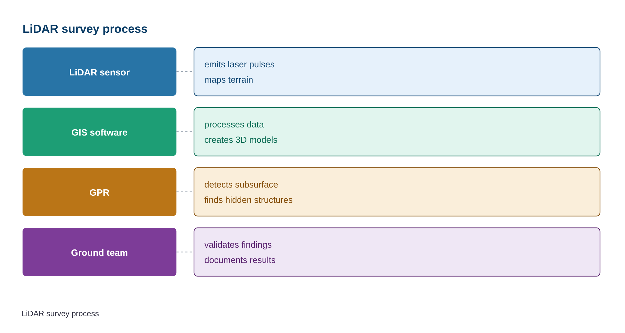
- LiDAR (Light Detection and Ranging): An airborne laser scanning technique that generates high-resolution 3D maps of terrain, vegetation, and subsurface features by measuring the time delay between laser pulses and their return, even through dense foliage.
- GIS (Geographic Information System) Mapping: A framework for collecting, storing, analysing, and visualising spatial data to identify patterns, relationships, and potential archaeological sites based on terrain features and historical records.
- Remote Sensing: The use of satellite or aerial imagery to detect anomalies in land cover, soil moisture, or vegetation that may indicate buried structures, particularly useful in large-scale surveys.
- Ground Penetrating Radar (GPR): A non-destructive geophysical method that uses radar pulses to image the subsurface, capable of detecting buried walls, foundations, or cavities up to several metres deep.
- Drone Documentation: Unmanned aerial vehicles equipped with high-resolution cameras and multispectral sensors to capture detailed imagery of landscapes, enabling rapid and cost-effective documentation of heritage sites.
- Photogrammetry: The science of making measurements from photographs, used here to create 3D models of monuments and terrain from drone or aerial imagery, aiding in precise structural analysis.
- Joint Coordination Committee (JCC): A collaborative body constituted by DAMH and NIAS to oversee the project, ensuring methodological rigour, data integration, and adherence to conservation protocols.
- Data Integration and Analysis: Combining LiDAR-derived digital elevation models (DEMs), GIS layers, and historical photographs to generate predictive models of potential archaeological sites, reducing reliance on random excavation.
Key Features
| Feature | Significance |
|---|---|
| LiDAR Survey | Enables high-resolution topographic mapping to detect micro-topographical anomalies beneath vegetation, facilitating non-invasive identification of buried structures. |
| GIS Mapping | Integrates spatial data to create layered maps for systematic documentation, spatial analysis, and long-term monitoring of archaeological sites. |
| Ground Penetrating Radar (GPR) | Uses electromagnetic pulses to detect subsurface anomalies, aiding in the precise localisation of buried monuments without physical excavation. |
| Drone Documentation | Provides aerial imagery for rapid, high-resolution surveying of large and inaccessible heritage landscapes, enhancing accuracy in site assessment. |
| Photogrammetry | Generates 3D models from overlapping photographs to reconstruct the topography and structural details of monuments with precision. |
Why it Matters
Cultural Heritage Preservation
- Reveals concealed monuments from the Kalyana-Chalukya period (10th–12th centuries CE), enriching India’s documented architectural heritage.
- Validates local traditions asserting the presence of 101 wells and 101 temples, potentially doubling the known heritage footprint of Lakkundi.
- Enhances the accuracy of heritage inventories, reducing reliance on speculative or incomplete historical records.
- Supports the State government’s proposal to include Lakkundi in the UNESCO World Heritage Tentative List, leveraging scientific documentation.
Technological Advancement in Archaeology
- Demonstrates the integration of cutting-edge geospatial technologies (LiDAR, GPR, GIS) in Indian archaeological surveys, setting a precedent for future projects.
- Reduces the need for large-scale, invasive excavations by pinpointing high-probability sites, thereby minimising disturbance to the archaeological landscape.
- Facilitates data-driven decision-making for conservation, prioritising interventions based on empirical evidence rather than anecdotal or visual surveys.
Urban and Regional Planning
- Provides a comprehensive baseline dataset for sustainable urban planning in Gadag district, balancing heritage conservation with developmental needs.
- Informs zoning regulations and heritage impact assessments, ensuring that future infrastructure projects do not encroach upon undocumented heritage sites.
Academic and Research Utility
- Offers empirical data to validate or refine art-historical theories, particularly regarding the hybrid Vesara architectural style of the Kalyana-Chalukyas.
- Enhances interdisciplinary collaboration between archaeology, geospatial science, and history, fostering innovation in heritage studies.
Challenges
1. Data Interpretation and Accuracy
- LiDAR and GPR data require expert interpretation to distinguish between natural geological features and man-made structures, posing a risk of false positives.
- Vegetation density and soil composition may obscure subsurface anomalies, necessitating multiple survey techniques for cross-verification.
UPSC Link: GS Paper 1 – Indian Heritage
2. Resource and Timeline Constraints
- The six-month timeline for the survey may limit the depth of analysis, particularly for large or complex sites.
- High costs associated with advanced technologies (LiDAR, drones) and expert manpower may strain departmental budgets.
UPSC Link: GS Paper 3 – Technology Missions
3. Legal and Ethical Considerations
- Discovery of previously unknown monuments may trigger debates over ownership, access, and conservation responsibilities under the Ancient Monuments and Archaeological Sites and Remains (AMASR) Act, 1958.
- Ensuring equitable access to findings for local communities, researchers, and policymakers without commercial exploitation.
UPSC Link: GS Paper 2 – Government Policies
4. Sustainable Conservation Post-Discovery
- Preservation of newly identified sites requires long-term funding, skilled conservationists, and community engagement to prevent vandalism or neglect.
- Balancing conservation with tourism development to avoid over-exploitation of newly revealed heritage assets.
UPSC Link: GS Paper 1 – Indian Culture
5. Climate and Environmental Risks
- Monsoon-induced soil erosion or vegetation regrowth may obscure newly identified sites over time, necessitating periodic re-surveys.
- Extreme weather events could damage exposed or newly discovered structures before conservation measures are implemented.
UPSC Link: GS Paper 3 – Disaster Management
Challenges — UPSC Perspective
| Issue | Concern |
|---|---|
| False Positives in LiDAR Data | Risk of misidentifying natural landforms as archaeological features, leading to unnecessary excavation or conservation efforts. |
| High Operational Costs | Limited budget allocation may constrain the scope or duration of the survey, affecting comprehensiveness. |
| Regulatory Gaps in AMASR Act | Ambiguities in the Act regarding newly discovered sites may delay protection or conservation measures. |
| Community Displacement Risks | Potential for heritage-led gentrification or displacement of local populations if tourism infrastructure expands without safeguards. |
| Data Security and Ownership | Unauthorised access to high-resolution LiDAR/GIS data may lead to commercial exploitation or forgery of heritage assets. |
| Inter-Institutional Coordination | Delays in decision-making due to bureaucratic or jurisdictional overlaps between DAMH, NIAS, and ISRO. |
Way Forward
- Constitute the Joint Coordination Committee (JCC) within two weeks to delineate roles, timelines, and deliverables for both DAMH and NIAS.
- Prioritise cross-verification of LiDAR and GPR findings using drone photogrammetry and ground-truthing to minimise false positives.
- Develop a phased conservation plan for newly identified sites, integrating input from local communities, art historians, and conservationists.
- Leverage ISRO’s technical expertise for high-resolution satellite data to supplement LiDAR surveys, particularly for inaccessible terrains.
- Draft amendments to the AMASR Act to clarify procedures for the protection and management of newly discovered monuments.
- Establish a digital repository of LiDAR/GIS data with restricted access protocols to prevent misuse while enabling academic research.
- Integrate findings into the Detailed Project Report (DPR) for Lakkundi’s UNESCO Tentative List nomination, highlighting scientific validation.
- Conduct public awareness campaigns to educate local stakeholders on the significance of the survey and their role in heritage preservation.
UPSC Value Addition
Keywords for Mains Answer-Writing
LiDAR survey in archaeology · Non-invasive archaeological techniques · Kalyana-Chalukya architecture · Vesara style of temple architecture · Cultural heritage conservation · GIS mapping in heritage documentation · Ground Penetrating Radar (GPR) · Drone-based photogrammetry · Archaeological survey methods · State-of-the-art digital technologies in heritage · Department of Archaeology Museums and Heritage (DAMH) · National Institute of Advanced Studies (NIAS)
Constitutional & Policy Linkages
- [‘Article 49 – Protection of Monuments’, ‘Directives for state protection of cultural heritage sites.’]
- [‘Article 51A(f) – Cultural Heritage Duty’, ‘Fundamental duty to value and preserve the rich heritage of India.’]
Concept Flow
Local tradition asserts existence of 101 wells and 101 temples in Lakkundi → → Vegetation overgrowth obscures surface visibility of monuments → → Department of Archaeology initiates LiDAR/GPR survey to detect subsurface anomalies → → NIAS integrates LiDAR, GIS, and drone data to generate high-resolution 3D models → → Cross-verification through ground-truthing confirms presence of buried structures → → Data informs DPR for UNESCO Tentative List nomination → → Findings guide conservation, tourism planning, and legal protection under AMASR Act.
Prelims Practice Questions
Q1. Consider the following statements regarding the LiDAR survey technique used in archaeological studies:
1. LiDAR can penetrate dense vegetation to map hidden structures.
2. It is a remote sensing method that uses laser pulses to create high-resolution topographic maps.
3. Ground Penetrating Radar (GPR) is a complementary technique that detects subsurface anomalies.
4. LiDAR is primarily used for underwater archaeological surveys.
How many of the above statements are correct?
- Only one
- Only two
- Only three
- All
Answer: Only three — Statements 1, 2, and 3 are correct. Statement 4 is incorrect as LiDAR is not primarily used for underwater surveys; it is effective for terrestrial and aerial mapping.
Q2. Assertion (A): The Vesara style of temple architecture is a hybrid form blending Nagara, Dravida, and Bhumija styles.
Reason (R): The Kalyana-Chalukya dynasty, which ruled between the 10th and 12th centuries CE, patronized this architectural style in regions like Lakkundi.
Options:
A. Both A and R are true, and R is the correct explanation of A.
B. Both A and R are true, but R is not the correct explanation of A.
C. A is true, but R is false.
D. A is false, but R is true.
Answer: ? — Both the assertion and reason are correct, and the reason accurately explains the assertion. The Vesara style is indeed a hybrid form, and the Kalyana-Chalukya dynasty is historically associated with its patronage.
Q3. Match the following archaeological survey techniques with their primary applications:
Column I (Survey Technique) | Column II (Application)
1. LiDAR | A. Detecting subsurface anomalies
2. GIS Mapping | B. Creating high-resolution topographic maps
3. Ground Penetrating Radar (GPR) | C. Spatial analysis and layering of archaeological data
4. Drone-based Photogrammetry | D. High-resolution 3D modeling from aerial imagery
- 1-B, 2-C, 3-A, 4-D
- 1-A, 2-B, 3-C, 4-D
- 1-B, 2-A, 3-D, 4-C
- 1-D, 2-C, 3-A, 4-B
Answer: 1-B, 2-C, 3-A, 4-D — LiDAR (1) is used for creating high-resolution topographic maps (B). GIS Mapping (2) is for spatial analysis and layering (C). GPR (3) detects subsurface anomalies (A). Drone-based Photogrammetry (4) provides high-resolution 3D modeling (D).
Mains Practice Question
✍ The integration of advanced digital technologies such as LiDAR, GIS mapping, and Ground Penetrating Radar (GPR) into archaeological surveys represents a paradigm shift in the documentation and conservation of cultural heritage. Critically examine the role of these technologies in enhancing the precision and efficiency of archaeological investigations. Also, assess their contribution to the sustainable management of heritage sites. (15 Marks)
Approach: MODEL-ANSWER SKELETON:
1. **Introduction (2 marks)**
– Define archaeological survey methods and their traditional limitations (e.g., reliance on surface visibility, labor-intensive excavations).
– Introduce the role of digital technologies (LiDAR, GIS, GPR, drone-based photogrammetry) as non-invasive, high-precision tools.
2. **Role of LiDAR in Archaeology (3 marks)**
– Explain LiDAR’s mechanism: laser pulses to penetrate vegetation and create detailed topographic maps.
– Cite examples: Lakkundi project (Kalyana-Chalukya period), Angkor Wat (Cambodia), or Mayan cities (Guatemala).
– Highlight benefits: rapid data collection, identification of buried structures, and reduced environmental impact.
3. **GIS Mapping and Remote Sensing (3 marks)**
– Define GIS mapping: spatial analysis, layering of data (e.g., historical maps, satellite imagery).
– Explain remote sensing: detection of anomalies (e.g., soil moisture, vegetation patterns) indicative of buried structures.
– Example: Use of GIS in the ‘Lost Cities’ project in India or global initiatives like the ‘Endangered Archaeology in the Middle East and North Africa’ (EAMENA).
4. **Ground Penetrating Radar (GPR) (2 marks)**
– Mechanism: electromagnetic waves to detect subsurface anomalies (e.g., walls, foundations).
– Advantages: non-destructive, high-resolution imaging of shallow subsurface features.
– Example: GPR surveys in Rajasthan’s ancient sites or European medieval cities.
5. **Drone-based Photogrammetry (2 marks)**
– Mechanism: aerial photography and 3D modeling for detailed documentation.
– Benefits: accessibility to remote or hazardous sites, cost-effectiveness, and high-resolution outputs.
– Example: Use in mapping India’s rock-art sites (e.g., Bhimbetka) or global heritage sites like Machu Picchu.
6. **Contribution to Sustainable Heritage Management (3 marks)**
– **Precision and Efficiency**: Reduces the need for extensive excavations, minimizing damage to sites.
– **Documentation and Preservation**: Enables digital archiving for future research and conservation planning.
– **Policy and Planning**: Supports the preparation of Detailed Project Reports (DPRs) for heritage conservation (e.g., Lakkundi’s DPR for UNESCO nomination).
– **Community Engagement**: Facilitates public awareness and tourism planning without physical intrusion.
7. **Challenges and Limitations (2 marks)**
– **Cost and Expertise**: High initial investment and need for specialized training.
– **Data Interpretation**: Requires skilled professionals to analyze complex datasets.
– **Ethical Considerations**: Balancing non-invasive methods with the need for physical evidence in certain contexts.
8. **Conclusion (2 marks)**
– Summarize the transformative potential of these technologies in archaeology.
– Emphasize their role in aligning heritage conservation with sustainable development goals (e.g., SDG 11: Sustainable Cities and Communities).
Source: The Hindu
Generated by AanyaAi for educational purpose.
Related guides on our sites
- Best PSIR optional coaching for upsc
- Best economics optional coaching for upsc
- UPSC History optional
- Is history a good optional for upsc exam

- लक्कुंडी के छिपे स्मारकों की खोज करेगा LiDAR सर्वेक्षण, जानिए पूरी प्रक्रिया - September 2, 2026
- लक्कुंडी के छिपे स्मारकों की खोज करेगा LiDAR सर्वेक्षण, जानें पूरा मामला - September 2, 2026
- LiDAR Survey to Uncover Hidden Monuments in Lakkundi for UPSC Exam - September 2, 2026

No Comments