


28 Sep 17 Tribal Habitations Submerged as Godavari Nears Flood Warning in Polavaram
✎ The Sir Arthur Cotton Barrage at Dowleswaram is a critical flood-control and irrigation infrastructure on the Godavari River, where flood warnings are issued at 10 lakh cusecs inflow, necessitating coordinated disaster management…
Subject Relevance — Where This Topic Fits
- GS Paper II — Governance, Constitution, Polity, Social Justice and International Relations (Disaster Management) | GS Paper III — Environment, Ecology, Bio-diversity and Disaster Management
- Prelims: Godavari River Basin, Sir Arthur Cotton Barrage, Polavaram Project, Flood Warning System, Cusecs, Andhra Pradesh Water Resources Information and Management System (APWRIMS), Konaseema Islands, Disaster Management Act, 2005
- Essay: Climate change and its impact on riverine ecosystems in India, Role of institutions in mitigating natural disasters: A case study of flood management in India
Quick Revision: The Sir Arthur Cotton Barrage at Dowleswaram is a critical flood-control and irrigation infrastructure on the Godavari River, where flood warnings are issued at 10 lakh cusecs inflow, necessitating coordinated disaster management responses to protect downstream communities and agricultural lands.
Why is this in the news?
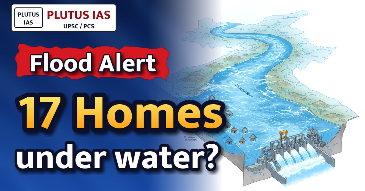
The Godavari River, one of India’s major peninsular rivers, has entered a critical flood phase with the Sir Arthur Cotton Barrage in Andhra Pradesh registering an inflow of 9.66 lakh cusecs, approaching the first flood warning threshold of 10 lakh cusecs. This situation has submerged 17 tribal habitations in Polavaram district and placed 171 villages on high alert, highlighting the challenges of flood forecasting, infrastructure management, and disaster preparedness in India’s river basins.
Background
- The Godavari River, with a basin area of approximately 312,812 sq. km, is the second-longest river in India after the Ganga and flows through six states, including Maharashtra, Telangana, Chhattisgarh, Madhya Pradesh, Odisha, and Andhra Pradesh.
- The Sir Arthur Cotton Barrage, constructed in 1852 and later upgraded, is a critical flood-control and irrigation structure located at Dowleswaram in Andhra Pradesh, regulating water flow into the Godavari Delta and its extensive canal network.
- The Polavaram Project, a multi-purpose irrigation and hydroelectric project on the Godavari River in Andhra Pradesh, is designed to provide irrigation to over 2.9 lakh hectares, generate 960 MW of power, and supply drinking water to Visakhapatnam city, while also serving as a flood-mitigation measure.
- Flood warnings in the Godavari Basin are issued at three levels: the first warning at 10 lakh cusecs, the second at 13 lakh cusecs, and the third at 17 lakh cusecs, based on inflow measurements at the Sir Arthur Cotton Barrage.
- The Andhra Pradesh Water Resources Information and Management System (APWRIMS) plays a pivotal role in real-time monitoring, forecasting, and dissemination of hydrological data, enabling timely decision-making during flood events.
- The Godavari Delta, comprising the Konaseema region, is a highly fertile and densely populated area, making it particularly vulnerable to flooding due to its low-lying topography and intricate network of distributaries.
What is the Sir Arthur Cotton Barrage and its role in flood management?
- The Sir Arthur Cotton Barrage is a historic and strategic water regulation structure across the Godavari River at Dowleswaram, Andhra Pradesh, named after the British engineer Sir Arthur Cotton, who pioneered irrigation projects in southern India.
- The barrage serves a dual purpose: controlling floodwaters during monsoon seasons and diverting water into the extensive Godavari Delta canal system for irrigation, thereby supporting agriculture in one of India’s most productive delta regions.
- The barrage is equipped with 172 gates, allowing controlled release of water to manage flood peaks and prevent breaches in downstream areas, including the Konaseema Islands and tribal habitations in Polavaram district.
- Flood warnings at the barrage are triggered based on inflow thresholds measured in cusecs (cubic feet per second), with the first warning issued at 10 lakh cusecs to alert authorities and downstream communities.
- The barrage’s efficacy in flood mitigation is contingent on real-time data from APWRIMS, which provides inflow forecasts, rainfall patterns, and reservoir levels to enable proactive decision-making.
- The barrage also supports ecological balance by regulating water flow, which is critical for the Godavari Delta’s mangrove ecosystems and the livelihoods of fishing communities.
Key Features
| Feature | Significance |
|---|---|
| Sir Arthur Cotton Barrage inflow | Serves as the primary flood-monitoring and control point for the Godavari delta; first warning issued at 10 lakh cusecs inflow to initiate emergency preparedness. |
| Polavaram Project gates | Strategic water regulation infrastructure to manage upstream floodwaters and protect downstream regions from excessive inundation. |
| Godavari Basin Forecast (APWRIMS) | Provides real-time hydrological data and predictive analytics to guide flood mitigation efforts and resource allocation. |
| Tribal habitations in Polavaram | Disproportionately vulnerable populations due to geographical isolation and limited access to relief infrastructure during flooding events. |
| Sabari and Sileru river inflows | Contributing tributaries whose combined discharge significantly amplifies the flood risk in the Godavari valley and delta regions. |
Why it Matters
Hydrological and Environmental
- The Godavari, India’s second-longest river, exhibits extreme seasonal variability, necessitating robust flood forecasting and adaptive water management systems.
- Submergence of tribal habitations highlights the intersection of ecological fragility and human settlement patterns in flood-prone zones.
- The Sir Arthur Cotton Barrage’s operational thresholds (10 lakh cusecs warning) reflect a calibrated balance between flood control and irrigation demands.
Socio-Economic
- Flooding disrupts livelihoods in agriculture-dependent delta regions, with long-term implications for food security and rural economies.
- Displacement of tribal communities underscores the need for inclusive disaster preparedness and rehabilitation policies.
- Damage to irrigation canals (1,400 cusecs released) threatens kharif crop cycles, impacting farmer incomes and agricultural output.
Institutional and Governance
- The APWRIMS system exemplifies the integration of technology in disaster management, enabling data-driven decision-making for flood mitigation.
- Coordinated operation of the Polavaram Project and barrage gates demonstrates multi-agency collaboration in crisis response.
- Early warning systems and real-time monitoring are critical for reducing human and economic losses during monsoon-driven floods.
Challenges
1. Vulnerability of Tribal Populations
- Geographical isolation limits access to early warnings and relief measures during flood events.
- Limited infrastructure in tribal habitations exacerbates the impact of submergence, leading to prolonged displacement.
- Cultural and economic ties to land make rehabilitation and relocation particularly challenging.
UPSC Link: GS-I: Vulnerable Sections
2. Hydrological Uncertainty and Forecasting Gaps
- Sudden spikes in tributary inflows (e.g., Sabari and Sileru) challenge the accuracy of basin-wide flood predictions.
- Climate change-induced erratic monsoon patterns increase the frequency and intensity of flood events.
- Data latency in real-time monitoring systems can delay critical interventions.
UPSC Link: GS-III: Disaster Management
3. Infrastructure and Resource Constraints
- Aging or inadequate flood-control infrastructure (e.g., barrage gates, embankments) may fail under extreme stress.
- Limited storage capacity in reservoirs upstream of the barrage restricts floodwater buffering options.
- Resource allocation for relief and rehabilitation is often reactive rather than proactive.
UPSC Link: GS-II: Governance
4. Inter-State Coordination Challenges
- Flood management requires seamless coordination between upstream (Odisha, Chhattisgarh) and downstream (Andhra Pradesh) states.
- Differences in monitoring protocols or data-sharing mechanisms can hinder unified response strategies.
- Legal frameworks for inter-state water disputes (e.g., Godavari Water Disputes Tribunal) must be invoked promptly.
UPSC Link: GS-II: Federalism
5. Agricultural and Economic Disruptions
- Prolonged flooding damages standing crops, leading to food security concerns and economic losses for farmers.
- Disruption of irrigation canals affects kharif and rabi crop cycles, with cascading effects on rural livelihoods.
- Insurance and compensation mechanisms for affected farmers often face delays or inadequacies.
UPSC Link: GS-III: Agriculture
Challenges — UPSC Perspective
| Issue | Concern |
|---|---|
| Tribal habitations | Geographical isolation and limited access to relief infrastructure |
| Forecasting accuracy | Sudden tributary inflows challenge real-time predictions |
| Infrastructure resilience | Aging flood-control systems may fail under extreme stress |
| Inter-state coordination | Differences in monitoring protocols hinder unified response |
| Agricultural impact | Crop damage and irrigation disruptions threaten food security |
Way Forward
- Enhance real-time hydrological monitoring with IoT-based sensors and AI-driven predictive models to improve flood forecasting accuracy.
- Strengthen tribal community resilience through targeted early warning dissemination (e.g., mobile alerts, community networks) and pre-positioned relief stocks.
- Upgrade and modernize the Sir Arthur Cotton Barrage and Polavaram gates to handle higher discharge thresholds and reduce failure risks.
- Establish a dedicated inter-state flood management task force for the Godavari basin to streamline coordination and data-sharing protocols.
- Expand crop insurance coverage and expedite compensation claims for flood-affected farmers to mitigate economic losses.
- Conduct post-flood damage assessments to identify critical infrastructure gaps and prioritize investments in flood mitigation.
- Integrate climate resilience into river basin management plans, incorporating projections of extreme weather events.
- Promote afforestation and watershed management in upstream regions (e.g., Odisha, Chhattisgarh) to reduce soil erosion and sediment load.
UPSC Value Addition
Keywords for Mains Answer-Writing
Flood management in India · Disaster Management Act, 2005 · Polavaram Project · Sir Arthur Cotton Barrage · Godavari River basin · Tribal displacement and rehabilitation · Inter-State River Water Disputes Act, 1956 · National Disaster Response Force (NDRF) · Flood warning systems in India · Environmental impact of large dams · River basin management · Climate change and extreme weather events · Submergence of habitations · Inter-state coordination in flood management
Constitutional & Policy Linkages
- [‘Article 262: Inter-State Water Disputes’, ‘Legal framework for resolving transboundary water conflicts’]
- [‘Article 21: Right to Life’, ‘Ensuring protection of vulnerable populations during disasters’]
- [‘Seventh Schedule: Union List (Item 56)’, ‘Water resources regulation and flood control’]
Concept Flow
Heavy monsoon rainfall in Odisha, Chhattisgarh, and Andhra Pradesh → Increased discharge in Sabari and Sileru tributaries → Convergence of tributary flows raises Godavari’s water level upstream of the Sir Arthur Cotton Barrage → APWRIMS forecasts peak inflow of ~10.1 lakh cusecs, triggering first flood warning at 10 lakh cusecs → Operation of Polavaram gates and barrage gates to regulate flow and prevent downstream flooding → Submergence of 17 tribal habitations in Polavaram due to upstream flooding and inadequate buffering → Activation of disaster response protocols, including evacuation and relief distribution in affected areas → Gradual decline in inflow levels post-peak, easing flood pressure but necessitating long-term rehabilitation
Prelims Practice Questions
Q1. Consider the following statements regarding the Sir Arthur Cotton Barrage on the Godavari River:
1. It is located downstream of the Polavaram Project.
2. The first flood warning is issued when the inflow reaches 10 lakh cusecs.
3. The barrage is primarily used for irrigation and flood control in the Godavari Delta.
How many of the above statements are correct?
- Only one
- Only two
- All three
- None
Answer: All three — Statement 1 is correct as the Sir Arthur Cotton Barrage is located downstream of the Polavaram Project. Statement 2 is correct as the first flood warning is issued at an inflow of 10 lakh cusecs. Statement 3 is correct as the barrage is used for irrigation and flood control in the Godavari Delta.
Q2. Assertion (A): The Polavaram Project is a multi-purpose irrigation project aimed at providing irrigation benefits to the delta regions of Andhra Pradesh.
Reason (R): The project includes a dam across the Godavari River and is designed to address water scarcity in the region.
Options:
A. Both A and R are true, and R is the correct explanation of A.
B. Both A and R are true, but R is NOT the correct explanation of A.
C. A is true, but R is false.
D. A is false, but R is true.
Answer: ? — Both the Assertion (A) and Reason (R) are true. The Polavaram Project is indeed a multi-purpose irrigation project aimed at providing irrigation benefits to the delta regions of Andhra Pradesh. The project includes a dam across the Godavari River and is designed to address water scarcity in the region. The Reason (R) correctly explains the Assertion (A).
Q3. Match the following pairs related to flood management in India:
Column I (Institution/Act) Column II (Function)
1. National Disaster Management Authority (NDMA) a. Coordinates rescue and relief operations during disasters
2. National Disaster Response Force (NDRF) b. Formulates policies for disaster management
3. Disaster Management Act, 2005 c. Provides legal framework for disaster management in India
4. Central Water Commission (CWC) d. Monitors and forecasts water levels in rivers
- 1-b, 2-a, 3-c, 4-d
- 1-a, 2-b, 3-c, 4-d
- 1-b, 2-c, 3-d, 4-a
- 1-c, 2-a, 3-b, 4-d
Answer: 1-b, 2-a, 3-c, 4-d — 1 matches with b (NDMA formulates policies for disaster management), 2 matches with a (NDRF coordinates rescue and relief operations), 3 matches with c (Disaster Management Act, 2005 provides the legal framework), and 4 matches with d (CWC monitors and forecasts water levels in rivers).
Mains Practice Question
✍ The recurring inundation of tribal habitations in the Polavaram region due to flooding of the Godavari River underscores the inadequacies in India’s flood management architecture. Critically examine the efficacy of the existing institutional and legal frameworks—including the Disaster Management Act, 2005, the National Disaster Response Framework, and the role of inter-state river basin authorities—in mitigating flood risks and protecting vulnerable communities. Also, elucidate the constitutional and statutory provisions governing inter-state water disputes and their relevance in addressing flood-related challenges. (15 Marks)
Approach: MODEL-ANSWER SKELETON:
1. **Institutional Framework**:
– Role of the National Disaster Management Authority (NDMA) under the Disaster Management Act, 2005: policy formulation, coordination, and capacity-building.
– Functioning of the National Disaster Response Force (NDRF) and State Disaster Response Forces (SDRF) in rescue and relief operations.
– Limitations: delayed deployment, resource constraints, and lack of pre-emptive action in tribal areas.
2. **Legal Framework**:
– Disaster Management Act, 2005: provisions for early warning systems, preparedness, and rehabilitation.
– Gaps: inadequate implementation in tribal regions, lack of community-based disaster preparedness, and insufficient funding for mitigation measures.
3. **Inter-State Coordination**:
– Role of the Central Water Commission (CWC) in monitoring river water levels and issuing flood warnings.
– Relevance of the Inter-State River Water Disputes Act, 1956: mechanisms for resolving disputes but limited applicability in flood management.
– Challenges: lack of a unified river basin authority for the Godavari, inter-state coordination failures, and delayed responses.
4. **Vulnerable Communities**:
– Tribal habitations in Polavaram: displacement, loss of livelihoods, and inadequate rehabilitation.
– Constitutional provisions: Article 21 (Right to Life and Personal Liberty) and Directive Principles of State Policy (Articles 39(b), 47) mandating state protection.
5. **Way Forward**:
– Strengthening early warning systems and community-based disaster management.
– Enhancing inter-state cooperation through a unified river basin authority.
– Ensuring inclusive rehabilitation policies for tribal communities.
Balance of Views: Acknowledge successes (e.g., NDMA’s role in recent disasters) while critiquing systemic gaps (e.g., delayed warnings, inadequate infrastructure in tribal areas).
Source: The Hindu
Generated by AanyaAi for educational purpose.
Related guides on our sites
- Best sociology optional coaching
- Best coaching for sociology optional
- Best sociology optional coaching online
- is sociology good optional

- पेट्रोलियम (संशोधन) विधेयक 2026: हितधारकों से सुझाव आमंत्रित - September 30, 2026
- UERC imposes 67 paise/unit surcharge on open access power in Uttarakhand - September 30, 2026
- एलपीयू हिंसा मामले में हाईकोर्ट ने सरकार से पूछा- अब तक क्या किया? - September 30, 2026

No Comments