


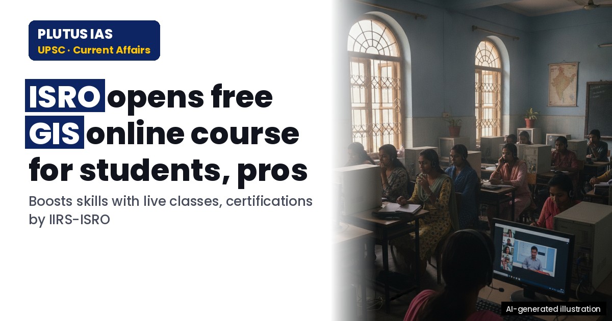
02 Oct ISRO Launches Free GIS Online Course for UPSC & PCS Aspirants
✎ GIS is a spatial data analysis tool integrating satellite imagery, maps, and statistical data to support evidence-based governance, disaster management, and sustainable development.
Subject Relevance — Where This Topic Fits
- GS Paper II — Science and Technology (Role of ISRO in Capacity Building) | GS Paper III — Science and Technology (Geospatial Technologies and Applications)
- Prelims: Geographic Information System (GIS), Remote Sensing, ISRO, IIRS Dehradun, Geospatial Data, Digital Cartography, Spatial Analysis
- Essay: The role of public institutions in fostering skill development for emerging technologies, Geospatial technologies: Bridging the gap between data and governance
Quick Revision: GIS is a spatial data analysis tool integrating satellite imagery, maps, and statistical data to support evidence-based governance, disaster management, and sustainable development.
Why is this in the news?
The Indian Institute of Remote Sensing (IIRS), a constituent unit of the Indian Space Research Organisation (ISRO), has announced an online training programme titled ‘Overview of Geographic Information System (GIS)’ for students, researchers, and professionals. Applications are open until 11 October 2026, and the programme is particularly relevant for aspirants preparing for the UPSC Civil Services Examination, given the increasing integration of geospatial technologies in governance, disaster management, and urban planning.
Background
- The Indian Space Research Organisation (ISRO) is India’s premier space agency, mandated with the development of space technology and its application for national development.
- The Indian Institute of Remote Sensing (IIRS), located in Dehradun, is a key centre under ISRO dedicated to research, training, and capacity building in remote sensing, GIS, and geoinformatics.
- Geographic Information System (GIS) is a framework for gathering, managing, and analysing spatial and geographic data, widely used in urban planning, environmental monitoring, disaster management, and infrastructure development.
- ISRO’s IIRS has been conducting online and offline training programmes in geospatial technologies to bridge the skill gap in the country, aligning with the National Geospatial Policy 2022 and the Digital India initiative.
- The programme aligns with the Union Government’s push for skill development in emerging technologies, as reflected in initiatives like the Skill India Mission and the Atal Innovation Mission.
What is Geographic Information System (GIS)?
- GIS is a computer-based tool for collecting, storing, analysing, and visualising spatial or geographic data, enabling decision-making in diverse fields such as agriculture, forestry, urban planning, and public health.
- It integrates data from various sources, including satellite imagery, aerial photography, and ground surveys, to create layered maps that reveal patterns and relationships not visible in traditional data formats.
- [‘GIS is widely used in disaster management for flood mapping, landslide susceptibility assessment, and resource allocation during crises, as seen in the National Disaster Management Authority’s (NDMA) initiatives.’, ‘The technology supports sustainable development goals by enabling evidence-based policymaking, such as in the Smart Cities Mission or the Jal Shakti Abhiyan, where water resource mapping is critical.’, ‘GIS is interoperable with other geospatial technologies like Remote Sensing and Global Navigation Satellite Systems (GNSS), forming the backbone of India’s geospatial ecosystem.’, ‘In the context of the UPSC Civil Services Examination, GIS is relevant to subjects like Geography (Paper I), Environment (GS Paper III), and Science and Technology (GS Paper III), particularly in questions related to spatial planning, climate change, and infrastructure development.’, ‘ISRO’s IIRS has been instrumental in providing GIS training to over 1,00,000 participants globally, including government officials, students, and professionals, through its Distance Learning Programme (DLP) and online courses.’]
Key Features
| Feature | Significance |
|---|---|
| Online Mode of Delivery | Enables nationwide and international participation without geographical constraints, leveraging digital infrastructure for scalable capacity building. |
| Live Interactive Sessions | Facilitates real-time doubt resolution and peer interaction, enhancing comprehension and engagement compared to asynchronous learning. |
| Recorded Lecture Repository | Provides on-demand access to course material, allowing self-paced revision and reinforcement of concepts. |
| Merit Certificate on Completion | Validates acquired skills for academic and professional purposes, enhancing employability and academic credibility. |
| Dual Access (Live + Offline) | Ensures flexibility for participants with bandwidth or time constraints while maintaining attendance tracking and certification eligibility. |
Why it Matters
Technological Advancement
- Promotes indigenous capacity in Geospatial Technologies, a critical domain for India’s Digital India and Atmanirbhar Bharat initiatives.
- Strengthens India’s self-reliance in space-based data utilisation, aligning with ISRO’s mandate to advance geospatial applications.
- Enhances skill development in emerging technologies, supporting India’s transition toward a knowledge-driven economy.
Human Capital Development
- Bridges the skill gap in GIS professionals, addressing the demand-supply imbalance in sectors like urban planning, disaster management, and agriculture.
- Provides structured learning pathways for students and professionals, fostering a pipeline of trained geospatial analysts.
- Encourages interdisciplinary research by equipping participants with foundational GIS knowledge applicable across domains.
Institutional Collaboration
- Leverages ISRO’s expertise and infrastructure, ensuring high-quality training aligned with global standards in geospatial sciences.
- Facilitates networking opportunities among participants, fostering knowledge exchange and collaborative projects.
- Serves as a model for future ISRO-led capacity-building initiatives in niche technological domains.
Challenges
1. Digital Divide and Accessibility
- Limited internet penetration in rural and remote areas may restrict participation, exacerbating regional disparities in skill development.
- Technical requirements (e.g., bandwidth, compatible devices) could exclude participants from economically weaker sections.
UPSC Link: GS3: Digital Divide and Inclusive Growth
2. Quality Assurance in Online Learning
- Ensuring consistent engagement and learning outcomes in a virtual environment poses challenges in maintaining academic rigor.
- Monitoring and verifying participant attendance and performance remotely requires robust technological and administrative safeguards.
UPSC Link: GS2: E-Governance and Digital Infrastructure
3. Certification and Recognition
- The value and recognition of the certificate may vary across academic institutions and employers, necessitating clear articulation of learning outcomes.
- Ensuring the certificate’s credibility in domestic and international job markets requires alignment with industry standards.
UPSC Link: GS4: Ethical Governance and Transparency
4. Scalability and Resource Constraints
- High demand may strain ISRO’s resources, including faculty, infrastructure, and administrative capacity for large-scale execution.
- Sustaining long-term engagement post-training requires follow-up mechanisms, such as mentorship or advanced courses.
UPSC Link: GS3: Resource Allocation and Efficiency
Challenges — UPSC Perspective
| Issue | Concern |
|---|---|
| Participant Diversity | Ensuring equitable access for students, professionals, and researchers from varied socio-economic backgrounds. |
| Technical Preparedness | Addressing disparities in participants’ digital literacy and access to requisite hardware/software. |
| Content Relevance | Ensuring the curriculum aligns with evolving industry needs and academic expectations. |
| Assessment Integrity | Preventing malpractices in online examinations and maintaining fair evaluation standards. |
| Post-Training Support | Providing avenues for continuous learning and application of GIS skills in professional settings. |
Way Forward
- Expand outreach to rural and underserved regions through targeted awareness campaigns and partnerships with local institutions.
- Develop tiered certification pathways (e.g., beginner, intermediate, advanced) to cater to diverse skill levels and career goals.
- Integrate the course with existing government initiatives like the National Geospatial Policy 2022 to enhance synergy and recognition.
- Establish a feedback mechanism to continuously improve course content, delivery methods, and assessment frameworks.
- Collaborate with universities and colleges to embed GIS modules into academic curricula, fostering long-term skill integration.
- Leverage ISRO’s regional centres and nodal agencies to decentralise training and reduce logistical burdens on participants.
- Introduce mentorship programs pairing participants with GIS professionals to facilitate practical application and career guidance.
UPSC Value Addition
Keywords for Mains Answer-Writing
Geospatial Technology · Indian Space Research Organisation (ISRO) · Indian Institute of Remote Sensing (IIRS) · Geographic Information System (GIS) · Remote Sensing · Online Training Programme · Skill Development in GIS · ISRO LMS Portal · Space Technology Applications · Digital Governance · Geospatial Data Analysis · Capacity Building in Science and Technology
Concept Flow
Rise in demand for geospatial technologies in governance and industry → ISRO’s initiative to bridge skill gaps → Design of online GIS training program → Application window and selection process → Delivery via live and recorded sessions → Assessment and certification → Skill utilisation in professional and academic domains.
Prelims Practice Questions
Q1. Consider the following statements regarding the Indian Institute of Remote Sensing (IIRS):
1. IIRS is a constituent unit of the Indian Space Research Organisation (ISRO).
2. IIRS offers online training programmes in Geographic Information System (GIS) for students and professionals.
3. The certification for IIRS courses is provided by the University Grants Commission (UGC).
How many of the above statements are correct?
- Only one
- Only two
- All three
- None
Answer: Only two — Statements 1 and 2 are correct as IIRS is indeed a unit of ISRO and offers GIS training. Statement 3 is incorrect because IIRS certifications are provided by ISRO itself, not UGC.
Q2. Which of the following is the primary objective of the ‘Geographic Information System (GIS) Overview’ online training programme recently announced by ISRO’s IIRS?
- To provide hands-on training in satellite launch vehicle operations
- To develop foundational understanding of GIS among participants
- To certify participants as professional astronomers
- To offer financial grants for geospatial research projects
Answer: To develop foundational understanding of GIS among participants — The primary objective of the GIS Overview programme is to develop a foundational understanding of GIS among participants, as explicitly stated in the announcement.
Q3. Assertion (A): The Indian Institute of Remote Sensing (IIRS) is headquartered in Ahmedabad.
Reason (R): IIRS is a constituent unit of the Indian Space Research Organisation (ISRO) and is located in Dehradun.
- Both A and R are true, and R is the correct explanation of A
- Both A and R are true, but R is NOT the correct explanation of A
- A is true, but R is false
- A is false, but R is true
Answer: A is false, but R is true — Assertion (A) is false because IIRS is headquartered in Dehradun, not Ahmedabad. Reason (R) is true as IIRS is a constituent unit of ISRO and is located in Dehradun.
Mains Practice Question
✍ Geospatial technologies, particularly Geographic Information Systems (GIS), are increasingly recognised as critical tools for governance, disaster management, and sustainable development. In this context, critically examine the role of the Indian Space Research Organisation (ISRO) in advancing geospatial literacy and capacity building in India. (15 Marks)
Approach: MODEL-ANSWER SKELETON:
1. **Introduction (2 Marks)**: Define geospatial technologies and GIS, highlighting their relevance in governance, disaster management, and sustainable development.
2. **ISRO’s Role in Geospatial Capacity Building (5 Marks)**:
– Discuss ISRO’s initiatives, including the Indian Institute of Remote Sensing (IIRS), in providing training and certification programmes in GIS and remote sensing.
– Highlight the significance of online training programmes (e.g., GIS Overview course) in democratising access to geospatial education.
– Mention collaborations with academic institutions, government agencies, and international organisations.
3. **Impact on Governance and Development (4 Marks)**:
– Explain how geospatial literacy enhances policy-making, urban planning, and natural resource management.
– Provide examples of ISRO’s contributions to national projects (e.g., mapping, disaster response, agriculture).
– Discuss the role of GIS in achieving Sustainable Development Goals (SDGs).
4. **Challenges and Way Forward (4 Marks)**:
– Identify challenges such as digital divide, infrastructure gaps, and the need for continuous upskilling.
– Suggest measures to further strengthen geospatial literacy, including public-private partnerships, integration with school curricula, and leveraging emerging technologies (e.g., AI, big data).
5. **Conclusion (1 Mark)**: Summarise the importance of ISRO’s initiatives in fostering geospatial literacy and its long-term impact on India’s development.
Source: amarujala.com
Generated by AanyaAi for educational purpose.
Related guides on our sites
- How to prepare for GS paper 1 for UPSC CSE mains exam
- Best UPSC coaching for IFOS exam
- Best mentorship programme for upsc
- UPSC+BA degree

- ISRO Launches Free GIS Online Course for UPSC & PCS Aspirants - October 2, 2026
- ओडिशा के SAMS पोर्टल को मिला SKOCH प्लेटिनम अवार्ड 2026 - October 2, 2026
- Government Identifies 28 Places in Ladakh on Survey of India Map - October 2, 2026

No Comments