


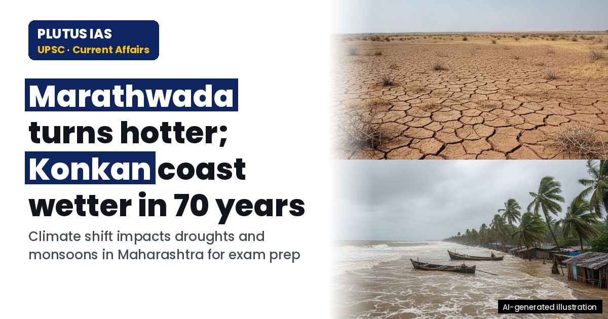
23 Oct Marathwada Turns Hotter; Konkan Wetter in 70 Years: IMD-IITM Study
✎ Climate zones in Maharashtra have shifted over seven decades: Marathwada and West Vidarbha transitioned from tropical savanna to hot semi-arid zones due to rising temperatures, while the Konkan coast expanded into a tropical…
Subject Relevance — Where This Topic Fits
- GS Paper I — Geography (Climate and Weather Systems) | GS Paper III — Environment and Climate Change
- Prelims: Monsoon variability, El Niño-Southern Oscillation (ENSO), Köppen climate classification, semi-arid zones, tropical monsoon zones, IMD, IITM, drought declaration criteria, taluka-level climate shifts
- Essay: Climate change and its regional manifestations: A case study of Maharashtra, Agricultural resilience in the face of shifting climate zones
Quick Revision: Climate zones in Maharashtra have shifted over seven decades: Marathwada and West Vidarbha transitioned from tropical savanna to hot semi-arid zones due to rising temperatures, while the Konkan coast expanded into a tropical monsoon zone with increased rainfall, necessitating adaptive agricultural strategies.
Why is this in the news?
A recent peer-reviewed study published in *Mausam*, the journal of the India Meteorological Department (IMD), has documented a significant shift in climate zones across Maharashtra over the past seven decades. The study, conducted by scientists from IMD and the Indian Institute of Tropical Meteorology (IITM), Pune, reveals that regions like Marathwada and West Vidarbha have transitioned from a tropical savanna climate to a hot semi-arid climate, while the Konkan coast has witnessed an expansion of the tropical monsoon zone. This shift has critical implications for monsoon patterns, drought frequency, and agricultural planning, particularly in the context of the ongoing El Niño-induced drought in Maharashtra.
Background
- The Köppen climate classification system categorizes global climates based on temperature and precipitation patterns, dividing India into distinct climate zones such as tropical monsoon, tropical savanna, and semi-arid regions.
- The IMD and IITM, Pune, are premier institutions under the Ministry of Earth Sciences, responsible for meteorological observations, climate research, and monsoon forecasting in India.
- Climate zones are typically defined over 30-year periods (climate normal) to account for long-term trends, with the latest normals covering 1991–2020 replacing the earlier 1961–1990 period.
- El Niño, a phase of the El Niño-Southern Oscillation (ENSO), is associated with warmer-than-average sea surface temperatures in the central and eastern tropical Pacific Ocean, often leading to reduced monsoon rainfall in India.
- Droughts in India are declared at the taluka (sub-district) level based on rainfall deficits, crop conditions, and water availability, with Maharashtra declaring drought in 265 of its 358 talukas in September 2026 due to a 19% rainfall deficit.
- Agricultural planning in India is heavily dependent on monsoon rainfall, with crops like sugarcane, soybeans, and cotton being particularly vulnerable to shifts in climate zones and rainfall patterns.
What are Climate Zones and How Do They Shift?
- Climate zones are geographical regions classified based on long-term average temperature and precipitation patterns, such as tropical monsoon (high rainfall), tropical savanna (warm with a dry season), and semi-arid (hot with low rainfall) zones.
- The Köppen climate classification is widely used in India, with the tropical monsoon zone covering the western coasts (Konkan, Goa, coastal Karnataka, Kerala), the tropical savanna zone covering central and peninsular India (including Marathwada and West Vidarbha historically), and semi-arid zones covering parts of Rajasthan, Gujarat, and Maharashtra.
- Climate zone shifts occur due to long-term changes in temperature and precipitation, which can be driven by natural variability (e.g., ENSO, Indian Ocean Dipole) or anthropogenic factors (e.g., global warming, land-use changes).
- The study by IMD and IITM analyzed 70 years of weather data (1951–2020) and reclassified Maharashtra’s climate zones over successive 30-year periods (1951–1980, 1961–1990, 1991–2020), revealing a transition of Marathwada and West Vidarbha from tropical savanna to hot semi-arid zones.
- The shift in Marathwada and West Vidarbha is primarily attributed to rising daytime and night-time temperatures, which have increased the aridity of the region, while the expansion of the tropical monsoon zone along the Konkan coast is linked to increased rainfall in southern India.
- These shifts are not uniform across India; for instance, the hot semi-arid zone in central India has slightly shrunk over the same period, highlighting the regional variability in climate change impacts.
- Climate zone shifts have direct implications for agriculture, as crops suited to a tropical savanna climate (e.g., sorghum, millets) may become less viable in a hot semi-arid climate, necessitating changes in cropping patterns and water management.
- The study underscores the need for dynamic agricultural planning that incorporates climate zone shifts, including adjustments in sowing times, crop selection, and irrigation strategies to enhance resilience.
Key Features
| Feature | Significance |
|---|---|
| Shift in Marathwada and West Vidarbha from tropical savanna to hot semi-arid zone | Indicates rising daytime and night-time temperatures, reduced rainfall, and heightened vulnerability to droughts, necessitating revised agricultural and water-resource strategies. |
| Expansion of tropical monsoon zone along Konkan, Goa, coastal Karnataka, and Kerala | Signals increased heavy seasonal rainfall, requiring adaptation in cropping patterns, infrastructure planning, and flood-risk management. |
| Redrawing of India’s climate zones over successive 30-year periods (1951–1980 to 1991–2020) | Demonstrates long-term climatic trends, enabling evidence-based policy formulation and climate-risk assessment. |
| Regional divergence in rainfall trends—decline over northern plains, increase over southern India | Highlights the need for region-specific climate adaptation measures and resource allocation. |
| El Niño’s exacerbation of drought conditions in Marathwada and Vidarbha during 2026 | Illustrates the compounded impact of climatic variability on agricultural output and rural livelihoods. |
Why it Matters
Agricultural Productivity
- Alters optimal crop choices and sowing timelines, impacting yield stability and food security in Marathwada and West Vidarbha.
- Increases reliance on irrigation and drought-resistant varieties in affected regions, raising input costs for farmers.
- Coastal zones may face challenges from excessive rainfall, including waterlogging and pest infestations, affecting horticulture and plantation crops.
Water Resource Management
- Demands recalibration of reservoir operations, groundwater extraction policies, and inter-basin water transfer strategies.
- Raises concerns over long-term sustainability of traditional water-harvesting structures in semi-arid regions.
- Coastal areas require enhanced drainage systems and flood-mitigation infrastructure to address increased monsoon intensity.
Climate Policy and Governance
- Underscores the necessity of integrating climate zone shifts into national and state-level adaptation frameworks, such as the National Action Plan on Climate Change (NAPCC).
- Highlights the role of meteorological agencies (IMD, IITM) in providing granular climate data for policy design.
- Emphasizes the importance of multi-stakeholder coordination between agricultural, water, and disaster management authorities.
Economic Impact
- Agricultural distress in drought-prone regions may lead to migration, rural unemployment, and increased welfare expenditures.
- Coastal economic zones could face disruptions in fisheries, tourism, and port operations due to intensified rainfall and cyclonic activity.
- Insurance and credit markets may need to adapt to evolving climate risks, affecting risk pricing and agricultural lending.
Scientific and Research Implications
- Validates the use of 30-year climate normals for policy planning, aligning with international best practices.
- Demonstrates the utility of peer-reviewed journals (e.g., IMD’s *Mausam*) in disseminating actionable climate science.
- Provides a template for sub-national climate vulnerability assessments, aiding state-level climate action plans.
Challenges
1. Climate-Induced Agricultural Vulnerability
- Increased frequency of droughts in Marathwada and West Vidarbha threatens food production and farmer incomes.
- Shift in climate zones may render traditional crop varieties unsuitable, necessitating research into climate-resilient seeds.
- Lack of integrated climate-smart agriculture (CSA) practices exacerbates yield variability and economic instability.
UPSC Link: GS Paper 3: Agriculture & Climate Change
2. Water Scarcity and Drought Management
- Declining groundwater levels and reduced monsoon rainfall intensify water stress in semi-arid regions.
- Inadequate long-term water storage and inefficient irrigation practices limit adaptive capacity.
- Delayed drought declarations and relief measures fail to address acute rural distress.
UPSC Link: GS Paper 3: Water Resources & Drought Management
3. Coastal Zone Vulnerability
- Expansion of the tropical monsoon zone increases risks of flooding, landslides, and infrastructure damage along the Konkan coast.
- Unplanned urbanization and deforestation exacerbate flood risks, straining disaster response systems.
- Erosion of coastal ecosystems (mangroves, wetlands) reduces natural buffers against cyclones and storm surges.
UPSC Link: GS Paper 1: Geography & Disaster Management
4. Data Gaps and Monitoring Challenges
- Incomplete or inconsistent climate data at sub-district levels hampers precise vulnerability mapping.
- Limited integration of meteorological data with agricultural and hydrological models restricts policy efficacy.
- Delayed publication of climate normals (e.g., IMD’s 30-year datasets) reduces their utility for real-time planning.
UPSC Link: GS Paper 3: Science & Technology
5. Policy Coordination and Implementation Gaps
- Fragmented governance between central and state agencies delays climate adaptation measures.
- Lack of standardized protocols for integrating climate projections into development plans (e.g., PMKSY, MGNREGS).
- Insufficient funding for climate-resilient infrastructure and research in vulnerable regions.
UPSC Link: GS Paper 2: Governance & Public Policy
Challenges — UPSC Perspective
| Issue | Concern |
|---|---|
| Shift to hot semi-arid zone in Marathwada/West Vidarbha | Increased drought frequency, reduced agricultural productivity, and rural distress. |
| Expansion of tropical monsoon zone along Konkan coast | Higher flood risks, infrastructure damage, and economic disruptions. |
| Regional divergence in rainfall trends | Uneven resource allocation and policy responses across India. |
| El Niño-induced droughts | Compound climatic variability with socio-economic vulnerabilities. |
| Data latency in climate normals | Delayed policy adjustments and reduced adaptive capacity. |
| Policy fragmentation in climate adaptation | Ineffective integration of climate science into development planning. |
Government Initiatives — Must-Memorise for Prelims
- National Mission for Sustainable Agriculture (NMSA)
- Pradhan Mantri Krishi Sinchayee Yojana (PMKSY)
- National Action Plan on Climate Change (NAPCC)
- Maharashtra State Action Plan on Climate Change (MSAPCC)
Way Forward
- Integrate IMD’s updated climate normals (1991–2020) into agricultural advisory systems for revised sowing and cropping recommendations.
- Expand climate-resilient seed banks and promote drought-tolerant crop varieties in Marathwada and West Vidarbha.
- Enhance groundwater recharge programs and promote micro-irrigation (drip/sprinkler) to mitigate water scarcity.
- Develop region-specific flood-risk maps and early warning systems for coastal districts in the Konkan zone.
- Strengthen inter-agency coordination (IMD, IITM, state departments) for real-time climate data sharing and policy formulation.
- Incorporate climate projections into district-level disaster management plans (NDMP) and state climate action plans.
- Promote afforestation and wetland conservation in coastal zones to enhance natural flood mitigation.
- Establish a dedicated fund for climate adaptation research, focusing on sub-national vulnerabilities.
UPSC Value Addition
Keywords for Mains Answer-Writing
Climate change in India · Climate zones · Marathwada and Vidarbha drought · El Niño and Indian monsoon · Tropical monsoon zone expansion · Hot semi-arid zone shift · Indian Meteorological Department (IMD) · Indian Institute of Tropical Meteorology (IITM) · Agricultural planning under climate change · Regional climate variability in Maharashtra · Koppen climate classification · Sustainable agriculture · Long-term weather data analysis · Monsoon variability
Concept Flow
Rising global temperatures → Increased evapotranspiration and altered rainfall patterns → Shift in Köppen climate zones (e.g., Marathwada to hot semi-arid). → El Niño events → Weakened Indian monsoon → Reduced rainfall in semi-arid regions → Intensified drought conditions. → Expansion of tropical monsoon zone → Increased heavy rainfall → Higher flood risks and soil erosion along Konkan coast. → Climate zone shifts → Altered crop suitability and sowing timelines → Changes in agricultural productivity and rural livelihoods. → Policy response → Integration of climate normals into agricultural and water policies → Adaptation of cropping patterns and infrastructure. → Governance challenges → Fragmented implementation → Need for multi-stakeholder coordination and standardized protocols.
Prelims Practice Questions
Q1. Consider the following statements regarding climate zones in India as per the Koppen classification:
1. Marathwada and West Vidarbha have shifted from the tropical savanna zone to the hot semi-arid zone over the past seven decades.
2. The tropical monsoon zone has expanded along the Konkan coast, Goa, coastal Karnataka, and Kerala.
3. The hot semi-arid zone has expanded across central India as a whole over the same period.
How many of the above statements are correct?
- Only one
- Only two
- All three
- None
Answer: Only two — Statement 1 and 2 are correct as per the study by IMD and IITM. Statement 3 is incorrect because the study notes that the hot semi-arid zone shrank slightly over the period in central India as a whole.
Q2. Assertion (A): The El Niño phenomenon typically weakens the Indian monsoon.
Reason (R): El Niño involves the periodic warming of the Pacific Ocean, which disrupts atmospheric circulation patterns, including the Indian monsoon.
Options:
A. Both A and R are true, and R is the correct explanation of A.
B. Both A and R are true, but R is not the correct explanation of A.
C. A is true, but R is false.
D. A is false, but R is true.
Answer: ? — Both the assertion and reason are correct, and the reason correctly explains the assertion. El Niño’s warming of the Pacific Ocean disrupts global weather patterns, including the Indian monsoon, leading to reduced rainfall.
Q3. Match the following climate zones with their characteristic features:
Column I (Climate Zone) Column II (Characteristic Feature)
A. Tropical Monsoon Zone 1. Hot with low rainfall and a long dry season
B. Hot Semi-Arid Zone 2. Warm throughout the year with a long dry season
C. Tropical Savanna Zone 3. Wettest zone with heavy seasonal rainfall
Options:
A. A-3, B-1, C-2
B. A-1, B-2, C-3
C. A-2, B-3, C-1
D. A-3, B-2, C-1
Answer: ? — Tropical Monsoon Zone (A) is characterized by heavy seasonal rainfall (3). Hot Semi-Arid Zone (B) is hot with low rainfall (1). Tropical Savanna Zone (C) is warm throughout the year with a long dry season (2).
Mains Practice Question
✍ The shifting of climate zones in Maharashtra, as evidenced by recent studies, underscores the need for adaptive agricultural strategies. Critically examine the implications of these shifts for India’s agricultural planning and food security, with reference to the Koppen climate classification and recent monsoon variability. (15 Marks)
Approach: MODEL-ANSWER SKELETON:
1. **Introduction (2 marks)**: Define climate zones using the Koppen classification and briefly describe the study’s findings on Maharashtra’s climate shifts (Marathwada and Vidarbha transitioning to hot semi-arid zones; Konkan coast expanding into tropical monsoon zones).
2. **Implications for Agricultural Planning (5 marks)**:
– Crop suitability: Shift from tropical savanna to hot semi-arid zones necessitates a transition from water-intensive crops (e.g., sugarcane) to drought-resistant varieties (e.g., millets, pulses).
– Sowing and harvesting timings: Adjustments required due to altered rainfall patterns and temperature regimes.
– Soil management: Increased focus on soil moisture conservation and agroforestry to mitigate aridity.
– Policy interventions: Integration of climate zone shifts into the National Mission for Sustainable Agriculture (NMSA) and State Action Plans on Climate Change.
3. **Food Security Concerns (4 marks)**:
– Regional disparities: Contrasting impacts on Maharashtra’s interior (drought-prone) and coastal areas (flood-prone), necessitating targeted interventions.
– Buffer stocks and supply chain resilience: Need for decentralized storage and procurement systems to address localized production shocks.
– Livelihood diversification: Promotion of non-farm income sources (e.g., horticulture, dairy) in drought-affected regions.
4. **Monsoon Variability and El Niño (3 marks)**:
– Link between El Niño and reduced monsoon rainfall (19% deficit in 2026), exacerbating climate-induced vulnerabilities.
– Role of the Indian Meteorological Department (IMD) in long-term forecasting and early warning systems.
5. **Conclusion (1 mark)**: Emphasize the urgency of integrating climate science into agricultural policy, with a call for multi-stakeholder collaboration (government, research institutions like IITM, farmers).
Source: The Indian Express
Maharashtra PCS (MPSC) — State PCS Practice
Prelims: Over the past 70 years, which region of Maharashtra has experienced a significant increase in temperature while also observing an increase in rainfall, as per recent climate studies?
- A. Vidarbha
- B. Marathwada
- C. Western Maharashtra
- D. Konkan Coast
Answer: B. Marathwada — Marathwada has become hotter over the past 70 years, while the Konkan Coast has turned wetter, as per climate zone shifts documented in recent studies.
Mains: Analyze the socio-economic and agricultural implications of the shifting climate zones in Maharashtra, with a focus on Marathwada’s rising temperatures and the Konkan Coast’s increased rainfall. Suggest policy measures to mitigate adverse effects and leverage opportunities arising from these changes.
Generated by AanyaAi for educational purpose.
Related guides on our sites
- Current affairs for upsc 2026
- UPSC EPFO syllabus
- Gs Paper 1 Syllabus
- How to prepare for GS paper 1 for UPSC CSE mains exam

- Odisha vs Andhra Pradesh: Supreme Court Contempt Over Kotia Polls - October 24, 2026
- आरबीआई द्वारा 91, 182 और 364 दिनीय ट्रेजरी बिलों की नीलामी: प्रमुख तथ्य - October 24, 2026
- Inflation’s Second-Round Effects: RBI Policy & Economic Impact Analysis - October 24, 2026

No Comments