
29 Oct Ganga Flood Control Board: 19th Meeting Highlights & Key Decisions
✎ The Ganga Flood Control Board (GFCB) is a high-level institutional mechanism for coordinating flood management in the Ganga Basin, integrating central and state efforts with modern technologies and risk-based planning.
Subject Relevance — Where This Topic Fits
- GS Paper II — Functions and responsibilities of the Union and the States, devolution of powers and finances up to local levels and challenges therein | GS Paper III — Disaster and disaster management | GS Paper III — Conservation, environmental pollution and degradation, environmental impact assessment
- Prelims: Ganga Flood Control Board (GFCB), National Water Mission, Artificial Recharge of Groundwater, Bhaskaracharya National Institute for Space Applications and Geo-informatics (BISAG-N), National Disaster Management Authority (NDMA), National Disaster Response Force (NDRF), Flood Management Programme (FMP)
- Essay: Role of federalism in disaster management: Lessons from the Ganga Basin, Science, technology, and governance: The future of flood resilience in India
Quick Revision: The Ganga Flood Control Board (GFCB) is a high-level institutional mechanism for coordinating flood management in the Ganga Basin, integrating central and state efforts with modern technologies and risk-based planning.
Why is this in the news?
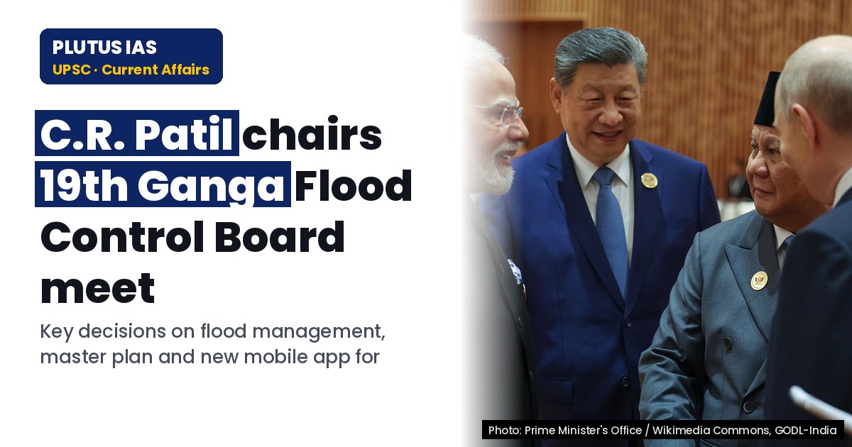
The 19th meeting of the Ganga Flood Control Board (GFCB), held on 27 October 2026 under the chairmanship of the Union Minister for Jal Shakti, highlighted institutional reforms, technological interventions, and inter-state coordination for flood management in the Ganga Basin. The meeting underscored the launch of the ‘Punar Bharan’ mobile application for groundwater recharge site identification and discussed revised mandates for the Ganga Flood Control Commission (GFCC), reflecting a shift toward risk-based, basin-wide flood management strategies.
Background
- The Ganga Basin, spanning multiple Indian states and parts of Nepal and Bangladesh, is highly vulnerable to recurrent floods due to factors such as monsoon variability, river morphology changes, and anthropogenic pressures like urbanization and infrastructure development.
- The Ganga Flood Control Board (GFCB) was constituted by the Government of India on 18 April 1972 under the Ministry of Irrigation and Power to coordinate flood management, erosion control, and drainage issues across the Ganga Basin.
- The GFCB operates as a high-level institutional platform, chaired by the Union Minister for Jal Shakti, with representation from central ministries, basin states, and technical agencies like the Ganga Flood Control Commission (GFCC).
- Historically, flood management in India has evolved from isolated structural measures (e.g., embankments, dams) to integrated, basin-wide approaches emphasizing coordination, risk assessment, and modern technologies.
- The National Disaster Management Act, 2005, and the National Disaster Management Policy, 2009, provide the legal and policy framework for disaster management, including floods, with a focus on preparedness, mitigation, and response.
- The National Water Mission (2011) and the National Hydrology Project (2016) have strengthened India’s capacity for hydrological data collection, flood forecasting, and integrated water resources management.
What is the Ganga Flood Control Board (GFCB)?
- The GFCB is a body constituted under the Ministry of Jal Shakti to address flood, erosion, and drainage challenges in the Ganga Basin through coordinated planning and implementation.
- It is chaired by the Union Minister for Jal Shakti and includes representatives from central ministries (e.g., Ministry of Agriculture and Farmers’ Welfare, Ministry of Environment, Forest and Climate Change), basin states (Uttar Pradesh, Bihar, West Bengal, Jharkhand, Uttarakhand), and technical agencies like the Ganga Flood Control Commission (GFCC).
- The chairperson of the GFCC serves as the Member Secretary of the GFCB and is responsible for technical assessments, river morphology studies, and the development of flood management plans for the basin.
- The GFCB’s mandate includes inter-state coordination, risk-based flood management planning, and the integration of modern technologies such as remote sensing, GIS, and mobile applications for real-time data collection and decision-making.
- The Board meets periodically to review ongoing initiatives, assess the progress of flood management projects, and deliberate on emerging challenges such as climate change-induced extreme weather events and urban flooding.
- The GFCB’s institutional framework is designed to bridge the gap between central planning and state-level implementation, ensuring that flood management strategies are both technically sound and contextually appropriate.
- The Board’s decisions are guided by the principles of cooperative federalism, with a focus on shared responsibility between the Union and state governments for disaster risk reduction.
Key Features
| Feature | Significance |
|---|---|
| Ganga Flood Control Board (GFCB) | A high-level institutional platform established in 1972 under the Ministry of Jal Shakti to coordinate flood management, erosion control, and drainage issues in the Ganga Basin across central and state governments. |
| 19th Meeting of GFCB (27 Oct 2026) | Chaired by the Union Minister for Jal Shakti, this meeting reviewed ongoing initiatives, strengthened inter-state coordination, and discussed emerging approaches for flood management in the Ganga Basin. |
| Recharge Mobile App Launch | Developed by BISAG-N under the National Water Mission, this app identifies scientifically suitable sites for artificial groundwater recharge to mitigate flood risks and enhance water security. |
| Revised Terms of Reference (ToR) for GFCB | Proposes strengthening basin-level flood management planning, river morphology studies, sediment analysis, and development of a Flood Management Information System to improve coordination and decision-making. |
| Risk-Based Basin Master Plan | A proposed framework to integrate flood risk assessment, infrastructure adequacy (e.g., bridges), and modern technologies for time-bound implementation of flood management projects. |
Why it Matters
Institutional Coordination
- GFCB serves as a constitutional and administrative bridge between the Union Government and Ganga Basin states (Uttar Pradesh, Bihar, West Bengal, etc.) to harmonise flood management policies under Article 252 and the Inter-State Water Disputes Act, 1956.
- The Board’s structure ensures federalism-compliant decision-making while addressing transboundary challenges in the Ganga Basin.
- Strengthening of GFCB’s ToR and restructuring aims to reduce bureaucratic delays and improve technical evaluations for flood mitigation projects.
Technological Integration
- The ‘Recharge Mobile App’ exemplifies the use of geospatial technology and remote sensing (via BISAG-N) to identify groundwater recharge zones, aligning with the National Water Mission’s objectives.
- Modern survey techniques (e.g., LiDAR, drone mapping) and robust technical audits were emphasised to assess river morphology, sediment load, and infrastructure constraints.
- Development of a Flood Management Information System (FMIS) will enable real-time data sharing and evidence-based policymaking across states.
Environmental and Hydrological Sustainability
- Focus on river morphology studies and sediment analysis addresses long-term ecological impacts of flood control structures, ensuring ecological balance in the Ganga Basin.
- Artificial groundwater recharge initiatives aim to restore aquifer levels, reducing dependency on surface water and mitigating flood-drought cycles.
- Risk-based planning integrates climate change projections and hydrological variability to future-proof flood management strategies.
Economic and Social Resilience
- Effective flood management reduces agricultural losses, protects rural livelihoods, and prevents displacement in the densely populated Ganga Basin.
- Timely implementation of flood control projects minimises infrastructure damage (e.g., roads, bridges), ensuring continuity of economic activities.
- Improved drainage systems and erosion control measures enhance urban and rural resilience against monsoon-related disasters.
Policy and Governance Reforms
- Revised ToR for GFCB and its restructuring reflect a shift towards outcome-based governance, with clear timelines and accountability mechanisms for flood management projects.
- Emphasis on statutory clearances and inter-ministerial coordination ensures compliance with environmental laws (e.g., EIA Notification, 2006) and land acquisition norms.
- The meeting underscored the need for capacity-building among state agencies to adopt modern flood management technologies and methodologies.
Challenges
1. Inter-State Coordination Gaps
- Divergent priorities among Ganga Basin states (e.g., West Bengal vs. Uttar Pradesh) can hinder unified flood management strategies despite the GFCB’s mandate.
- Delays in inter-state agreements on water sharing and project implementation remain a persistent challenge under the Inter-State Water Disputes Act, 1956.
- Lack of standardised data-sharing protocols across states complicates basin-wide risk assessments and master planning.
UPSC Link: Inter-State Water Disputes Act, 1956
2. Technical and Infrastructure Constraints
- Inadequate assessment of river morphology and sediment dynamics leads to suboptimal design of flood control structures (e.g., embankments, spurs).
- Bridges and culverts often obstruct natural waterways, exacerbating flood risks during peak discharge events.
- Outdated drainage systems in urban areas (e.g., Kanpur, Patna) fail to cope with increased runoff due to unplanned urbanisation and climate change.
UPSC Link: River Morphology and Sediment Transport
3. Environmental and Ecological Trade-offs
- Large-scale flood control measures (e.g., embankments) can disrupt river ecosystems, alter sediment deposition patterns, and reduce biodiversity in floodplains.
- Artificial groundwater recharge, while beneficial, requires careful site selection to avoid salinisation or contamination of aquifers.
- Climate change-induced variability in monsoon patterns challenges traditional flood management paradigms, necessitating adaptive strategies.
UPSC Link: Ganga River Basin Ecology
4. Governance and Implementation Bottlenecks
- Lengthy statutory clearances (e.g., forest clearance, wildlife clearance) delay project execution, despite the urgency of flood mitigation.
- Inadequate funding and resource allocation at the state level hinder the adoption of modern technologies (e.g., GIS, remote sensing) for flood monitoring.
- Limited institutional capacity in state agencies to interpret geospatial data and implement risk-based planning frameworks.
UPSC Link: National Water Mission
5. Data and Monitoring Gaps
- Inconsistent hydrological data across states impedes accurate flood forecasting and real-time decision-making.
- Absence of a unified Flood Management Information System (FMIS) limits cross-state collaboration and transparency in project monitoring.
- Lack of post-project evaluation mechanisms to assess the effectiveness of flood control measures and inform future planning.
UPSC Link: Flood Management Information System
6. Climate Change and Extreme Events
- Increased frequency of extreme rainfall events (e.g., cloudbursts, glacial lake outbursts) overwhelms existing flood control infrastructure.
- Rising temperatures accelerate glacial melt in the Himalayas, altering river discharge patterns and sediment loads in the Ganga Basin.
- Urban heat island effects exacerbate localised flooding in cities, necessitating integrated urban flood management strategies.
UPSC Link: Climate Change and Water Resources
Challenges — UPSC Perspective
| Issue | Concern |
|---|---|
| Inter-state disputes | Delays in consensus on water sharing and project implementation under the Inter-State Water Disputes Act, 1956. |
| River morphology changes | Inadequate studies on sediment dynamics and channel shifts leading to suboptimal flood control designs. |
| Urban drainage systems | Outdated infrastructure in cities (e.g., Kanpur, Patna) unable to handle increased runoff from unplanned development. |
| Statutory clearances | Lengthy environmental and forest clearances delaying critical flood mitigation projects. |
| Data inconsistencies | Lack of standardised hydrological data across states hindering accurate flood forecasting. |
| Climate variability | Increased frequency of extreme rainfall events overwhelming existing flood control measures. |
Government Initiatives — Must-Memorise for Prelims
- National Water Mission (NWM)
- Artificial Groundwater Recharge under NWM
- Flood Management Programme (FMP) of the Ministry of Jal Shakti
Way Forward
- Finalise and operationalise the revised Terms of Reference (ToR) for GFCB to streamline coordination and decision-making processes.
- Develop a unified Flood Management Information System (FMIS) for real-time data sharing and evidence-based policymaking across Ganga Basin states.
- Accelerate the implementation of risk-based Basin Master Plans, integrating modern survey techniques (e.g., LiDAR, drone mapping) and climate projections.
- Strengthen inter-state agreements under the Inter-State Water Disputes Act, 1956, to ensure timely execution of flood management projects.
- Enhance capacity-building programmes for state agencies to adopt geospatial technologies, sediment analysis, and risk-based planning frameworks.
- Prioritise the removal of infrastructure obstructions (e.g., bridges, culverts) in natural waterways to improve river flow dynamics and reduce flood risks.
- Establish a post-project evaluation mechanism to assess the effectiveness of flood control measures and inform future planning.
- Integrate climate resilience into flood management strategies, including glacial lake outburst flood (GLOF) risk assessments and urban flood management plans.
UPSC Value Addition
Keywords for Mains Answer-Writing
Ganga Flood Control Board (GFCB) · flood management in India · inter-state river governance · National Water Mission · Bhaskaracharya National Institute for Space Applications and Geo-information (BISAG) · Rejuvenation Mobile App · risk-based basin master plan · Ganga Basin states · flood control institutional mechanisms · modern survey techniques in flood management · river morphology and sedimentation studies · flood management information system · National Water Policy · inter-state coordination in water resources · climate-resilient infrastructure for flood management
Constitutional & Policy Linkages
- Article 262: Adjudication of disputes relating to inter-state rivers and river valleys.
Concept Flow
Monsoon variability and climate change → Increased frequency of extreme rainfall events → Altered river discharge and sediment load → Strain on existing flood control infrastructure → GFCB meeting to review and revise flood management strategies. → Urbanisation and unplanned development → Inadequate drainage systems → Localised flooding → Need for integrated urban flood management → Emphasis on modern survey techniques and infrastructure upgrades. → Inter-state water disputes → Delays in project implementation → Need for strengthened coordination under GFCB → Revised ToR and Basin Master Plans to ensure timely execution. → Depletion of groundwater resources → Need for artificial recharge → Development of ‘Recharge Mobile App’ → Integration of geospatial technology for site identification. → River morphology changes → Erosion and sediment deposition → Suboptimal design of flood control structures → Focus on sediment analysis and modern survey techniques in revised ToR. → Lack of real-time data sharing → Inaccurate flood forecasting → Need for Flood Management Information System (FMIS) → Development of unified data-sharing protocols. → Statutory clearances and bureaucratic delays → Project execution bottlenecks → Emphasis on streamlined governance and capacity-building in GFCB meeting.
Prelims Practice Questions
Q1. Consider the following statements regarding the Ganga Flood Control Board (GFCB):
1. The GFCB was constituted by the Central Government on 18 April 1972.
2. The Board is chaired by the Union Minister of Jal Shakti.
3. The Ganga Flood Control Commission serves as the Member Secretary of the GFCB.
4. The Board includes representatives from only the Central Ministries and excludes state governments.
How many of the above statements are correct?
- Only one
- Only two
- Only three
- All
Answer: Only three — Statements 1, 2, and 3 are correct. Statement 4 is incorrect as the Board includes representatives from Ganga Basin states along with central ministries.
Q2. Which of the following is the primary objective of the ‘Rejuvenation Mobile App’ launched during the 19th meeting of the Ganga Flood Control Board?
- A. To provide real-time flood forecasting in the Ganga Basin
- B. To identify suitable sites for artificial groundwater recharge using scientific methods
- C. To monitor riverbank erosion in the Ganga Basin
- D. To facilitate inter-state water sharing agreements
Answer: B. To identify suitable sites for artificial groundwater recharge using scientific methods — The ‘Rejuvenation Mobile App’ was developed to assist in the scientific identification of suitable sites for implementing artificial groundwater recharge measures, as part of the National Water Mission.
Q3. Assertion (A): The Ganga Flood Control Board serves as a high-level institutional platform to strengthen cooperation and coordination between the Centre and states for effective flood management.
Reason (R): The Board includes representatives from central ministries and chief ministers or their representatives from Ganga Basin states.
In the context of the above two statements, which one of the following is correct?
- Both A and R are true, and R is the correct explanation of A
- Both A and R are true, but R is not the correct explanation of A
- A is true, but R is false
- A is false, but R is true
Answer: Both A and R are true, and R is the correct explanation of A — Both Assertion (A) and Reason (R) are true. The Board’s composition, including central ministries and state representatives, facilitates inter-state coordination, which is a key function of the GFCB.
Mains Practice Question
✍ The institutional architecture for flood management in India, particularly in the Ganga Basin, has evolved significantly over the decades. Critically examine the role and effectiveness of the Ganga Flood Control Board (GFCB) in addressing the challenges of flood management. Also, analyse how modern technological interventions, such as the ‘Rejuvenation Mobile App’, can enhance the Board’s operational efficiency. (15 Marks)
Approach: MODEL-ANSWER SKELETON:
1. **Constitutional and Institutional Framework** (3 Marks):
– Brief background of the GFCB: Constitution under the River Boards Act, 1956 (or relevant legal basis), and its mandate to address flood control, erosion, and drainage in the Ganga Basin.
– Composition: Union Minister of Jal Shakti as Chairperson, representatives from central ministries (e.g., Ministry of Environment, Forest and Climate Change, Ministry of Rural Development), and chief ministers or their nominees from Ganga Basin states (Uttar Pradesh, Bihar, West Bengal, Jharkhand, Uttarakhand, etc.).
– Role of the Ganga Flood Control Commission as the Member Secretary.
2. **Key Functions and Achievements** (4 Marks):
– Coordination between Centre and states for flood management plans.
– Development of inter-state flood management schemes (e.g., embankments, drainage projects).
– Preparation of flood management plans, including risk-based basin master plans.
– Addressing river morphology and sedimentation issues through technical studies.
– Establishment of flood management information systems for real-time monitoring.
3. **Challenges and Limitations** (4 Marks):
– Fragmented governance: Overlapping jurisdictions between central and state agencies.
– Delayed implementation of projects due to bureaucratic hurdles and inter-state disputes.
– Inadequate integration of modern technologies in traditional flood management practices.
– Limited focus on climate-resilient infrastructure and adaptive strategies.
– Constraints in data sharing and technological adoption across states.
4. **Modern Technological Interventions** (3 Marks):
– **Rejuvenation Mobile App**: Developed by BISAG under the National Water Mission to identify suitable sites for artificial groundwater recharge. Explain its utility in enhancing groundwater availability and reducing flood risks.
– **Modern Survey Techniques**: Use of LiDAR, remote sensing, and GIS for accurate river morphology and sedimentation studies.
– **Flood Management Information Systems**: Integration of real-time data from satellites and ground stations for predictive modelling and early warning systems.
– **Risk-Based Basin Master Plans**: Incorporation of probabilistic risk assessments to prioritize interventions.
5. **Way Forward** (1 Mark):
– Strengthening inter-state coordination through institutional reforms (e.g., empowered committees, dedicated funding mechanisms).
– Promoting public-private partnerships for technology adoption.
– Enhancing capacity-building among state agencies for modern flood management techniques.
– Aligning flood management strategies with the National Water Policy and climate adaptation goals.
Source: PIB (Press Information Bureau)
Generated by AanyaAi for educational purpose.
Related guides on our sites
- Anthropology VS PSIR
- Best PSIR optional coaching
- Best PSIR optional coaching online
- Best geography optional coaching

- DFPD’s Special Campaign 6 Concludes: Key Outcomes & Governance - November 5, 2026
- एमवाई भारत का ‘अपना वोट जानें’ अभियान: युवाओं में चुनावी जागरूकता - November 5, 2026
- Delhi’s ‘Very Poor’ AQI: UPSC & PCS Environment Update - November 5, 2026

No Comments