

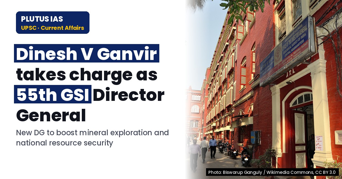
01 Nov Dinesh V. Ganvir takes charge as 55th GSI Director: Key priorities for UPSC
✎ The Geological Survey of India (GSI) is India’s premier geoscientific agency, mandated to conduct geological mapping, mineral exploration, and geohazard studies, with a renewed focus on critical mineral security and technological…
Subject Relevance — Where This Topic Fits
- GS Paper II — International Relations (Geopolitics of Critical Minerals) | GS Paper III — Science and Technology (Geological Exploration, Mineral Security), Economy (Resource Efficiency, Self-Reliance) | GS Paper IV — Ethics in Governance (Scientific Integrity, Institutional Leadership)
- Prelims: Geological Survey of India (GSI), Critical Minerals, Mineral Auctions, Exploration Licensing (EL), National Mineral Exploration Policy (NMEP), UNESCO World Heritage Sites (Bhimbetka, Ellora), Geological Mapping, Glaciology, Landslide Early Warning Systems
- Essay: Science and Technology as Catalysts for National Development, Balancing Resource Security with Environmental Sustainability
Quick Revision: The Geological Survey of India (GSI) is India’s premier geoscientific agency, mandated to conduct geological mapping, mineral exploration, and geohazard studies, with a renewed focus on critical mineral security and technological modernisation under the National Mineral Exploration Policy (NMEP).
Why is this in the news?
The appointment of Shri Dinesh V. Ganvir as the 55th Director-General of the Geological Survey of India (GSI) on 01 November 2026 underscores the institution’s evolving role in India’s mineral security framework, technological modernisation, and scientific leadership. The transition occurs amid heightened national emphasis on critical mineral exploration, import substitution, and the integration of advanced geoscientific methodologies to support India’s developmental and sustainability goals.
Background
- The Geological Survey of India (GSI), established in 1851, functions under the Ministry of Mines, Government of India, as the premier agency for geological mapping, mineral exploration, and geoscientific research.
- GSI’s mandate includes the preparation of geological maps, assessment of mineral resources, and provision of geoscientific inputs for infrastructure development, disaster risk reduction, and environmental management.
- India’s critical mineral strategy, aligned with the vision of ‘Atmanirbhar Bharat’ (Self-Reliant India), prioritises the exploration and sustainable utilisation of minerals such as lithium, cobalt, rare earth elements, and graphite to reduce import dependence.
- The National Mineral Exploration Policy (NMEP) 2016 and subsequent amendments (e.g., Mineral Auctions) have institutionalised a framework for systematic mineral exploration, with GSI playing a pivotal role in generating geological data and delineating exploration blocks.
- GSI’s contributions extend to international collaborations, including participation in UNESCO programmes (e.g., World Heritage Sites like Bhimbetka and Ellora), bilateral initiatives (e.g., India-Peru Joint Working Group), and multilateral forums (e.g., IMARC 2022).
- Recent years have witnessed a five-fold increase in exploration efforts for critical and strategic minerals, with GSI generating 359 geological reports and 377 geological memoranda, facilitating the auction of 40 mineral blocks.
Geological Survey of India (GSI): Institutional Role, Mandate, and Operational Framework
- The Geological Survey of India (GSI) is a multidisciplinary scientific organisation under the Ministry of Mines, tasked with conducting geological surveys, mineral exploration, and geoscientific research to support national development.
- Core functions include: (a) geological mapping at various scales (regional to thematic), (b) mineral resource assessment and exploration, (c) engineering geology for infrastructure projects, (d) geohazard studies (e.g., landslides, glacier dynamics), and (e) geoscientific inputs for policy formulation and disaster management.
- GSI operates through six regional offices (Northern, Eastern, Southern, Western, Central, and Northeastern) and specialised divisions such as the Marine and Coastal Surveys Division, Geodata and Digital Geoscience Division, and the Geological Survey of India Training Institute.
- The organisation plays a critical role in the National Mineral Exploration Policy (NMEP) by generating baseline geological data, identifying prospective mineral blocks, and preparing exploration reports for auction under the Mineral Auctions framework.
- GSI’s responsibilities include the preparation of the National Geochemical Mapping (NGCM) programme, which aims to generate geochemical baseline data across the country to identify mineral potential and environmental anomalies.
- Institutional collaborations span international bodies (e.g., UNESCO, International Union of Geological Sciences), bilateral agreements (e.g., India-Russia Mining Sub-Group), and research partnerships with academic institutions and industry.
- GSI’s modernisation efforts include the adoption of advanced technologies such as remote sensing, GIS, AI-driven data analytics, and laboratory infrastructure upgrades to enhance exploration efficiency and accuracy.
- The organisation’s work supports multiple Sustainable Development Goals (SDGs), including SDG 9 (Industry, Innovation, and Infrastructure), SDG 12 (Responsible Consumption and Production), and SDG 13 (Climate Action) through geoscientific inputs for sustainable resource management and disaster risk reduction.
Key Features
| Feature | Significance |
|---|---|
| Appointment of 55th Director General of GSI | Ensures continuity and leadership in India’s geological and mineral exploration governance. |
| Three-decade experience in geological surveys | Brings institutional memory, technical expertise, and administrative acumen to strategic mineral exploration. |
| Focus on critical and strategic minerals | Aligns with India’s objective of reducing import dependence and enhancing mineral security. |
| Integration of advanced technologies (AI, remote sensing, data analytics) | Improves accuracy, efficiency, and scalability of mineral exploration processes. |
| Strengthening of laboratory infrastructure and offshore exploration | Expands GSI’s analytical and geographical capabilities for comprehensive resource assessment. |
Why it Matters
Economic
- Enhances domestic mineral exploration, reducing reliance on imports and supporting ‘Atmanirbhar Bharat’ initiatives.
- Facilitates systematic identification of mineral blocks for auction, boosting revenue generation and resource utilisation.
- Supports infrastructure development through geotechnical studies for major projects.
Strategic
- Strengthens mineral security by prioritising exploration of critical minerals essential for defence, energy, and technology sectors.
- Contributes to India’s self-sufficiency in strategic resources, reducing geopolitical vulnerabilities.
- Enhances geospatial data for national security and disaster management.
Scientific and Institutional
- Promotes scientific excellence in geological surveys, mapping, and multidisciplinary research.
- Reinforces GSI’s role as a premier institution for geological and geotechnical studies.
- Encourages international collaborations and knowledge exchange in mineral exploration.
Environmental and Disaster Management
- Supports landslide early warning systems, glacial studies, and climate-resilient infrastructure planning.
- Provides data-driven inputs for sustainable development and environmental conservation.
Challenges
1. Limited Exploration Coverage in Remote Regions
- Geological surveys in inaccessible terrains (e.g., Himalayan regions, deep underground) remain challenging due to logistical and technological constraints.
- Requires investment in advanced remote sensing, drones, and AI-driven data processing.
UPSC Link: Geographical Survey of India – Challenges
2. Technological Gaps in Mineral Exploration
- Need for modern equipment and analytical tools to match global standards in mineral prospecting.
- Integration of emerging technologies (e.g., hyperspectral imaging, machine learning) is resource-intensive.
UPSC Link: Mineral Exploration – Technological Advancements
3. Regulatory and Bureaucratic Delays
- Clearance processes for exploration projects can lead to time overruns and cost escalations.
- Coordination between central and state agencies is critical for seamless implementation.
UPSC Link: Mineral Laws (Amendment) Act, 2023 – Implementation
4. Environmental and Social Opposition
- Local communities and environmental groups may resist mining activities due to ecological concerns.
- Requires robust stakeholder engagement and sustainable mining practices.
UPSC Link: Environmental Impact Assessment – Mining Sector
5. Data Integration and Standardisation
- Fragmented geological data across states and agencies hinders comprehensive resource mapping.
- Need for a national geospatial database with standardised protocols.
UPSC Link: National Geospatial Policy, 2022
Challenges — UPSC Perspective
| Issue | Concern |
|---|---|
| Access to remote terrains | Logistical and technological barriers limit comprehensive geological surveys. |
| High cost of advanced exploration technologies | Financial constraints may delay adoption of AI, drones, and remote sensing. |
| Regulatory bottlenecks | Clearance delays and inter-agency coordination issues slow project execution. |
| Environmental and social resistance | Potential conflicts with local communities and environmental norms. |
| Data fragmentation | Lack of standardised geospatial databases across states and agencies. |
Way Forward
- Accelerate integration of AI, machine learning, and remote sensing in mineral exploration to enhance precision and reduce costs.
- Strengthen laboratory infrastructure and analytical capabilities for advanced mineral testing and certification.
- Expand offshore exploration initiatives to tap into deep-sea mineral resources.
- Develop a national geospatial database with standardised protocols for seamless data integration and sharing.
- Enhance stakeholder engagement to address environmental and social concerns in mining regions.
- Streamline regulatory processes for mineral exploration projects to reduce bureaucratic delays.
- Promote international collaborations with organisations like UNESCO, USGS, and Geoscience Australia for knowledge exchange.
- Focus on capacity building through training programmes for geologists and technical staff in emerging technologies.
UPSC Value Addition
Keywords for Mains Answer-Writing
Indian Geological Survey (GSI) · Mineral Security · National Mineral Exploration Policy (NMEP) · Critical and Strategic Minerals · Mineral Auction Regime · Geological Mapping · Disaster Risk Reduction · Atmanirbhar Bharat Mission · Offshore Mineral Exploration · Geoscience Research · Geological Survey of India Act, 1958 · Mineral Concession Rules, 2016 · UNESCO World Heritage Sites · Glacial and Cryospheric Studies · Landslide Early Warning Systems · Data-Driven Geoscience · Multidisciplinary Geological Investigations · Mineral Block Identification · Scientific Excellence in Geoscience
Concept Flow
Appointment of GSI Director General → Strategic leadership in mineral exploration → Prioritisation of critical minerals → Alignment with ‘Atmanirbhar Bharat’ and mineral security → Integration of advanced technologies → Improved accuracy and efficiency in exploration → Systematic identification of mineral blocks → Preparation for auction and revenue generation → Strengthening of laboratory and offshore infrastructure → Expansion of GSI’s analytical capabilities → Enhanced geospatial data → Support for infrastructure, disaster management, and policy formulation → Sustainable and inclusive mineral exploration → Balancing economic growth with environmental and social considerations
Prelims Practice Questions
Q1. Consider the following statements regarding the Geological Survey of India (GSI):
1. GSI operates under the administrative control of the Ministry of Mines, Government of India.
2. GSI is mandated to conduct geological surveys and mineral exploration for the entire country.
3. GSI’s functions include disaster risk reduction and early warning systems for landslides.
4. GSI is solely responsible for the auction of mineral blocks in India.
How many of the above statements are correct?
- Only one
- Only two
- Only three
- All
Answer: Only three — Statements 1, 2, and 3 are correct. GSI functions under the Ministry of Mines (Statement 1), conducts nationwide geological surveys and mineral exploration (Statement 2), and contributes to disaster risk reduction, including landslide early warning systems (Statement 3). Statement 4 is incorrect as mineral block auctions are conducted by state governments under the Mineral Auction Rules, 2015, with technical inputs from GSI.
Q2. Assertion (A): The Geological Survey of India (GSI) plays a pivotal role in identifying mineral blocks for auction in India.
Reason (R): GSI prepares geological reports and exploration blocks, which are essential inputs for the mineral auction process under the National Mineral Exploration Policy (NMEP).
In the context of the above two statements, which of the following is correct?
- Both A and R are true, and R is the correct explanation of A
- Both A and R are true, but R is not the correct explanation of A
- A is true, but R is false
- A is false, but R is true
Answer: Both A and R are true, and R is the correct explanation of A — Both Assertion (A) and Reason (R) are true. GSI’s role in preparing geological reports and exploration blocks is indeed a critical input for the mineral auction process under the NMEP, making R the correct explanation of A.
Q3. Match the following initiatives of the Geological Survey of India (GSI) with their respective objectives:
Column I (Initiative) | Column II (Objective)
———————————————–|———————————————–
A. National Mission-II | 1. Strengthening offshore mineral exploration
B. Geological Mapping of Western Bastar Craton | 2. Systematic identification of mineral blocks
C. UNESCO World Heritage Site Studies | 3. Thematic mapping for mineral potential
D. Offshore Mineral Exploration | 4. Conservation and geological studies
Select the correct match:
- A-2, B-3, C-4, D-1
- A-3, B-2, C-1, D-4
- A-1, B-4, C-3, D-2
- A-4, B-1, C-2, D-3
Answer: A-2, B-3, C-4, D-1 — The correct match is: A-2 (National Mission-II focuses on systematic identification of mineral blocks), B-3 (Geological Mapping of Western Bastar Craton is a thematic mapping exercise for mineral potential), C-4 (UNESCO World Heritage Site Studies involve conservation and geological studies), and D-1 (Offshore Mineral Exploration aims to strengthen exploration in offshore areas).
Mains Practice Question
✍ The Geological Survey of India (GSI) is increasingly being positioned as a key institution for advancing India’s mineral security and self-reliance agenda. Critically examine this assertion with reference to the evolving role of GSI in mineral exploration, technological upgradation, and policy integration. Also, analyse the challenges that GSI faces in fulfilling its mandate in the context of India’s developmental priorities. (15 Marks)
Approach: MODEL-ANSWER SKELETON:
1. **Introduction (2 Marks)**
– Briefly define GSI’s constitutional and statutory mandate under the Geological Survey of India Act, 1958, and its administrative control under the Ministry of Mines.
– Contextualise the current emphasis on mineral security and self-reliance (Atmanirbhar Bharat) in India’s policy discourse.
2. **GSI’s Evolving Role in Mineral Security (4 Marks)**
– **Mineral Exploration and Mapping**: Discuss GSI’s role in systematic geological mapping (e.g., Western Bastar Craton), preparation of mineral block reports, and contribution to the National Mineral Exploration Policy (NMEP).
– **Critical and Strategic Minerals**: Explain GSI’s focus on identifying and auctioning blocks for critical minerals (e.g., lithium, cobalt, rare earths) under the mineral auction regime.
– **Data-Driven Decision Making**: Highlight the integration of advanced technologies (e.g., remote sensing, AI, big data analytics) in mineral prospectivity mapping.
3. **Technological Upgradation and Institutional Capacity (4 Marks)**
– **Modernisation Initiatives**: Discuss GSI’s efforts to upgrade laboratory infrastructure, analytical capabilities, and offshore exploration (e.g., National Centre for Polar and Ocean Research collaboration).
– **Multidisciplinary Research**: Elaborate on GSI’s contributions to disaster risk reduction (e.g., landslide early warning systems), glaciology, and cryospheric studies.
– **International Collaborations**: Mention GSI’s participation in global platforms (e.g., UNESCO, IMARC) to enhance technical expertise and knowledge exchange.
4. **Policy Integration and Challenges (3 Marks)**
– **Alignment with National Policies**: Discuss how GSI’s work aligns with the National Mineral Policy 2019, Mineral Concession Rules 2016, and the Vision for Atmanirbhar Bharat.
– **Challenges**: Identify key challenges such as limited funding, regulatory bottlenecks in mineral auctions, data privacy concerns in digital mapping, and the need for inter-ministerial coordination (e.g., with Ministry of Environment, Forest and Climate Change for forest clearances).
5. **Conclusion (2 Marks)**
– Summarise GSI’s critical role in India’s mineral security and self-reliance agenda.
– Emphasise the need for sustained investment, technological innovation, and policy coherence to realise GSI’s full potential.
**Balanced View Required**: Acknowledge GSI’s strengths (e.g., technical expertise, institutional legacy) while critically assessing its limitations (e.g., resource constraints, bureaucratic hurdles).
Source: PIB (Press Information Bureau)
Generated by AanyaAi for educational purpose.
Related guides on our sites
- Best PSIR optional coaching for upsc
- Best economics optional coaching for upsc
- Best PSIR optional teacher for upsc
- Best teacher of PSIR optional for upsc

- Dinesh V. Ganvir takes charge as 55th GSI Director: Key priorities for UPSC - November 1, 2026
- केरल में जल जीवन मिशन के शेष कार्यों के लिए ₹26,074.17 करोड़ की आवश्यकता: राज्य विधानसभा में जानकारी - November 1, 2026
- Lok Sabha Speaker to Inaugurate PAC Chairpersons’ Conference in Kerala - November 1, 2026
No Comments