


06 Aug Karnataka Launches AI-Powered Digital Crop Survey for Precision Agriculture
✎ The Composite Digital Crop Survey (CDCS) in Karnataka leverages AI, ML, SAR, drones, and GIS to automate and enhance the accuracy of agricultural data collection, building on the existing Digital Crop Survey (DCS) framework.
Subject Relevance — Where This Topic Fits
- GS Paper III — Agriculture, Technology, Food Security and Issues related to Direct and Indirect Farm Subsidies and Minimum Support Prices | GS Paper III — Infrastructure: e-Governance- Applications, Models, Successes, Limitations, and Potential
- Prelims: Digital Crop Survey (DCS), Composite Digital Crop Survey (CDCS), Synthetic Aperture Radar (SAR), Geographic Information System (GIS), Machine Learning (ML), Artificial Intelligence (AI), Drone surveys, e-governance in agriculture
- Essay: Role of technology in transforming India’s agricultural sector: A case study of Karnataka’s AI-driven crop survey, Data-driven governance: Balancing precision, privacy, and policy in India’s digital public infrastructure
Quick Revision: The Composite Digital Crop Survey (CDCS) in Karnataka leverages AI, ML, SAR, drones, and GIS to automate and enhance the accuracy of agricultural data collection, building on the existing Digital Crop Survey (DCS) framework.
Why is this in the news?
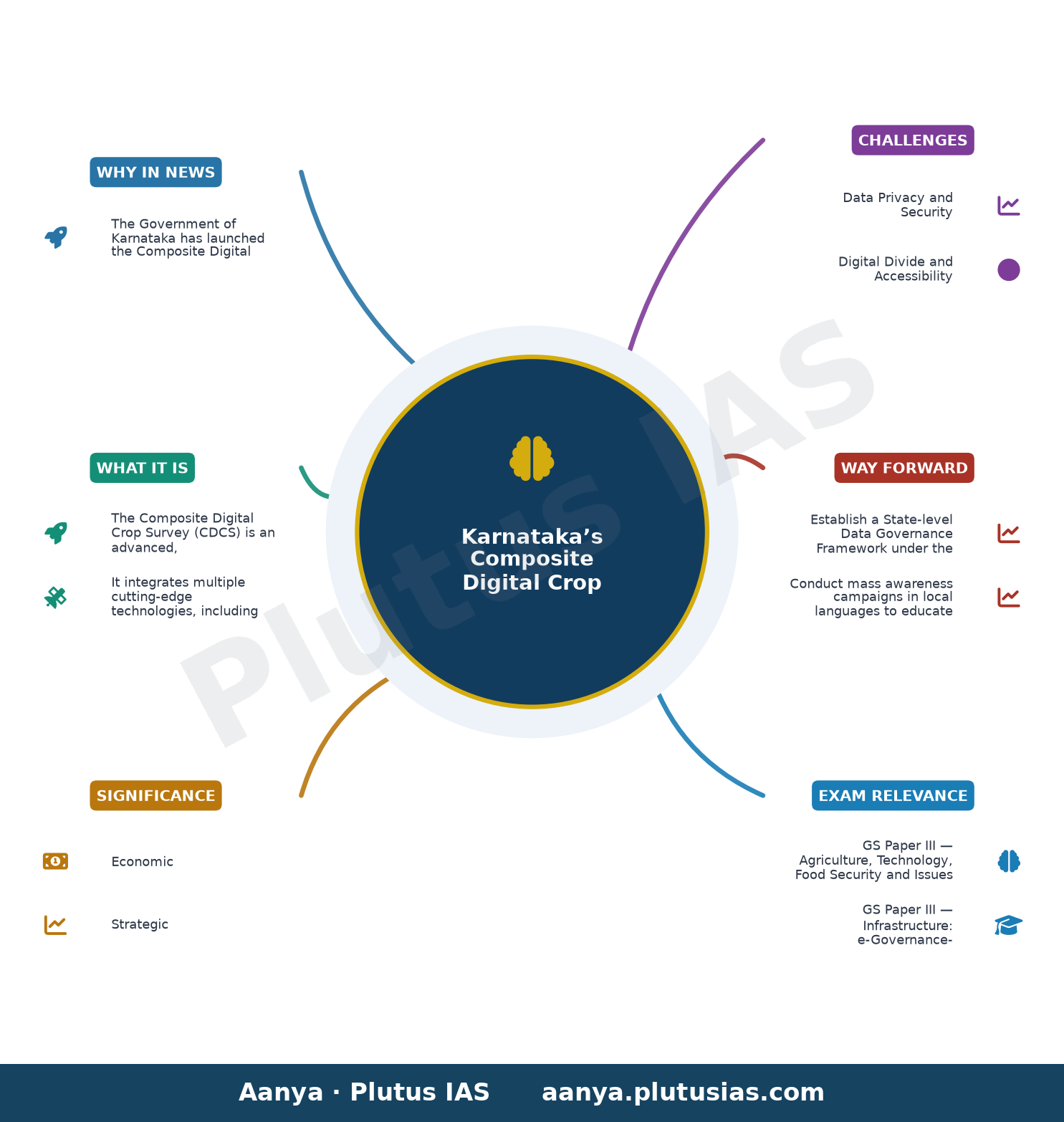
The Government of Karnataka has launched the Composite Digital Crop Survey (CDCS), a pilot initiative integrating advanced technologies such as high-resolution satellite imagery, Synthetic Aperture Radar (SAR), drone surveys, GIS, Artificial Intelligence (AI), and Machine Learning (ML) to enhance the accuracy and reliability of agricultural data. This initiative builds on the existing Digital Crop Survey (DCS), introduced in 2018, and aims to strengthen evidence-based policymaking and agricultural governance in the state.
Background
- Karnataka introduced the Digital Crop Survey (DCS) in 2018 as a GIS-based mobile application to collect authenticated plot-level crop data, replacing traditional manual surveys which were prone to errors and delays.
- The DCS was designed to address challenges such as inaccurate crop estimation, delays in data compilation, and lack of real-time monitoring, which often led to inefficiencies in agricultural planning and subsidy disbursement.
- The DCS leveraged mobile technology and GIS to enable farmers to self-report crop data, which was then verified by field officials, improving transparency and reducing fraud in crop insurance and subsidy claims.
- Despite its advantages, the DCS faced limitations in data precision due to reliance on manual inputs, limited coverage in remote or inaccessible areas, and challenges in distinguishing between similar crop types using basic remote sensing.
- The integration of AI, ML, SAR, and drone surveys in the CDCS represents a paradigm shift toward automated, high-accuracy, and real-time agricultural data collection, aligning with the broader national push for digital agriculture under initiatives like the Digital India Land Records Modernization Programme (DILRMP).
- Karnataka’s agricultural sector, with diverse cropping patterns across regions such as Malnad, Bayaluseeme, and coastal areas, requires precise and granular data for effective policy interventions, making technological advancements critical.
What is the Composite Digital Crop Survey (CDCS)?
- The Composite Digital Crop Survey (CDCS) is an advanced, technology-driven agricultural data collection system launched by Karnataka to enhance the accuracy, reliability, and scientific validation of crop surveys.
- It integrates multiple cutting-edge technologies, including high-resolution satellite imagery, Synthetic Aperture Radar (SAR), drone surveys, Geographic Information System (GIS), Artificial Intelligence (AI), and Machine Learning (ML), to automate and refine the data collection process.
- The CDCS is currently being implemented on a pilot basis in five selected *hoblis* (administrative sub-divisions) across Karnataka, representing all geographical divisions to ensure diverse cropping patterns are captured.
- The system aims to replace or supplement manual data collection by enabling automated crop identification, area estimation, and yield prediction using AI and ML models trained on historical and real-time remote sensing data.
- Synthetic Aperture Radar (SAR) is particularly useful in cloud-prone regions, as it can penetrate cloud cover and provide consistent data regardless of weather conditions, unlike optical satellite imagery.
- Drone surveys will supplement satellite data by providing hyper-local, high-resolution imagery for small and fragmented landholdings, where satellite data may lack precision.
- The integration of GIS ensures spatial accuracy, enabling the mapping of crop plots with high precision and facilitating the overlay of socio-economic and environmental data for comprehensive analysis.
- The ultimate objective is to generate real-time, authenticated crop data that can be used for evidence-based policymaking, efficient subsidy disbursement, crop insurance claims, and agricultural planning.
Key Features
| Feature | Significance |
|---|---|
| High-resolution satellite imagery | Enables precise identification of crop types, acreage, and health across large areas with minimal temporal gaps. |
| Synthetic Aperture Radar (SAR) | Provides all-weather, day-night imagery unaffected by cloud cover, critical for monsoon-dependent agriculture. |
| Drone surveys | Facilitates hyper-local validation of crop data, reducing discrepancies in farmer-reported information. |
| GIS integration | Spatially correlates crop data with land records, soil maps, and agro-climatic zones for holistic analysis. |
| Artificial Intelligence & Machine Learning | Automates classification of crops, detects anomalies (e.g., pest infestations), and predicts yield trends using historical and real-time data. |
Why it Matters
Economic
- Enhances accuracy of agricultural statistics, reducing data asymmetry for market regulators and agri-businesses.
- Supports targeted subsidy disbursement (e.g., PM-KISAN, state-level schemes) by validating beneficiary eligibility through plot-level data.
- Facilitates better crop insurance pricing and claim settlements by providing verifiable, high-frequency data on crop health and yield.
Strategic
- Strengthens India’s food security framework by improving early warning systems for droughts, floods, or pest outbreaks.
- Enables evidence-based agricultural policy formulation, aligning with the National Mission on Sustainable Agriculture (NMSA).
- Reduces leakages in welfare schemes through transparent, tamper-proof data collection, aligning with the Digital India vision.
Technological
- Demonstrates India’s capability in leveraging frontier technologies (AI, SAR, drones) for governance, setting a precedent for other states.
- Integrates geospatial data with administrative records, advancing the use of spatial analytics in public administration.
- Provides a scalable model for other sectors (e.g., forestry, urban planning) requiring high-resolution spatial data.
Environmental
- Supports climate-resilient agriculture by monitoring soil moisture, water stress, and crop resilience to extreme weather events.
- Enables tracking of land-use changes, deforestation, and crop diversification trends for sustainable land management.
Challenges
1. Data Privacy and Security
- Risk of misuse of farmer data by private entities or unauthorized surveillance, necessitating robust data governance frameworks.
- Compliance with the Digital Personal Data Protection Act, 2023, to ensure consent-based data collection and storage.
UPSC Link: GS3: Cyber Security
2. Digital Divide and Accessibility
- Small and marginal farmers may lack access to smartphones or digital literacy, leading to underrepresentation in the survey.
- Need for multi-modal data collection (e.g., field enumerators, community kiosks) to ensure inclusivity.
UPSC Link: GS2: Social Justice
3. Technological Dependence and Costs
- High initial investment in AI/ML infrastructure, satellite imagery, and drone technology may strain state resources.
- Maintenance of high-resolution data pipelines and real-time processing systems requires continuous funding and technical expertise.
UPSC Link: GS3: Science & Tech
4. Interoperability and Standardization
- Integration of diverse data sources (satellite, drone, GIS) requires standardized protocols to avoid inconsistencies.
- Need for seamless data sharing between state agencies, central ministries (e.g., MoA&FW), and private partners.
UPSC Link: GS2: Governance
5. Farmer Resistance and Trust Deficit
- Farmers may perceive the survey as intrusive or fear it could lead to higher land taxes or land ceiling violations.
- Lack of awareness about the benefits of data-driven governance may reduce participation rates.
UPSC Link: GS1: Rural Development
Challenges — UPSC Perspective
| Issue | Concern |
|---|---|
| Data Privacy | Risk of unauthorized access or commercial exploitation of farmer data. |
| Digital Literacy | Exclusion of small farmers due to lack of digital skills or infrastructure. |
| Cost Overruns | High expenditure on technology adoption and maintenance in rural areas. |
| Interoperability | Inconsistencies arising from non-standardized data formats across agencies. |
| Farmer Skepticism | Perceived threats to land rights or increased regulatory scrutiny. |
Way Forward
- Establish a State-level Data Governance Framework under the Karnataka State Data Policy to define data ownership, consent, and usage rights.
- Conduct mass awareness campaigns in local languages to educate farmers on the benefits of the survey and data privacy safeguards.
- Develop a tiered digital infrastructure model, combining high-tech (AI, drones) with low-tech (SMS, community kiosks) for inclusive data collection.
- Pilot blockchain-based data validation to ensure tamper-proof records and enable transparent audit trails for subsidies and insurance claims.
- Collaborate with ISRO, NRSC, and private geospatial firms to optimize satellite imagery acquisition and reduce costs.
- Integrate the CDCS with the National Crop Insurance Portal (NCIP) and PM-KISAN databases to streamline beneficiary verification.
- Create a feedback mechanism for farmers to report discrepancies, ensuring iterative improvement of the survey methodology.
UPSC Value Addition
Keywords for Mains Answer-Writing
Digital Public Infrastructure · Agricultural Technology · Precision Agriculture · Geospatial Technology · Synthetic Aperture Radar (SAR) · Drone Technology in Governance · AI and ML in Public Policy · Crop Insurance Schemes · Evidence-based Policy Making · Agricultural Data Governance · Digital Land Records · Karnataka Digital Crop Survey (DCS) · Composite Digital Crop Survey (CDCS) · GIS-based Agricultural Surveys · Farmers’ Welfare through Technology
Concept Flow
Farmer-land records digitization (e.g., Bhoomi project) → Need for accurate crop data → Integration of AI, SAR, and drones → Composite Digital Crop Survey (CDCS) → Evidence-based policy formulation → Targeted agricultural welfare schemes → Enhanced food security and climate resilience.
Prelims Practice Questions
Q1. Consider the following statements regarding the Composite Digital Crop Survey (CDCS) launched by Karnataka:
1. The CDCS integrates high-resolution satellite imagery, Synthetic Aperture Radar (SAR), drone surveys, GIS data, Artificial Intelligence (AI), and Machine Learning (ML).
2. The CDCS replaces the existing Digital Crop Survey (DCS) implemented since 2018.
3. The CDCS is being piloted in five selected hoblis representing all geographical divisions of Karnataka.
4. The primary objective of CDCS is to automate the collection of agricultural data without human intervention.
How many of the above statements are correct?
- Only one
- Only two
- Only three
- All
Answer: Only three — Statements 1 and 3 are correct. Statement 2 is incorrect as CDCS enhances the existing DCS, not replaces it. Statement 4 is incorrect as the objective is to enhance accuracy and reliability of data, not full automation without human intervention.
Q2. Assertion (A): The Composite Digital Crop Survey (CDCS) in Karnataka uses Synthetic Aperture Radar (SAR) to penetrate cloud cover and obtain accurate crop data.
Reason (R): SAR is a form of radar that uses the microwave region of the electromagnetic spectrum to create high-resolution images of the Earth’s surface, unaffected by weather conditions or daylight.
Options:
A. Both A and R are true, and R is the correct explanation of A.
B. Both A and R are true, but R is not the correct explanation of A.
C. A is true, but R is false.
D. A is false, but R is true.
Answer: ? — Both A and R are true, and R correctly explains A. SAR’s ability to penetrate cloud cover and provide high-resolution imagery underpins its use in CDCS for accurate crop data collection.
Q3. Match the following technologies with their respective applications in the Composite Digital Crop Survey (CDCS):
Technologies:
1. High-resolution satellite imagery
2. Synthetic Aperture Radar (SAR)
3. Drone surveys
4. GIS data
Applications:
A. Provides detailed land-use mapping and crop identification
B. Enables real-time monitoring of crop health and soil conditions
C. Offers high-resolution imagery unaffected by cloud cover
D. Facilitates spatial analysis and integration of multiple data layers
Select the correct match:
- 1-A, 2-C, 3-B, 4-D
- 1-C, 2-A, 3-D, 4-B
- 1-B, 2-D, 3-A, 3-C
- 1-D, 2-B, 3-C, 4-A
Answer: 1-A, 2-C, 3-B, 4-D — The correct match is: 1-A (High-resolution satellite imagery for land-use mapping), 2-C (SAR for imagery unaffected by cloud cover), 3-B (Drones for real-time monitoring), 4-D (GIS for spatial analysis).
Mains Practice Question
✍ The integration of Artificial Intelligence (AI) and Machine Learning (ML) with geospatial technologies such as GIS, SAR, and drone surveys in Karnataka’s Composite Digital Crop Survey (CDCS) represents a paradigm shift in agricultural governance. Critically examine the potential benefits and challenges of such a technologically-driven approach to crop surveys. Also, assess its implications for evidence-based policymaking and farmers’ welfare. (15 Marks)
Approach: MODEL-ANSWER SKELETON:
1. **Introduction (2 marks)**
– Briefly define CDCS and its technological components (AI, ML, GIS, SAR, drones).
– Contextualise within India’s broader push for Digital Public Infrastructure (DPI) and precision agriculture.
2. **Potential Benefits (5 marks)**
– **Accuracy and Reliability**: How AI/ML improves data precision (e.g., real-time crop health monitoring, reduced human error).
– **Efficiency**: Automation of data collection reduces time and cost compared to traditional surveys.
– **Evidence-Based Policymaking**: How high-resolution, granular data enables targeted interventions (e.g., crop insurance, subsidies, climate-resilient agriculture).
– **Farmers’ Welfare**: Direct benefits like reduced delays in claim settlements under PMFBY, improved access to credit, and precision farming inputs.
– **Climate Resilience**: SAR’s ability to monitor crops under cloud cover aids in disaster management.
3. **Challenges and Limitations (5 marks)**
– **Digital Divide**: Rural-urban disparities in access to technology and digital literacy.
– **Data Privacy and Security**: Risks of misuse of farm-level data; compliance with data governance frameworks (e.g., DPDP Act 2023).
– **Infrastructure Gaps**: Reliance on high-speed internet, availability of drones/SAR satellites, and skilled manpower.
– **Cost and Scalability**: High initial investment and maintenance costs; feasibility for smaller states.
– **Ethical Concerns**: Potential for algorithmic bias in AI/ML models leading to inequitable outcomes.
4. **Implications for Policymaking and Farmers’ Welfare (3 marks)**
– **Policy Design**: How CDCS can inform schemes like PM-KISAN, PMFBY, and soil health cards.
– **Farmer Empowerment**: Transparency in data collection and grievance redressal mechanisms.
– **Long-Term Impact**: Shift towards data-driven agriculture and its role in achieving Sustainable Development Goals (SDGs) like Zero Hunger (SDG 2).
5. **Conclusion (2 marks)**
– Summarise the transformative potential of CDCS while acknowledging ground realities.
– Emphasise the need for a balanced approach combining technology with institutional reforms and stakeholder participation.
Source: The Hindu
Generated by AanyaAi for educational purpose.

- तमिलनाडु के लिए क्या है ‘एल नीनो’ और उत्तर-पूर्वी मानसून का खतरा? - September 23, 2026
- El Nino & Northeast Monsoon: Impact on Tamil Nadu for UPSC 2026 - September 23, 2026
- हिमाचल में डिजिटल भुगतान क्रांति: बिलासपुर अव्वल, महिलाओं की भागीदारी 93% तक पहुंची - September 23, 2026

No Comments