

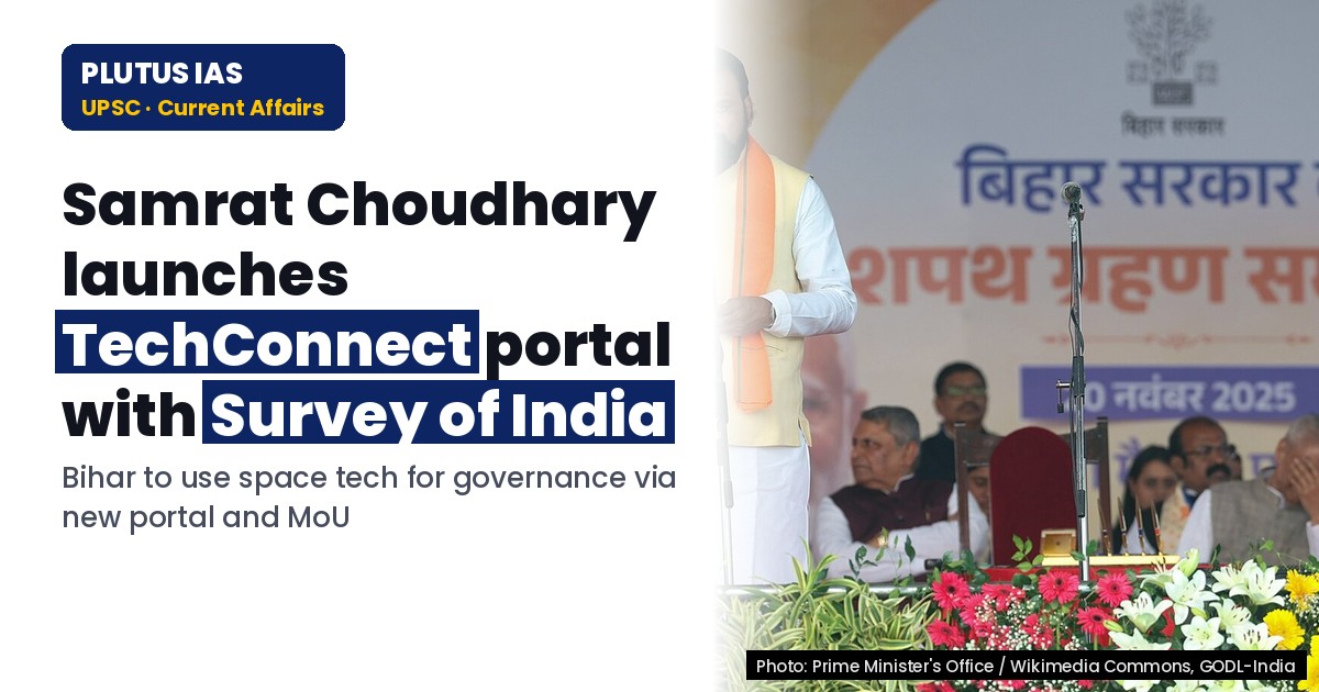
29 Oct Bihar Launches TechConnect Portal with Survey of India for Governance
✎ The ‘TechConnect’ portal and SoI MoU represent Bihar’s proactive approach to integrating geospatial technologies into governance, with a focus on disaster resilience, water management, and sustainable development.
Subject Relevance — Where This Topic Fits
- GS Paper II — Governance, Constitution, Polity, Social Justice and International Relations (Science & Technology Governance) | GS Paper III — Science and Technology, Disaster Management, Environmental Conservation, and Economic Development
- Prelims: Remote Sensing, Geospatial Technology, Disaster Management, National Remote Sensing Centre (NRSC), Survey of India (SoI), Space Applications, Bihar Remote Sensing Application Centre (BIRSAC), Digital Governance
- Essay: The Role of Science and Technology in National Development: A Case Study of Bihar’s Initiatives, Disaster Resilience and Sustainable Development: Integrating Geospatial Solutions
Quick Revision: The ‘TechConnect’ portal and SoI MoU represent Bihar’s proactive approach to integrating geospatial technologies into governance, with a focus on disaster resilience, water management, and sustainable development.
Why is this in the news?
The Government of Bihar has launched the ‘TechConnect’ portal and signed a Memorandum of Understanding (MoU) with the Survey of India (SoI) to enhance the adoption of space-based technologies for governance, disaster management, and developmental planning. This initiative, unveiled during the ‘Space Application Adoption Workshop-2026’ in Patna, underscores the state’s commitment to leveraging geospatial tools to address challenges such as flood monitoring, water resource management, and agricultural planning, aligning with national goals of a ‘Viksit Bharat’ by 2047.
Background
- Bihar, with its geographical vulnerability to floods from rivers like the Ganga, Son, and Gandak, faces recurrent challenges in water resource management and disaster preparedness.
- The state has historically been a centre of learning, with contributions from scholars like Aryabhata and Chanakya, and continues to prioritise scientific innovation for socio-economic development.
- The National Remote Sensing Centre (NRSC) under ISRO has been instrumental in providing geospatial data and applications for governance, including flood mapping and agricultural monitoring.
- The Survey of India (SoI), established in 1767, is the premier mapping agency of the Government of India, responsible for topographical surveys and geospatial data dissemination.
- Bihar Remote Sensing Application Centre (BIRSAC) has been working on utilising remote sensing and GIS technologies for natural resource management and disaster mitigation in the state.
- The Union Government’s vision of ‘Viksit Bharat 2047’ emphasises the integration of science, technology, and innovation to achieve sustainable and inclusive development.
What is the ‘TechConnect’ Portal and the MoU with the Survey of India?
- The ‘TechConnect’ portal is a digital platform launched by the Government of Bihar to facilitate the adoption of space-based technologies, including remote sensing, GIS, and satellite data, for governance and developmental planning.
- The portal aims to bridge the gap between scientific innovation and ground-level implementation by providing stakeholders—government agencies, farmers, and the public—with accessible geospatial tools and data.
- The MoU signed between Bihar Remote Sensing Application Centre (BIRSAC) and the Survey of India (SoI) seeks to enhance technical collaboration in geospatial data sharing, capacity building, and joint projects for developmental and disaster management applications.
- The collaboration will enable Bihar to access high-resolution topographical data, digital elevation models, and other geospatial datasets from SoI, which are critical for flood modelling, land-use planning, and infrastructure development.
- The initiative aligns with the broader national framework of the ‘National Geospatial Policy 2022,’ which aims to democratise geospatial data and promote its use in governance and economic activities.
- Space-based technologies, such as remote sensing from satellites like Resourcesat and Cartosat, provide real-time data on land cover, water bodies, and vegetation, which are essential for agricultural planning and disaster response.
- The portal and MoU are part of Bihar’s strategy to address challenges like flood mitigation, water resource management, and agricultural productivity through data-driven decision-making.
- The workshop ‘Space Application Adoption Workshop-2026’ served as a platform to sensitise policymakers, scientists, and technocrats on the potential of space-based solutions for state development.
Key Features
| Feature | Significance |
|---|---|
| Launch of ‘टेककनेक्ट’ portal | A digital platform facilitating real-time exchange of space-based data, remote sensing applications, and technical innovations between government departments, academia, and industry stakeholders in Bihar. |
| MoU with Survey of India (SOI) | Establishes formal collaboration for geospatial data sharing, mapping, and capacity-building to enhance developmental planning and disaster management in Bihar. |
| Bihar Remote Sensing Application Centre (BIRSAC) integration | Strengthens institutional framework for utilising satellite imagery, GIS, and aerial surveys in agriculture, land-use planning, and infrastructure development. |
| Space Application Adoption Workshop-2026 | A two-day knowledge-sharing platform to sensitise policymakers, technocrats, and researchers on leveraging space technology for governance and socio-economic progress. |
| Focus on flood monitoring and water management | Integration of remote sensing data to predict, monitor, and mitigate flood risks in Ganga, Son, and Gandak basins, ensuring agricultural and urban resilience. |
Why it Matters
Governance and Public Administration
- Demonstrates the application of space technology in enhancing the efficiency and transparency of state administration through data-driven decision-making.
- Promotes inter-departmental coordination between scientific agencies (SOI, BIRSAC), line ministries, and local bodies for integrated developmental planning.
- Facilitates evidence-based policymaking by providing accurate geospatial data for resource allocation and infrastructure prioritisation.
Economic Development and Agriculture
- Enables precision agriculture through remote sensing, soil moisture mapping, and crop health monitoring, thereby increasing farm productivity and reducing input costs.
- Supports climate-resilient agriculture by providing early warnings for droughts, floods, and pest infestations using satellite data.
- Enhances irrigation efficiency by monitoring water bodies and groundwater levels, optimising the utilisation of resources such as the Ganga and its tributaries.
Disaster Management and Environmental Sustainability
- Strengthens flood forecasting and mitigation by integrating real-time satellite data with ground-based hydrological models, reducing human and economic losses.
- Aids in the assessment of land degradation, deforestation, and urban sprawl, supporting sustainable land-use policies and conservation efforts.
- Provides critical inputs for disaster risk reduction strategies, including evacuation planning and infrastructure resilience in flood-prone regions.
Technological Innovation and Human Capital
- Fosters a culture of innovation by creating a collaborative ecosystem between academia, industry, and government for developing indigenous space-based solutions.
- Enhances the skill sets of local officials, researchers, and students through workshops, training programmes, and exposure to cutting-edge geospatial technologies.
- Encourages entrepreneurship in the space and geospatial sectors, potentially leading to start-ups focused on agricultural tech, disaster management, and urban planning.
Strategic and Long-Term Planning
- Aligns with national missions such as the National Mission for Sustaining the Himalayan Ecosystem (NMSHE) and the National Hydrology Project (NHP) by leveraging space-based data.
- Supports Bihar’s Vision 2047 for sustainable development by integrating technological advancements with traditional knowledge systems.
- Contributes to the realisation of Sustainable Development Goals (SDGs), particularly SDG 2 (Zero Hunger), SDG 6 (Clean Water and Sanitation), and SDG 11 (Sustainable Cities and Communities).
Challenges
1. Data Integration and Interoperability
- Ensuring seamless integration of geospatial data from multiple sources (SOI, BIRSAC, international satellites) into a unified platform like ‘टेककनेक्ट’.
- Addressing discrepancies in data formats, scales, and resolutions to maintain consistency and reliability across applications.
- Developing standardised protocols for data sharing between state agencies, central institutions, and private entities.
UPSC Link: GS-III: Science & Technology
2. Capacity Building and Skill Development
- Training a workforce proficient in remote sensing, GIS, and space technology applications to utilise the ‘टेककनेक्ट’ portal effectively.
- Overcoming resistance to technological adoption among bureaucrats, field officials, and local communities through awareness campaigns and incentives.
- Ensuring continuous learning and upskilling to keep pace with rapid advancements in geospatial technologies.
UPSC Link: GS-II: Governance
3. Infrastructure and Resource Constraints
- Addressing the digital divide by ensuring equitable access to high-speed internet and computing resources in rural and remote areas of Bihar.
- Investing in state-of-the-art hardware, software, and cloud infrastructure to support large-scale geospatial data processing and analysis.
- Balancing the financial burden of technological upgrades with competing developmental priorities in a resource-constrained state.
UPSC Link: GS-III: Economic Development
4. Policy and Regulatory Frameworks
- Formulating clear guidelines for data privacy, security, and ownership to prevent misuse or unauthorised access to sensitive geospatial information.
- Establishing a robust legal framework for public-private partnerships in space technology adoption to encourage private sector participation.
- Aligning state-level initiatives with national policies such as the Geospatial Policy 2022 and the Space Activities Bill 2017.
UPSC Link: GS-II: Polity & Governance
5. Community Engagement and Acceptance
- Overcoming scepticism among farmers and local communities regarding the utility and accuracy of space-based solutions in agricultural practices.
- Ensuring that technological interventions are culturally sensitive and inclusive, particularly for marginalised and tribal communities.
- Promoting participatory approaches where local stakeholders are involved in the design, implementation, and monitoring of space-based initiatives.
UPSC Link: GS-IV: Ethics & Governance
Challenges — UPSC Perspective
| Issue | Concern |
|---|---|
| Data Privacy and Security | Risk of unauthorised access or misuse of sensitive geospatial data, necessitating stringent cybersecurity measures and legal safeguards. |
| Digital Divide | Unequal access to technology and internet connectivity in rural Bihar, potentially exacerbating socio-economic inequalities. |
| High Initial Costs | Significant investment required for infrastructure, training, and maintenance, which may strain state finances. |
| Inter-Agency Coordination | Challenges in aligning the objectives and workflows of multiple agencies (SOI, BIRSAC, state departments) for cohesive implementation. |
| Public Awareness | Low awareness among stakeholders about the benefits and applications of space technology, leading to low adoption rates. |
| Climate Vulnerability | Frequent natural disasters (floods, droughts) in Bihar may disrupt the implementation and utilisation of technological solutions. |
Way Forward
- Establish a dedicated ‘Geospatial Data Authority’ in Bihar to oversee the implementation, monitoring, and evaluation of space-based initiatives, ensuring accountability and transparency.
- Develop a phased capacity-building programme in collaboration with premier institutions (ISRO, IITs, NITs) to train officials, researchers, and farmers in remote sensing and GIS applications.
- Create pilot projects in flood-prone districts (e.g., Patna, Bhagalpur) to demonstrate the efficacy of space-based solutions in disaster management and agricultural planning, with measurable outcomes.
- Foster public-private partnerships (PPPs) to incentivise private sector investment in geospatial technology, including start-ups focused on agricultural tech and disaster resilience.
- Integrate ‘टेककनेक्ट’ with existing national platforms such as the National Remote Sensing Centre (NRSC) and the India Meteorological Department (IMD) for real-time data sharing and cross-validation.
- Launch awareness campaigns in local languages to educate farmers, local bodies, and communities about the benefits of space technology in improving livelihoods and reducing risks.
- Allocate dedicated funds in the state budget for the maintenance, upgradation, and expansion of the ‘टेककनेक्ट’ portal and associated infrastructure, ensuring long-term sustainability.
- Collaborate with international agencies (NASA, ESA) and neighbouring states (Uttar Pradesh, Jharkhand) to access advanced satellite data and best practices in geospatial governance.
UPSC Value Addition
Keywords for Mains Answer-Writing
Space technology applications · Remote Sensing for Disaster Management · Digital Governance in Bihar · Survey of India · Geospatial Data Utilisation · Technological Innovation in Governance · Bihar Remote Sensing Application Centre · Space-based Solutions for Development · Scientific Innovation and Public Administration · Intergovernmental Scientific Collaboration
Concept Flow
State recognises gaps in traditional governance and development planning due to limited data and monitoring capabilities. → Identification of space technology (remote sensing, GIS) as a tool to address developmental challenges (floods, agriculture, land-use). → Institutional collaboration: Bihar partners with Survey of India and establishes BIRSAC to access geospatial data and expertise. → Development of ‘टेककनेक्ट’ portal as a centralised platform for data sharing, innovation, and governance enhancement. → Capacity-building through workshops and training to equip stakeholders with technical skills. → Pilot implementation in flood-prone regions, demonstrating tangible benefits in disaster management and agricultural productivity. → Scaling up successful models across sectors (agriculture, urban planning, infrastructure) to achieve sustainable development goals.
Prelims Practice Questions
Q1. Consider the following statements regarding the Survey of India (SOI):
1. It is the oldest scientific department of the Government of India.
2. It functions under the Department of Science and Technology.
3. It is responsible for the preparation and updation of topographical maps of India.
4. The National Spatial Data Infrastructure (NSDI) is managed by the SOI.
How many of the above statements are correct?
- Only one
- Only two
- Only three
- All
Answer: All — Statements 1, 2, and 3 are correct. The Survey of India is indeed the oldest scientific department of the Government of India, functions under the Department of Science and Technology, and prepares topographical maps. Statement 4 is incorrect as NSDI is managed by the Department of Land Resources, Ministry of Rural Development.
Q2. Assertion (A): Remote sensing technology can be effectively used for flood monitoring and management.
Reason (R): Remote sensing provides real-time data on water levels, rainfall patterns, and land-use changes, which are critical for disaster preparedness and response.
Options:
A. Both A and R are true, and R is the correct explanation of A.
B. Both A and R are true, but R is not the correct explanation of A.
C. A is true, but R is false.
D. A is false, but R is true.
Answer: ? — Both the Assertion (A) and Reason (R) are true, and Reason (R) correctly explains Assertion (A). Remote sensing is a proven tool for flood monitoring due to its ability to provide real-time geospatial data essential for disaster management.
Q3. Match the following initiatives with their respective domains of application:
Initiative:
1. TechConnect Portal
2. Bihar Remote Sensing Application Centre (BIRSAC)
3. National Spatial Data Infrastructure (NSDI)
4. Space Application Centre (SAC), ISRO
Domain of Application:
A. Digital governance and technological innovation
B. Geospatial data management and utilisation
C. Remote sensing and disaster management
D. Space-based research and satellite applications
Options:
1-A, 2-C, 3-B, 4-D
1-B, 2-A, 3-D, 4-C
1-C, 2-B, 3-A, 4-D
1-D, 2-A, 3-C, 4-B
Answer: ? — 1-A (TechConnect Portal is a digital governance initiative), 2-C (BIRSAC focuses on remote sensing applications), 3-B (NSDI is a geospatial data infrastructure initiative), 4-D (SAC, ISRO is a space-based research centre).
Mains Practice Question
✍ The integration of space-based technologies and geospatial data is increasingly being leveraged to enhance governance and development outcomes in India. In this context, critically examine the role of the Survey of India (SOI) and remote sensing applications in disaster management and developmental planning. Also, analyse how initiatives like the TechConnect Portal in Bihar can contribute to bridging the digital divide and fostering technological innovation. (15 Marks)
Approach: **Introduction (2 marks):**
– Define space-based technologies and geospatial data, highlighting their significance in governance and development.
– Mention the constitutional and statutory framework governing geospatial data in India (e.g., Survey of India Act, 1875; National Geospatial Policy, 2022).
**Role of Survey of India (SOI) (4 marks):**
– Discuss SOI’s mandate: preparation and updation of topographical maps, geodetic control, and national spatial data infrastructure.
– Explain its role in disaster risk reduction (e.g., floodplain mapping, landslide susceptibility mapping).
– Highlight SOI’s collaboration with state agencies like BIRSAC for localised geospatial solutions.
**Remote Sensing Applications in Disaster Management (4 marks):**
– Define remote sensing and its types (optical, microwave, LiDAR).
– Explain its applications in flood monitoring, drought assessment, and cyclone tracking (cite examples like ISRO’s INSAT-3D, Resourcesat-2).
– Discuss the role of BIRSAC in Bihar’s flood-prone regions (e.g., real-time water level monitoring, crop damage assessment).
**TechConnect Portal and Digital Governance (3 marks):**
– Describe the TechConnect Portal as a digital platform for space-based solutions (e.g., GIS mapping, satellite data integration).
– Analyse its potential to democratise access to geospatial data for policymakers, farmers, and local governments.
– Discuss challenges: data privacy, interoperability with existing systems, and capacity-building needs.
**Conclusion (2 marks):**
– Summarise the transformative potential of space-based technologies in governance.
– Emphasise the need for multi-stakeholder collaboration (SOI, ISRO, state agencies, private sector) and policy integration for scalable impact.
Source: amarujala.com
Bihar PCS (BPSC) — State PCS Practice
Prelims: Which of the following is the primary objective of the ‘टेककनेक्ट पोर्टल’ launched in Bihar to promote technical innovation?
- A. To provide a platform for startups to connect with investors and mentors
- B. To facilitate the registration of new MSMEs in Bihar
- C. To offer free technical education to students across the state
- D. To streamline the process of land allocation for industrial projects
Answer: A. To provide a platform for startups to connect with investors and mentors — The ‘टेककनेक्ट पोर्टल’ aims to foster technical innovation by connecting startups with investors, mentors, and resources.
Mains: Discuss the significance of the ‘टेककनेक्ट पोर्टल’ and the recent MoU with the Survey of India for promoting technical innovation in Bihar. Highlight the potential benefits for the state’s economy and youth employment. (Expected points: Role of the portal in innovation ecosystem, collaboration with Survey of India, impact on Bihar’s tech landscape, challenges, and future prospects)
Generated by AanyaAi for educational purpose.
Related guides on our sites
- Current affairs for upsc 2026
- Best PSIR optional coaching for upsc
- Best PSIR optional teacher for upsc
- Best teacher of PSIR optional for upsc

- NAMASTE Scheme: Enhancing Sanitation Workers’ Livelihoods & Safety - November 14, 2026
- एमएसएमई का विशेष अभियान 6.0: स्वच्छता और लंबित मामलों का निपटारा - November 14, 2026
- Sea Vigil-26: Coastal Defence Drills Off Visakhapatnam - November 14, 2026
No Comments