


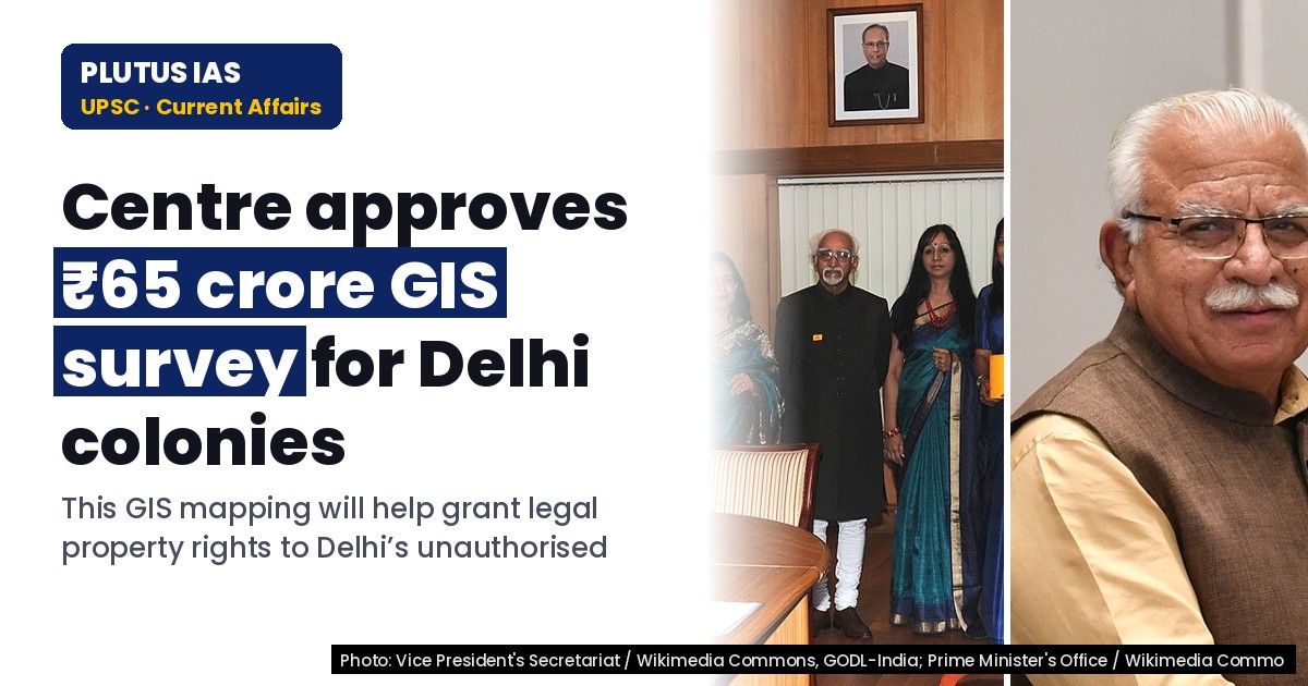
08 Oct Centre Approves ₹65 Crore for GIS Survey of Delhi’s Unauthorised Colonies
✎ The GIS-based survey under PM-UDAY is a technology-driven initiative to legalise property rights in Delhi’s unauthorised colonies, combining geospatial mapping, institutional coordination, and shared funding to enhance urban…
Subject Relevance — Where This Topic Fits
- GS Paper II — Governance, Constitution and Polity (Property Rights and Urban Governance) | GS Paper III — Environment and Urbanisation (Geospatial Technology and Urban Planning)
- Prelims: Unauthorised Colonies, PM-UDAY, GIS Mapping, Property Rights, Urban Development Fund, Spatial Technology Initiative, Delhi Revenue and Imaging Survey (DRISHTI)
- Essay: Urbanisation and the challenge of unauthorised settlements: Balancing legalisation with sustainable development, Technology as an enabler in governance: Geospatial tools for inclusive urban transformation
Quick Revision: The GIS-based survey under PM-UDAY is a technology-driven initiative to legalise property rights in Delhi’s unauthorised colonies, combining geospatial mapping, institutional coordination, and shared funding to enhance urban governance and socio-economic inclusion.
Why is this in the news?
The Union Ministry of Housing and Urban Affairs has sanctioned ₹65 crore under the ‘Delhi Revenue and Imaging Survey, Spatial Technology Initiative’ (DRISHTI) for a GIS-based survey and mapping of unauthorised colonies in Delhi. This initiative is a critical component of the Pradhan Mantri-Unauthorized Colonies in Delhi Awas Adhikar Yojana (PM-UDAY), aimed at regularising property rights for over 1,500 unauthorised colonies housing lakhs of families. The decision underscores the intersection of geospatial technology, urban governance, and the legal empowerment of marginalised urban populations.
Background
- Unauthorised colonies in Delhi have proliferated due to historical gaps in urban planning and regulatory enforcement, housing an estimated 40–50 lakh residents.
- Residents in these colonies often lack legal titles to their properties, leading to socio-economic vulnerabilities, including restricted access to formal credit, public services, and legal recourse.
- Geospatial technologies, including GIS, remote sensing, and digital mapping, are increasingly deployed by governments to improve urban governance, land records management, and service delivery.
- The Urban Development Fund (UDF), administered by the Ministry of Housing and Urban Affairs, provides financial support for urban infrastructure and governance projects, including those leveraging geospatial tools.
What is the GIS-based Survey under PM-UDAY?
- Objective: To create a transparent, accurate, and time-bound digital record of property boundaries, land use, and ownership in Delhi’s notified unauthorised colonies under PM-UDAY.
- Technology: Utilises Geographic Information System (GIS) for high-resolution mapping, satellite imagery, and field verification to authenticate property details, including geo-coordinates and land parcels.
- Scope: Covers over 1,500 unauthorised colonies in Delhi.
- Process: Involves multi-stage verification—initial satellite-based mapping, ground-truthing, boundary delineation, and issuance of digitally signed property documents (e.g., ownership certificates).
- Institutional Framework: PM-UDAY cells at district and headquarters levels will oversee the survey, coordinate with local authorities, and resolve disputes through a structured grievance redressal mechanism.
- Funding: ₹52 crore (80%) from the Urban Development Fund (UDF), with ₹13 crore (20%) contributed by the Delhi government’s revenue department, ensuring shared fiscal responsibility.
- Legal Backing: The survey is anchored in the provisions of the PM-UDAY scheme, which derives its legal mandate from the National Capital Territory of Delhi (Recognition of Property Rights of Residents in Unauthorised Colonies) Act, 2019.
- Outcome: Expected to confer legal security to property owners, facilitate access to formal credit (e.g., bank loans), improve tax compliance, and enable better urban planning and service delivery.
Key Features
| Feature | Significance |
|---|---|
| GIS-based survey under DRISHTI initiative | Enables systematic, transparent, and time-bound mapping of property boundaries in unauthorised colonies using geospatial technology. |
| Rs 65 crore financial allocation | Funding (Rs 52 crore from Union Ministry of Housing and Urban Affairs and Rs 13 crore from Delhi government) ensures resource adequacy for comprehensive survey implementation. |
| PM-UDAY scheme implementation | Provides legal security to property rights for residents of Delhi’s unauthorised colonies through systematic documentation and verification. |
| PM-UDAY cells in 13 districts | Establishes institutional mechanisms at the district level to expedite property registration and reduce bureaucratic delays. |
| Delhi Revenue and Imaging Survey, Spatial Technology Initiative (DRISHTI) | Integrates spatial technology with revenue administration to enhance accuracy and efficiency in property mapping. |
Why it Matters
Urban Governance and Property Rights
- Addresses the long-standing issue of unauthorised colonies by providing legal recognition to property ownership, thereby enhancing social equity and economic stability for residents.
- Facilitates systematic urban planning by generating accurate geospatial data on property boundaries, essential for infrastructure development and service delivery.
- Reduces disputes over land ownership through transparent and verifiable documentation, fostering trust in administrative processes.
Technological Integration in Governance
- Demonstrates the application of geospatial technology (GIS) in public administration, setting a precedent for similar initiatives in other urban areas.
- Improves the efficiency and reliability of property surveys by minimising human error and ensuring real-time data validation.
- Enhances the capacity of revenue departments to manage large-scale mapping projects with precision.
Fiscal Federalism and Intergovernmental Coordination
- Illustrates the collaborative model of Centre-State funding and implementation, balancing fiscal responsibilities between Union and State governments.
- Highlights the role of the Urban Development Fund (UDF) in supporting urban development projects through targeted financial assistance.
- Ensures equitable resource allocation for urban infrastructure projects, addressing disparities in development across regions.
Challenges
1. Geospatial Data Accuracy and Standardisation
- Ensuring high-resolution and error-free geospatial data collection, particularly in densely populated and irregularly developed unauthorised colonies.
- Standardising data formats and protocols across districts to enable seamless integration and interoperability of GIS datasets.
UPSC Link: Geospatial Data Policy, 2021
2. Legal and Administrative Hurdles in Property Documentation
- Overcoming historical ambiguities in land records and resolving conflicting claims over property boundaries.
- Streamlining the verification process to prevent delays in issuing property rights documents under PM-UDAY.
UPSC Link: Land Revenue Administration
3. Institutional Capacity and Human Resource Constraints
- Training and deploying skilled personnel for GIS-based surveys and property documentation to ensure technical proficiency.
- Strengthening the institutional framework of PM-UDAY cells to handle the volume of applications and reduce backlog.
UPSC Link: Urban Local Body Governance
4. Equity and Inclusivity in Beneficiary Identification
- Ensuring that marginalised and economically weaker sections of society in unauthorised colonies are not excluded from the benefits of property rights.
- Addressing potential biases in survey processes that may disproportionately affect certain communities or areas.
UPSC Link: Inclusive Urban Development
Challenges — UPSC Perspective
| Issue | Concern |
|---|---|
| Data privacy and security | Risk of unauthorised access or misuse of geospatial and property data, necessitating robust cybersecurity measures. |
| Public participation and awareness | Low awareness among residents about the survey process may lead to non-cooperation or misinformation. |
| Inter-departmental coordination | Delays in approvals or data sharing between revenue, survey, and urban development departments. |
| Cost overruns and resource constraints | Potential escalation in project costs due to unforeseen technical or logistical challenges. |
| Legal disputes over land ownership | Existing litigation or conflicting claims may hinder the survey and documentation process. |
Government Initiatives — Must-Memorise for Prelims
- Pradhan Mantri-Unauthorized Colonies in Delhi Awas Adhikar Yojana (PM-UDAY)
Way Forward
- Establish a dedicated multi-stakeholder task force comprising representatives from the Union Ministry of Housing and Urban Affairs, Delhi government, and GIS experts to oversee the implementation of the GIS survey.
- Develop a phased rollout plan for the survey, prioritising colonies with the highest density of unauthorised constructions and unresolved property disputes.
- Conduct extensive public awareness campaigns in local languages to educate residents about the survey process, benefits, and their rights under PM-UDAY.
- Invest in capacity-building programmes for revenue officials and survey teams to enhance their technical and administrative skills in GIS-based mapping.
- Strengthen grievance redressal mechanisms to address disputes arising during the survey, ensuring timely resolution and transparency.
- Integrate the GIS survey data with existing land records and urban planning databases to create a unified and updatable property registry.
- Monitor progress through regular audits and publish performance reports to maintain accountability and public trust in the initiative.
UPSC Value Addition
Keywords for Mains Answer-Writing
Unauthorised Colonies (Regulation of Development and Protection of Interest of Buyers) Act, 2019 · Pradhan Mantri-Unauthorized Colonies in Delhi Awas Adhikar Yojana (PM-UDAY) · Geographic Information System (GIS) · Delhi Revenue and Imaging Survey, Spatial Technology Initiative (DRISHTI) · Property rights in urban informal settlements · Urban Development Fund (UDF) · Spatial technology in governance · Land titling and urban land reform · Right to Property under Article 300A · Constitutional provisions for urban governance · Delhi Special Provisions Act, 2011 · Urban Informal Settlements (Regularisation and Development) Framework · Land survey and mapping technologies · Property rights and socio-economic security · Urban land governance and policy coherence
Concept Flow
Identification of unauthorised colonies in Delhi as a governance challenge requiring legal and administrative solutions. → Formulation of PM-UDAY scheme to grant property rights and regularise unauthorised colonies. → Approval of Rs 65 crore under DRISHTI initiative for GIS-based survey to map property boundaries systematically. → Implementation of the survey through PM-UDAY cells in 13 districts, integrating geospatial technology with revenue administration. → Resolution of property disputes and issuance of legal documents, enhancing security of tenure for residents. → Improved urban planning and service delivery based on accurate geospatial data, contributing to sustainable urban development.
Prelims Practice Questions
Q1. Consider the following statements about the Pradhan Mantri-Unauthorized Colonies in Delhi Awas Adhikar Yojana (PM-UDAY):
1. PM-UDAY is a Central Sector Scheme aimed at granting property rights to residents of unauthorised colonies in Delhi.
2. The scheme mandates a GIS-based survey and mapping of properties in notified unauthorised colonies.
3. The Union Ministry of Housing and Urban Affairs provides 100% funding for the implementation of PM-UDAY.
4. The scheme includes the establishment of PM-UDAY cells in districts to expedite property registration.
How many of the above statements are correct?
- Only one
- Only two
- Only three
- All four
Answer: Only three — Statement 1 is correct: PM-UDAY is a Central Sector Scheme for granting property rights in Delhi’s unauthorised colonies. Statement 2 is correct: GIS-based survey and mapping are mandated under the scheme. Statement 3 is incorrect: 80% of the funding is provided by the Union Ministry, while the remaining 20% is contributed by the Delhi government. Statement 4 is correct: PM-UDAY cells are established in districts to expedite registration.
Q2. Assertion (A): The Right to Property under Article 300A of the Constitution of India is a legal right and not a fundamental right.
Reason (R): The 44th Amendment Act, 1978, removed the right to property from the list of fundamental rights and reclassified it as a legal right.
Options:
A. Both A and R are true, and R is the correct explanation of A.
B. Both A and R are true, but R is not the correct explanation of A.
C. A is true, but R is false.
D. A is false, but R is true.
- A
- B
- C
- D
Answer: A — Both Assertion (A) and Reason (R) are true, and R correctly explains A. The 44th Amendment Act, 1978, indeed reclassified the right to property from a fundamental right (Article 19(1)(f)) to a legal right under Article 300A.
Q3. Match the following initiatives with their respective objectives:
Column I (Initiative) | Column II (Objective)
———————|———————-
A. PM-UDAY | 1. Granting property rights to residents of unauthorised colonies in Delhi
B. DRISHTI | 2. GIS-based survey and mapping of properties in unauthorised colonies
C. UDF | 3. Providing financial assistance for urban development projects
D. Delhi Special Provisions Act, 2011 | 4. Regulating and protecting the interests of buyers in unauthorised colonies
Select the correct match:
- A-1, B-2, C-3, D-4
- A-2, B-1, C-3, D-4
- A-1, B-3, C-2, D-4
- A-4, B-2, C-3, D-1
Answer: A-1, B-2, C-3, D-4 — Correct matches: A (PM-UDAY) is aimed at granting property rights (1), B (DRISHTI) involves GIS-based survey and mapping (2), C (UDF) provides financial assistance for urban development (3), and D (Delhi Special Provisions Act, 2011) regulates and protects buyers’ interests in unauthorised colonies (4).
Mains Practice Question
✍ The utilisation of spatial technologies such as GIS in urban governance represents a paradigm shift in land titling and property rights administration. Critically examine the significance of GIS-based surveys in the context of regularising unauthorised colonies under the PM-UDAY scheme. Also, analyse the constitutional and legal framework governing property rights in urban informal settlements in India. (15 Marks)
Approach: MODEL-ANSWER SKELETON:
1. **Introduction (2 Marks)**: Define GIS and its role in urban governance. Briefly introduce PM-UDAY and the context of unauthorised colonies in Delhi.
2. **Significance of GIS in PM-UDAY (5 Marks)**:
– **Transparency and Accuracy**: GIS ensures precise mapping of property boundaries, reducing disputes and fraud.
– **Time-bound Implementation**: GIS accelerates survey processes, aiding systematic documentation.
– **Legal Security**: Provides authenticated records, strengthening claims under Article 300A (Right to Property).
– **Data-Driven Governance**: Enables evidence-based policymaking and monitoring of urban development.
– **Interoperability**: Integrates with land records and revenue systems for seamless updation.
3. **Constitutional and Legal Framework (5 Marks)**:
– **Article 300A**: Right to Property as a legal right; state’s authority to regulate land use.
– **Unauthorised Colonies (Regulation of Development and Protection of Interest of Buyers) Act, 2019**: Legal framework for regularisation.
– **Delhi Special Provisions Act, 2011**: Empowers the Delhi government to regularise unauthorised colonies.
– **Land Titling Laws**: State-specific initiatives (e.g., Karnataka’s Bhoomi project) for digitised land records.
– **Judicial Precedents**: Landmark judgments (e.g., *State of Kerala v. The Hindu Mission*, 2020) on property rights in informal settlements.
4. **Challenges and Limitations (2 Marks)**:
– **Data Accuracy**: Dependence on historical records and ground verification.
– **Socio-economic Disparities**: Risk of marginalising vulnerable groups in documentation.
– **Implementation Gaps**: Coordination between Centre, state, and local bodies.
5. **Conclusion (1 Mark)**: Summarise the transformative potential of GIS in urban governance while acknowledging implementation challenges. Emphasise the need for multi-stakeholder collaboration.
Source: The Indian Express
Generated by AanyaAi for educational purpose.
Related guides on our sites
- Best PSIR optional coaching in delhi
- Best PSIR optional coaching in delhi for UPSC
- Best economics services coaching
- Anthropology VS PSIR


No Comments