


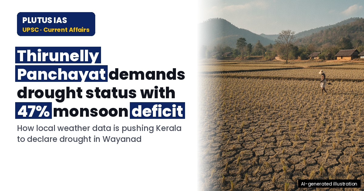
27 Oct How Thirunelly Panchayat Uses Weather Data to Demand Drought Status
✎ Community-based weather monitoring enhances hyperlocal climate data availability, enabling Panchayati Raj Institutions to assess drought conditions and advocate for evidence-based interventions, particularly in regions vulnerable…
Subject Relevance — Where This Topic Fits
- GS Paper III — Environment and Disaster Management | GS Paper III — Agriculture and Rural Development | GS Paper III — Science and Technology
- Prelims: Community-based weather monitoring, Drought declaration criteria, Southwest monsoon variability, El Niño and its impacts on India, Panchayati Raj Institutions and climate adaptation, Hyperlocal climate data, India Meteorological Department (IMD), Kerala State Disaster Management Authority (KSDMA), Crop water stress, Agro-meteorological advisory services
- Essay: The role of decentralised governance in climate resilience, Technology and citizen participation in environmental governance
Quick Revision: Community-based weather monitoring enhances hyperlocal climate data availability, enabling Panchayati Raj Institutions to assess drought conditions and advocate for evidence-based interventions, particularly in regions vulnerable to El Niño-induced rainfall deficits.
Why is this in the news?
Thirunelly grama panchayat in Wayanad, Kerala, has leveraged a community-based weather monitoring network to document a 47% deficit in southwest monsoon rainfall and a 2°C rise in average maximum temperatures, enabling evidence-based advocacy for drought-hit status. This initiative underscores the potential of hyperlocal climate data in informing local governance, particularly in the context of intensifying climate variability and the projected peak of El Niño conditions till February 2026.
Background
- The southwest monsoon is the primary source of rainfall for India, contributing approximately 75% of annual precipitation, with Kerala receiving around 2,000 mm during the June–September season.
- Kerala, a state in India’s southwest coast, is highly vulnerable to climate variability due to its topography, dense population, and dependence on agriculture, particularly paddy cultivation.
- The India Meteorological Department (IMD) operates a limited number of weather stations in Kerala, with Wayanad district having only one official station at Ambalavayal, leading to gaps in hyperlocal climate data.
- El Niño, a phase of the El Niño-Southern Oscillation (ENSO), is associated with suppressed rainfall over India, particularly during the southwest monsoon, and is projected to peak in intensity during the 2026–27 period.
- Panchayati Raj Institutions (PRIs) in India are constitutionally mandated to function as institutions of local self-government, with responsibilities including natural resource management and disaster preparedness under the 73rd Constitutional Amendment.
- The Hume Centre for Ecology and Wildlife Biology, a Kerala-based non-profit, has been instrumental in providing technical support for community-based weather monitoring initiatives across Wayanad.
Community-Based Weather Monitoring: Concept, Implementation, and Governance Implications
- Community-based weather monitoring involves the deployment of low-cost, locally managed instruments such as rain gauges and temperature sensors to collect hyperlocal meteorological data, often with the participation of trained volunteers from the community.
- Such systems enhance the granularity of climate data, addressing gaps left by sparse official meteorological networks, particularly in remote or topographically diverse regions like Wayanad.
- The Thirunelly panchayat’s initiative comprises 15 trained volunteers who record rainfall and temperature data from 15 rain gauges installed across wards and public institutions, enabling real-time assessment of local conditions.
- Hyperlocal data allows panchayats to identify micro-climatic variations, such as the 2°C rise in average maximum temperatures recorded in Thirunelly in September 2026 compared to 2025, which exacerbates drought conditions.
- Community-based monitoring facilitates evidence-based advocacy by local bodies, as demonstrated by Thirunelly’s demand for drought-hit status, supported by documented rainfall deficits and temperature anomalies.
- The initiative aligns with India’s broader climate adaptation strategies, including the National Mission for Sustainable Agriculture (NMSA) and the National Action Plan on Climate Change (NAPCC), which emphasise decentralised climate resilience.
- Community participation in climate monitoring fosters ownership and enhances the effectiveness of local disaster preparedness and response mechanisms, particularly in agrarian communities.
- The model demonstrates the potential for scaling up community-based weather monitoring through partnerships between PRIs, civil society organisations, and technical institutions like the Hume Centre.
Key Features
| Feature | Significance |
|---|---|
| Community-based weather monitoring network | Enables hyperlocal tracking of rainfall variability, temperature anomalies, and drought conditions, facilitating evidence-based local governance interventions. |
| Rain gauge installation across wards | Provides granular rainfall data at the ward level, overcoming limitations of sparse official meteorological stations. |
| 15 trained volunteer observers | Ensures consistent, real-time data collection and local ownership of climate monitoring processes. |
| Technical support from Hume Centre for Ecology and Wildlife Biology | Leverages scientific expertise to validate data, analyse trends, and contextualise findings within broader climate science. |
| Integration with IMD data | Cross-verifies local observations with regional meteorological records to strengthen the panchayat’s drought declaration case. |
| Temperature anomaly tracking | Documents rising maximum temperatures (e.g., >2°C in September 2026 vs. 2025), compounding rainfall deficits and exacerbating agricultural stress. |
Why it Matters
Agricultural Impact
- Severe disruption to paddy cultivation due to 47% monsoon rainfall deficit, leading to mid-season abandonment of fields in Thirunelly panchayat.
- Heat stress-induced early flowering in paddy, reducing yield potential during critical growth stages (transplanting and early vegetative phase).
- Adverse effects on cash crops (coffee, pepper) and horticultural produce, threatening livelihoods of small and marginal farmers.
- Water scarcity exacerbating irrigation challenges, particularly for water-intensive crops like paddy.
Governance and Policy
- Demonstrates the efficacy of decentralised climate monitoring in informing local disaster declarations and resource allocation decisions.
- Highlights the role of gram panchayats as first responders in climate adaptation, aligning with the 73rd Constitutional Amendment’s devolution of powers.
- Provides a model for integrating community science with institutional meteorological data to enhance climate resilience at the grassroots level.
- Underscores the need for state-level drought management frameworks to incorporate hyperlocal climate data for targeted interventions.
Climate Science and Adaptation
- Validates the compounding effects of El Niño-induced monsoon deficits and rising temperatures on agricultural productivity in Wayanad.
- Illustrates the utility of citizen science in filling data gaps in meteorological networks, particularly in ecologically sensitive regions like the Western Ghats.
- Serves as a case study for climate-smart agriculture (CSA) practices, such as drought-resistant crop varieties and water-efficient irrigation methods.
Socio-Economic Implications
- Threatens food security in Wayanad, a region known for rice production, with potential cascading effects on local markets and supply chains.
- Increases vulnerability of smallholder farmers, who lack financial buffers to withstand prolonged climatic shocks.
- May necessitate state-led relief measures, including crop insurance payouts, input subsidies, and alternative livelihood support.
Challenges
1. Data Reliability and Standardisation
- Ensuring consistency in data collection methods across 15 volunteer observers to avoid measurement biases or errors.
- Integrating community-collected data with IMD’s official records to maintain credibility and avoid disputes over drought declarations.
UPSC Link: GS-III: Climate Data and Governance
2. Resource Constraints in Local Governance
- Limited financial and technical capacity of gram panchayats to sustain long-term climate monitoring networks without external support.
- Delays in state-level approvals for drought declarations due to bureaucratic hurdles or lack of synchronised data interpretation.
UPSC Link: GS-II: Decentralisation and Local Governance
3. Agricultural Vulnerability to Climate Variability
- High dependence of Wayanad’s economy on rain-fed agriculture, making it highly susceptible to monsoon failures and temperature anomalies.
- Lack of widespread adoption of climate-resilient agricultural practices (e.g., drought-resistant varieties, micro-irrigation) among small farmers.
UPSC Link: GS-III: Agriculture and Climate Change
4. Inter-Agency Coordination Gaps
- Potential misalignment between panchayat-level initiatives and state-level drought management policies, leading to fragmented responses.
- Inadequate collaboration between meteorological agencies, agricultural departments, and local bodies in disseminating climate advisories.
UPSC Link: GS-II: Intergovernmental Relations
5. Socio-Economic Disparities in Climate Resilience
- Marginalised farming communities (e.g., Scheduled Tribes, women farmers) face disproportionate impacts due to limited access to adaptive technologies or financial resources.
- Risk of outmigration from drought-affected areas, exacerbating rural depopulation and labour shortages in agriculture.
UPSC Link: GS-I: Social Justice and Vulnerable Sections
Challenges — UPSC Perspective
| Issue | Concern |
|---|---|
| Volunteer fatigue | Sustaining long-term engagement of 15 observers without incentives or institutional support. |
| Data fragmentation | Risk of isolated datasets without integration into broader climate action plans. |
| Policy inertia | Delays in state-level drought declarations despite clear evidence from local monitoring. |
| Farmer indebtedness | Increased borrowing and distress sales of assets due to crop failures and income loss. |
| Ecosystem degradation | Potential long-term impacts on soil moisture, groundwater recharge, and biodiversity in Wayanad. |
| Climate misinformation | Spread of unverified claims or political narratives around drought causes, complicating evidence-based policymaking. |
Way Forward
- Expand the community-based weather monitoring network to other drought-prone panchayats in Wayanad and Kerala, leveraging the Hume Centre’s expertise.
- Integrate panchayat-collected data with state-level drought monitoring systems (e.g., Kerala State Disaster Management Authority) for real-time decision-making.
- Promote climate-resilient agriculture through training programmes on drought-resistant crop varieties, water-efficient irrigation, and soil conservation techniques.
- Strengthen the role of Krishi Vigyan Kendras (KVKs) in disseminating weather-based agro-advisories to farmers in Wayanad.
- Establish a dedicated fund at the panchayat level for drought relief, with transparent criteria for disbursement to affected farmers.
- Collaborate with academic institutions (e.g., Kerala Agricultural University) to conduct impact assessments and develop region-specific adaptation strategies.
- Enhance public awareness campaigns on water conservation, crop diversification, and sustainable farming practices to build long-term resilience.
- Advocate for the inclusion of hyperlocal climate data in Kerala’s State Action Plan on Climate Change to guide policy interventions.
UPSC Value Addition
Keywords for Mains Answer-Writing
Community-based weather monitoring · Local climate action · Drought management · Disaster risk reduction · Panchayati Raj Institutions · El Niño impacts · Hyperlocal data collection · Agricultural resilience · Water security governance · Climate-adaptive local governance
Concept Flow
El Niño-induced weakening of southwest monsoon → Reduced rainfall in Wayanad (47% deficit in Thirunelly panchayat) → Hyperlocal temperature rise (>2°C in Thirunelly) → Increased evapotranspiration and heat stress on crops → Community-based weather monitoring network → Real-time, ward-level rainfall and temperature data collection → Data analysis by Hume Centre → Validation and contextualisation of local observations with IMD records → Panchayat-level assessment → Evidence-based demand for drought-hit status declaration → State government response → Potential relief measures, crop insurance payouts, and agricultural advisories → Long-term adaptation → Climate-resilient agriculture, water conservation, and policy integration
Prelims Practice Questions
Q1. Consider the following statements regarding community-based weather monitoring in Thirunelly grama panchayat, Wayanad:
1. The panchayat has installed rain gauges in all wards and public institutions.
2. The initiative is implemented with technical support from the Hume Centre for Ecology and Wildlife Biology.
3. The network records a 53% deficit in southwest monsoon rainfall during the current season.
4. The panchayat has recorded a rise of more than 2°C in average maximum temperature in September 2026 compared to 2025.
How many of the above statements are correct?
- Only one
- Only two
- Only three
- All four
Answer: All four — Statements 1, 2, and 4 are correct. Statement 3 is incorrect as the panchayat recorded a 47% deficit, while the IMD station at Ambalavayal recorded a 53% deficit.
Q2. Assertion (A): Community-based weather monitoring systems enhance the accuracy of local climate data for drought assessment.
Reason (R): Hyperlocal data collection enables panchayats to make evidence-based demands for drought-hit status.
Options:
A. Both A and R are true, and R is the correct explanation of A.
B. Both A and R are true, but R is not the correct explanation of A.
C. A is true, but R is false.
D. A is false, but R is true.
Answer: ? — Both A and R are true, and R correctly explains why A is true: hyperlocal data improves accuracy and supports evidence-based governance.
Q3. Match the following initiatives with their respective objectives:
Column I (Initiative) | Column II (Objective)
— | —
1. Community-based weather monitoring in Thirunelly | A. Track hyperlocal rainfall variability and plan interventions
2. El Niño impact assessment | B. Assess global climate patterns affecting monsoon variability
3. Panchayati Raj Institutions | C. Decentralised governance and local climate action
4. IMD weather stations | D. Provide meteorological data for drought assessment
Options:
A. 1-A, 2-B, 3-C, 4-D
B. 1-B, 2-A, 3-D, 4-C
C. 1-C, 2-D, 3-A, 4-B
D. 1-D, 2-C, 3-B, 4-A
- A
- B
- C
- D
Answer: A — 1-A: Community-based monitoring tracks hyperlocal rainfall; 2-B: El Niño is a global climate phenomenon; 3-C: PRIs enable decentralised governance; 4-D: IMD stations provide meteorological data.
Mains Practice Question
✍ Critically analyse the role of Panchayati Raj Institutions (PRIs) in climate governance, with particular reference to community-based weather monitoring systems. How far can such initiatives enhance local resilience to climate-induced disasters like droughts? (15 Marks)
Approach: MODEL-ANSWER SKELETON:
1. **Contextual Introduction (2 marks)**
– Define PRIs and their constitutional mandate under Part IX of the Constitution (73rd Amendment Act, 1992).
– Highlight the increasing role of PRIs in climate governance, citing Article 243G and 243W.
2. **Community-based Weather Monitoring: A Governance Innovation (4 marks)**
– Explain the Thirunelly grama panchayat model: rain gauges, volunteer networks, and technical support from Hume Centre.
– Link to hyperlocal data collection and its advantages over IMD stations (e.g., granularity, real-time monitoring).
– Cite the panchayat’s evidence-based demand for drought-hit status using recorded data (47% rainfall deficit, 2°C temperature rise).
3. **Enhancing Local Resilience to Droughts (5 marks)**
– **Agricultural resilience**: Early intervention in paddy cultivation, water management, and crop diversification.
– **Water security**: Community-led water conservation, rainwater harvesting, and groundwater recharge strategies.
– **Institutional mechanisms**: Role of PRIs in coordinating with state agencies (e.g., Kerala State Disaster Management Authority) and accessing drought relief funds.
– **Limitations**: Data accuracy, scalability, and dependence on external technical support.
4. **Comparative Perspective and Challenges (3 marks)**
– Compare with other climate governance models (e.g., state-led schemes like the National Mission for Sustainable Agriculture or MGNREGA’s drought-proofing components).
– Discuss challenges: funding constraints, lack of technical expertise in rural areas, and integration with higher-level climate policies.
5. **Conclusion (1 mark)**
– PRIs, when empowered with community-based data systems, can significantly enhance local climate resilience, but require institutional support and capacity-building.
Source: The Hindu
Kerala PCS (Kerala PSC (KAS)) — State PCS Practice
Prelims: Which Wayanad panchayat has leveraged community-based weather data to strengthen its demand for drought-hit status from the Kerala government?
- A. Kalpetta Grama Panchayat
- B. Meenangadi Grama Panchayat
- C. Mananthavady Grama Panchayat
- D. Vythiri Grama Panchayat
Answer: B. Meenangadi Grama Panchayat — Meenangadi Grama Panchayat in Wayanad has utilized community-collected weather data to substantiate its request for drought-hit status due to prolonged dry spells.
Mains: Elaborate on the role of community-based weather data in supporting Meenangadi Grama Panchayat’s petition for declaring the region as drought-affected. Discuss the potential benefits and challenges associated with this approach in the context of Kerala’s administrative framework.
Generated by AanyaAi for educational purpose.
Related guides on our sites
- Best agriculture optional coaching
- Anthropology VS PSIR
- Best PSIR optional coaching
- Best PSIR optional coaching online

- How Thirunelly Panchayat Uses Weather Data to Demand Drought Status - October 27, 2026
- रक्षा मंत्री राजनाथ सिंह फिलीपींस में एडीएमएम-प्लस बैठक में होंगे शामिल - October 27, 2026
- Delhi’s Bottle-Return Scheme: Lessons from Uttarakhand & Goa for UPSC - October 27, 2026

No Comments