


06 Aug Karnataka Launches AI-Powered Digital Crop Survey: A Game-Changer for Agriculture
✎ The Composite Digital Crop Survey (CDCS) in Karnataka represents a paradigm shift in agricultural data governance by integrating geospatial technologies, AI, and ML to enhance the accuracy, reliability, and timeliness of crop…
Subject Relevance — Where This Topic Fits
- GS Paper III — Technology, Economic Development, Agriculture
- Prelims: Digital Public Infrastructure (DPI), Geospatial Intelligence, Remote Sensing, Synthetic Aperture Radar (SAR), GIS-based mobile applications, Machine Learning in agriculture, Agricultural Census, Sub-Mission on Agricultural Mechanization (SMAM), Pradhan Mantri Fasal Bima Yojana (PMFBY), National Mission for Sustainable Agriculture (NMSA)
- Essay: The convergence of artificial intelligence and agricultural policy: A paradigm shift in governance, Geospatial technologies as enablers of evidence-based policymaking in India
Quick Revision: The Composite Digital Crop Survey (CDCS) in Karnataka represents a paradigm shift in agricultural data governance by integrating geospatial technologies, AI, and ML to enhance the accuracy, reliability, and timeliness of crop data collection, thereby enabling evidence-based policymaking and efficient implementation of agricultural schemes.
Why is this in the news?
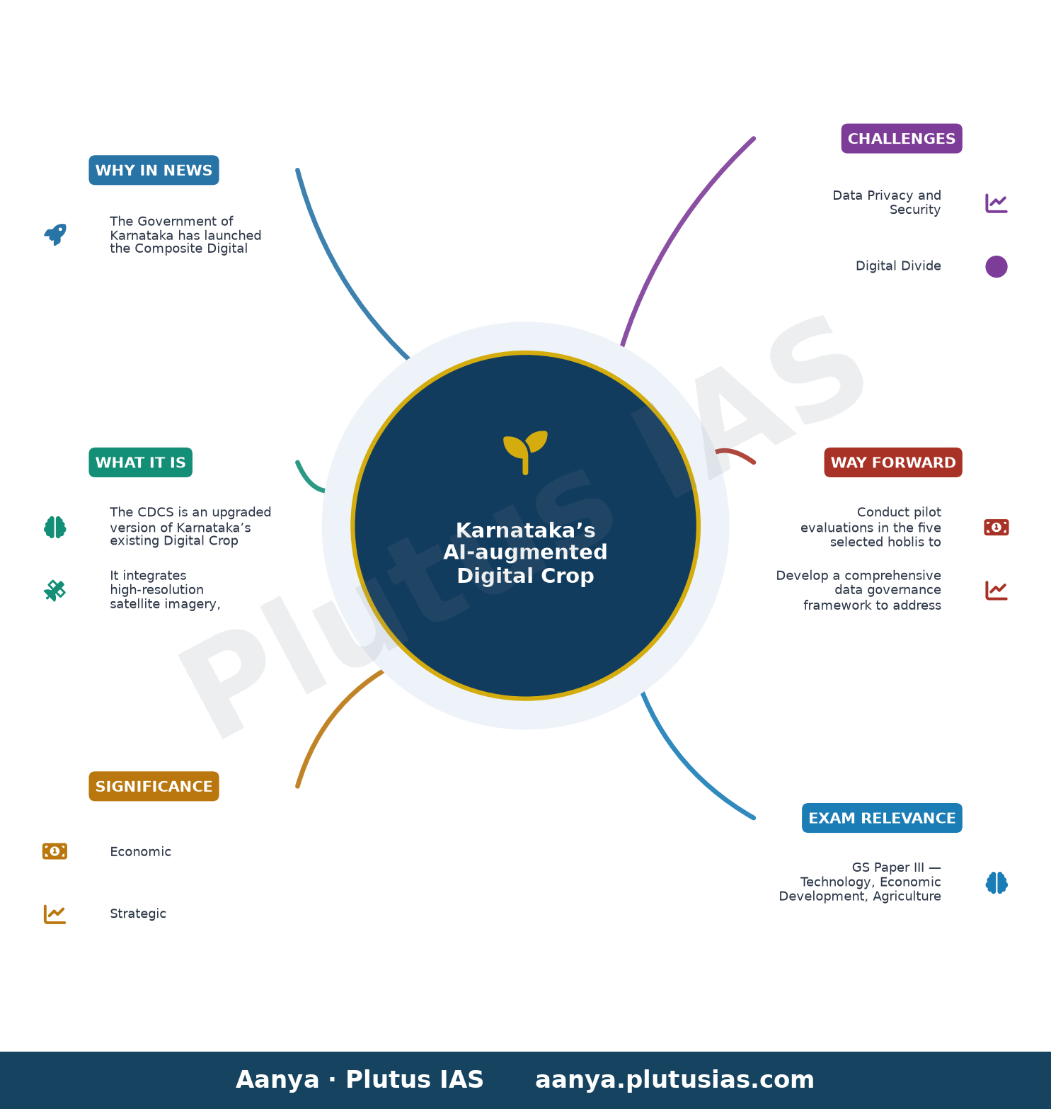
The Government of Karnataka has launched the Composite Digital Crop Survey (CDCS), a pilot initiative integrating advanced geospatial technologies, artificial intelligence, and machine learning to enhance the accuracy and reliability of agricultural data collection. This initiative builds upon the existing Digital Crop Survey (DCS) framework, which has been operational since 2018, and represents a significant evolution in the state’s approach to agricultural governance and evidence-based policymaking.
Background
- Karnataka’s Digital Crop Survey (DCS), initiated in 2018, was the first GIS-based mobile application for plot-level crop data collection in India, replacing traditional paper-based surveys.
- The DCS leveraged mobile technology to authenticate land records and crop details, reducing data entry errors and improving the timeliness of agricultural statistics.
- Agricultural data forms the backbone of multiple central and state schemes, including the Pradhan Mantri Fasal Bima Yojana (PMFBY), Minimum Support Price (MSP) procurement, and agricultural credit disbursement.
- Geospatial technologies, such as high-resolution satellite imagery and SAR, have been increasingly adopted in India for land-use mapping, disaster management, and environmental monitoring.
- Karnataka’s initiative is part of a broader trend of leveraging emerging technologies to address challenges in agricultural data governance, including fragmentation, delays, and inaccuracies.
What is the Composite Digital Crop Survey (CDCS)?
- The CDCS is an upgraded version of Karnataka’s existing Digital Crop Survey (DCS), incorporating advanced geospatial and AI/ML technologies to enhance data accuracy and reliability.
- It integrates high-resolution satellite imagery, Synthetic Aperture Radar (SAR), drone surveys, GIS data, and machine learning algorithms to validate and authenticate crop data at the plot level.
- The pilot phase will be implemented in five selected hoblis (administrative units) representing Karnataka’s diverse geographical regions, ensuring regional inclusivity and data representativeness.
- The use of SAR and drone surveys enables all-weather data collection, overcoming limitations posed by cloud cover and terrain variability, particularly in hilly and forested areas.
- AI and ML models will be trained to identify crop types, assess crop health, and detect anomalies in agricultural data, reducing manual intervention and human error.
- The CDCS aims to provide real-time, authenticated agricultural data, which will strengthen evidence-based policymaking, improve crop insurance schemes, and enhance agricultural credit delivery systems.
- The CDCS will also facilitate the integration of agricultural data with other government databases, such as land records, soil health data, and weather information, creating a comprehensive agricultural data ecosystem.
Key Features
| Feature | Significance |
|---|---|
| High-resolution satellite imagery | Enables precise identification and mapping of crop types, health, and acreage across large geographical areas with minimal human intervention. |
| Synthetic Aperture Radar (SAR) | Provides all-weather, day-night imaging capabilities, crucial for accurate crop monitoring during monsoon seasons or cloud cover. |
| Drone surveys | Facilitates hyper-local data collection in inaccessible or smallholder-dominated agricultural plots, enhancing granularity of survey data. |
| Geographic Information System (GIS) integration | Spatial analysis and visualization of crop patterns, soil health, and land-use changes for evidence-based agricultural planning. |
| Artificial Intelligence (AI) and Machine Learning (ML) | Automates data processing, anomaly detection, and predictive modeling to improve accuracy and reduce manual errors in crop surveys. |
Why it Matters
Economic
- Enhances agricultural productivity estimates by reducing data gaps and errors in crop acreage reporting, aiding in accurate market forecasting and price stabilization.
- Improves access to formal credit for farmers by providing authenticated, real-time land and crop records, reducing information asymmetry in financial institutions.
- Supports agricultural insurance schemes by enabling precise loss assessment and claim verification through high-accuracy data.
Strategic
- Strengthens India’s food security by ensuring reliable agricultural data, critical for policy interventions in droughts, floods, or pest outbreaks.
- Positions Karnataka as a leader in agricultural innovation, attracting investments in agri-tech and precision farming ecosystems.
- Facilitates integration with national agricultural databases (e.g., PM-KISAN, e-NAM) for seamless policy coordination.
Technological
- Demonstrates the application of frontier technologies (AI/ML, SAR, drones) in governance, setting a precedent for other states in digital agriculture.
- Reduces dependence on manual surveys, minimizing human errors and biases in data collection.
- Enables real-time monitoring of agricultural parameters, supporting dynamic policy adjustments.
Social
- Empowers small and marginal farmers by providing transparent, tamper-proof land and crop records, reducing disputes over land ownership.
- Enhances inclusivity by capturing data from remote and tribal regions, ensuring equitable agricultural development.
- Supports welfare schemes by linking verified data with direct benefit transfers (DBT) for farmers.
Challenges
1. Data Privacy and Security
- Risk of unauthorized access or misuse of sensitive agricultural and land data, necessitating robust cybersecurity frameworks.
- Potential for surveillance concerns due to high-resolution imagery and drone surveillance, requiring clear regulatory safeguards.
UPSC Link: GS3: Cybersecurity, Data Governance
2. Digital Divide
- Limited digital literacy among farmers, particularly in tribal and remote areas, may hinder effective adoption of the survey system.
- Inadequate infrastructure (internet connectivity, smartphones) in rural regions could exclude marginalized farmers from the benefits.
UPSC Link: GS2: Digital Divide, Rural Development
3. High Implementation Costs
- Initial capital expenditure for drones, satellite imagery, and AI/ML infrastructure may strain state budgets.
- Ongoing maintenance and training costs for personnel could pose long-term financial sustainability challenges.
UPSC Link: GS3: Fiscal Federalism, Agricultural Economics
4. Technological Reliability
- Dependence on AI/ML models may introduce biases or errors if training datasets are unrepresentative or outdated.
- Satellite and drone data may face limitations in cloud cover or dense vegetation, affecting accuracy in certain regions.
UPSC Link: GS3: Technology in Governance
5. Interoperability and Standardization
- Lack of standardized data formats across states may hinder seamless integration with national agricultural databases.
- Coordinating between multiple agencies (ISRO, state departments, private tech partners) could lead to delays or inconsistencies.
UPSC Link: GS2: Cooperative Federalism
Challenges — UPSC Perspective
| Issue | Concern |
|---|---|
| Data Privacy | Risk of misuse of sensitive agricultural data due to inadequate cybersecurity measures. |
| Digital Literacy | Low adoption among farmers in remote areas due to limited access to digital tools. |
| Cost Overruns | High initial and recurring costs may deter scalability across other states. |
| Technological Bias | AI/ML models may produce skewed results if trained on non-representative datasets. |
| Regulatory Gaps | Absence of clear guidelines on drone usage and data ownership in rural areas. |
Way Forward
- Conduct pilot evaluations in the five selected hoblis to assess accuracy, cost-effectiveness, and farmer feedback before statewide rollout.
- Develop a comprehensive data governance framework to address privacy, security, and ownership concerns, in line with the Digital Personal Data Protection Act, 2023.
- Invest in digital infrastructure (internet connectivity, smartphones) in rural areas to bridge the digital divide and ensure equitable access.
- Establish a multi-stakeholder task force comprising agricultural scientists, technologists, and farmers to refine AI/ML models and address biases.
- Integrate the CDCS with existing national databases (e.g., PM-KISAN, e-NAM) to create a unified agricultural data ecosystem.
- Provide capacity-building programs for farmers and field staff on using digital tools for crop surveys and data interpretation.
- Explore public-private partnerships (PPPs) to share costs and leverage private sector expertise in AI and drone technologies.
- Monitor and publish periodic reports on the survey’s impact on agricultural productivity, credit access, and policy outcomes.
UPSC Value Addition
Keywords for Mains Answer-Writing
Digital Public Infrastructure · Agricultural Data Governance · Composite Digital Crop Survey (CDCS) · Artificial Intelligence in Agriculture · Synthetic Aperture Radar (SAR) · Geographic Information Systems (GIS) · Drone Technology in Surveying · Evidence-based Policy Making · Precision Agriculture · Karnataka Agricultural Reforms · Crop Data Authentication · Machine Learning in Governance
Concept Flow
Agricultural data gaps → Need for accurate crop surveys → Adoption of digital technologies (AI, SAR, drones) → Integration into existing DCS framework → Pilot implementation in Karnataka → Validation of accuracy and scalability → Statewide adoption → Policy formulation based on real-time data → Enhanced agricultural governance.
Prelims Practice Questions
Q1. Consider the following statements regarding the Composite Digital Crop Survey (CDCS) launched by Karnataka:
1. The CDCS integrates high-resolution satellite imagery, Synthetic Aperture Radar (SAR), and drone surveys.
2. It uses Artificial Intelligence and Machine Learning to enhance the accuracy of crop data.
3. The survey is being implemented on a pilot basis in all districts of Karnataka.
How many of the above statements are correct?
- Only one
- Only two
- Only three
- None
Answer: Only two — Statements 1 and 2 are correct as they align with the technologies mentioned in the news. Statement 3 is incorrect because the pilot is limited to five selected hoblis, not all districts.
Q2. Assertion (A): The Composite Digital Crop Survey (CDCS) aims to strengthen evidence-based governance in Karnataka.
Reason (R): The use of AI and ML in CDCS enhances the reliability and scientific validation of agricultural data.
In the context of the above two statements, which one of the following is correct?
- Both A and R are true, and R is the correct explanation of A.
- Both A and R are true, but R is not the correct explanation of A.
- A is true, but R is false.
- A is false, but R is true.
Answer: Both A and R are true, and R is the correct explanation of A. — Both A and R are true, and R correctly explains A. The integration of AI and ML directly supports the goal of evidence-based governance by improving data accuracy.
Q3. Match the following technologies with their respective roles in the Composite Digital Crop Survey (CDCS):
Technologies:
1. Synthetic Aperture Radar (SAR)
2. Drone Surveys
3. Geographic Information Systems (GIS)
4. Machine Learning (ML)
Roles:
a. Provides high-resolution spatial data for mapping and analysis
b. Enables real-time, high-precision data collection over small areas
c. Uses radar to penetrate clouds and capture data regardless of weather conditions
d. Analyzes large datasets to identify patterns and improve predictions
Select the correct match:
- 1-c, 2-b, 3-a, 4-d
- 1-a, 2-b, 3-c, 4-d
- 1-b, 2-a, 3-d, 4-c
- 1-d, 2-c, 3-b, 4-a
Answer: 1-c, 2-b, 3-a, 4-d — The correct matches are: SAR (c) for radar-based data capture, drones (b) for high-precision surveys, GIS (a) for spatial data mapping, and ML (d) for data analysis.
Mains Practice Question
✍ The integration of Artificial Intelligence (AI) and Machine Learning (ML) in agricultural governance represents a paradigm shift in evidence-based policymaking. Critically examine the potential benefits and challenges of Karnataka’s Composite Digital Crop Survey (CDCS) in this context. (15 Marks)
Approach: MODEL-ANSWER SKELETON:
1. **Introduction (2 marks)**: Define Digital Public Infrastructure (DPI) in governance and its relevance to agriculture. Briefly introduce CDCS as Karnataka’s initiative.
2. **Benefits (6 marks)**:
– **Accuracy and Reliability**: Role of AI/ML in reducing human error and improving data authenticity (cite the transition from 2018 DCS to CDCS).
– **Real-time Monitoring**: Use of high-resolution satellite imagery, SAR, and drones for dynamic crop assessment.
– **Policy Formulation**: How authenticated data enables targeted subsidies, crop insurance, and disaster management.
– **Scientific Validation**: Integration of GIS and ML for predictive analytics (e.g., yield estimation, pest detection).
3. **Challenges (5 marks)**:
– **Digital Divide**: Accessibility issues for small and marginal farmers.
– **Data Privacy**: Concerns over ownership and misuse of agricultural data.
– **Technological Dependence**: Risk of over-reliance on AI/ML leading to reduced human oversight.
– **Implementation Costs**: High initial investment and maintenance of infrastructure.
4. **Conclusion (2 marks)**: Weigh the transformative potential of CDCS against its challenges, emphasizing the need for inclusive and ethical deployment. Highlight Karnataka’s role as a model for other states.
Source: The Hindu
Generated by AanyaAi for educational purpose.

- यूपीएससी के लिए सीएसआईआर साइक्विज: जानिए कैसे करें भागीदारी और लाभ उठाएं - September 21, 2026
- UPSC Alert: CSIR Science Quiz on My Bharat Portal for UPSC & State PCS 2026 - September 21, 2026
- एमएसएमई मंत्रालय ने शुरू किया विशेष अभियान 6.0: स्वच्छता और शिकायत निपटान पर जोर - September 21, 2026

No Comments