


06 Aug Karnataka Launches AI-Powered Digital Crop Survey for Precision Agriculture
✎ The Composite Digital Crop Survey (CDCS) integrates AI, ML, SAR, drones, and GIS to revolutionise agricultural data collection in Karnataka, ensuring precision, reliability, and real-time validation for evidence-based governance.
Subject Relevance — Where This Topic Fits
- GS Paper III — Agriculture | GS Paper III — Science and Technology
- Prelims: Digital Crop Survey (DCS), Composite Digital Crop Survey (CDCS), Synthetic Aperture Radar (SAR), Geographical Information System (GIS), Artificial Intelligence (AI), Machine Learning (ML), drone surveys, high-resolution satellite imagery, plot-level crop data, evidence-based policymaking
- Essay: The role of technology in transforming agricultural governance and food security, Precision agriculture and its implications for sustainable development
Quick Revision: The Composite Digital Crop Survey (CDCS) integrates AI, ML, SAR, drones, and GIS to revolutionise agricultural data collection in Karnataka, ensuring precision, reliability, and real-time validation for evidence-based governance.
Why is this in the news?
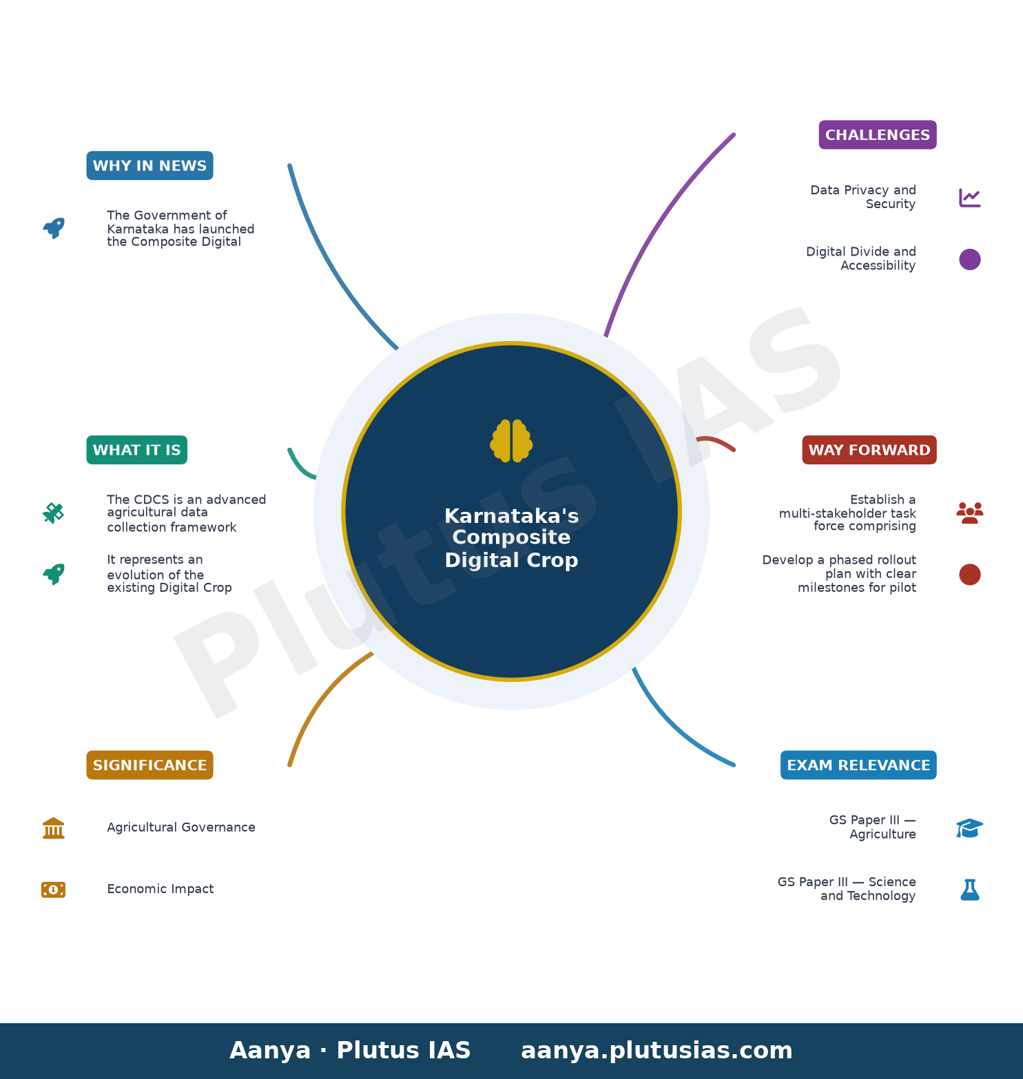
The Government of Karnataka has launched the Composite Digital Crop Survey (CDCS) as an advanced iteration of its existing Digital Crop Survey (DCS), integrating Artificial Intelligence (AI), Machine Learning (ML), Synthetic Aperture Radar (SAR), drone surveys, and high-resolution satellite imagery to enhance the accuracy, reliability, and scientific validation of agricultural data. This initiative underscores the state’s commitment to leveraging cutting-edge technologies for evidence-based governance and effective policymaking in the agricultural sector.
Background
- The Digital Crop Survey (DCS) was first implemented in Karnataka in 2018, utilising a GIS-based mobile application to collect authenticated plot-level crop data, marking a significant shift from traditional manual survey methods.
- Agricultural data collection in India has historically relied on manual enumeration, which is prone to errors, delays, and inconsistencies due to human intervention and logistical challenges.
- The integration of geospatial technologies in agriculture has been a global trend, with nations like the United States, Australia, and China adopting AI and remote sensing for crop monitoring and yield estimation.
- Karnataka, a leading agricultural state in India, has been proactive in adopting digital solutions to address challenges such as fragmented landholdings, climate variability, and market access for farmers.
- The pilot phase of the CDCS will be implemented in five selected hoblis (administrative divisions) to ensure geographical representation, covering diverse agro-climatic zones within the state.
- The initiative aligns with the broader national agenda of digital transformation in agriculture, as outlined in schemes such as the Digital Agriculture Mission and the Pradhan Mantri Kisan Samman Nidhi (PM-KISAN).
What is the Composite Digital Crop Survey (CDCS)?
- The CDCS is an advanced agricultural data collection framework that integrates Artificial Intelligence (AI), Machine Learning (ML), Synthetic Aperture Radar (SAR), drone surveys, high-resolution satellite imagery, and GIS to enhance the accuracy and reliability of crop surveys in Karnataka.
- It represents an evolution of the existing Digital Crop Survey (DCS), which was launched in 2018 and utilised a GIS-based mobile application for plot-level crop data collection.
- The CDCS aims to address the limitations of traditional manual survey methods by minimising human error, reducing data collection time, and providing real-time, high-resolution data on crop types, acreage, and health.
- High-resolution satellite imagery and SAR enable the detection of crop patterns, land use changes, and vegetation indices, even under cloud cover, thereby improving the robustness of the survey.
- Drone surveys complement satellite data by providing hyper-localised, on-ground validation of crop conditions, particularly in small and fragmented landholdings where satellite resolution may be insufficient.
- AI and ML algorithms are employed to process vast datasets, identify crop types, estimate yield, and detect anomalies such as pest infestations or drought stress, thereby enabling proactive agricultural interventions.
- The pilot phase will be implemented in five hoblis across Karnataka, ensuring representation of diverse agro-climatic zones, including coastal, arid, and irrigated regions.
- The initiative is expected to support evidence-based policymaking, improve agricultural productivity, and enhance the efficiency of subsidy disbursement and crop insurance schemes.
Key Features
| Feature | Significance |
|---|---|
| High-resolution satellite imagery | Enables precise land-use classification and crop identification by capturing spectral signatures of vegetation at fine spatial resolution. |
| Synthetic Aperture Radar (SAR) | Provides cloud-penetrating, day-night capability to monitor crop growth stages and detect anomalies such as waterlogging or drought stress. |
| Drone surveys | Facilitates hyper-localised data collection in inaccessible or smallholder-dominated agricultural plots for higher accuracy. |
| GIS integration | Spatial analysis tool to overlay crop data with soil, weather, and socio-economic layers for evidence-based policy formulation. |
| AI and ML algorithms | Automates data validation, anomaly detection, and predictive modelling to enhance reliability of crop statistics. |
Why it Matters
Agricultural Governance
- Transforms traditional crop surveys into a data-driven, real-time monitoring system to reduce human errors and biases in agricultural statistics.
- Enables evidence-based policy interventions such as targeted input subsidies, crop insurance payouts, and food security measures.
- Facilitates precision agriculture by providing plot-level data for soil health mapping and resource optimisation.
Economic Impact
- Improves market efficiency by providing accurate crop production estimates, reducing information asymmetry for farmers and traders.
- Enhances the credibility of agricultural data for agri-financing institutions, reducing credit risks in rural lending.
- Supports the development of agricultural insurance products by providing reliable yield data for claim assessments.
Technological Advancement
- Demonstrates the integration of emerging technologies (AI, SAR, drones) in public service delivery, setting a precedent for other states.
- Promotes digital inclusion in rural areas by leveraging satellite and drone-based data collection, reducing dependency on ground-level surveys.
- Encourages private sector participation in agricultural technology (AgTech) through data-sharing and innovation partnerships.
Socio-Political Implications
- Strengthens the credibility of government claims on agricultural output, reducing disputes over land records and crop claims.
- Supports climate-resilient agriculture by enabling early detection of crop stress and facilitating adaptive interventions.
- Enhances transparency in welfare schemes by providing verifiable data for beneficiary identification and exclusion errors.
Challenges
1. Data Privacy and Security
- Risk of unauthorised access or misuse of granular farm-level data, raising concerns over farmer privacy and data sovereignty.
- Need for robust cybersecurity frameworks to protect sensitive agricultural and personal data from cyber threats.
UPSC Link: GS3: Cyber Security
2. Digital Divide and Accessibility
- Small and marginal farmers may face challenges in accessing or interpreting high-tech survey outputs due to limited digital literacy.
- Dependence on advanced technologies may exclude farmers in remote or hilly regions with poor connectivity.
UPSC Link: GS2: Digital Divide
3. Cost and Scalability
- High initial investment in satellite imagery, drones, and AI/ML infrastructure may pose fiscal challenges for state budgets.
- Scaling the model to cover all districts requires sustained funding, technical expertise, and institutional capacity.
UPSC Link: GS3: Public Expenditure Management
4. Accuracy and Validation
- AI/ML models may produce false positives or negatives in crop classification, necessitating ground-truthing and periodic validation.
- Integration of multiple data sources (satellite, drone, ground) requires harmonisation to avoid discrepancies.
UPSC Link: GS3: Science & Technology
5. Policy Coordination
- Requires seamless coordination between multiple departments (Agriculture, Revenue, IT, Space) for effective implementation.
- Need for standardised protocols to ensure interoperability with national agricultural data systems (e.g., PM-KISAN, Soil Health Card).
UPSC Link: GS2: Centre-State Relations
Challenges — UPSC Perspective
| Issue | Concern |
|---|---|
| Farmer participation | Low awareness or trust in digital surveys may lead to incomplete or inaccurate data submission. |
| Data standardisation | Inconsistent data formats across regions or technologies may hinder aggregation and analysis. |
| Regulatory compliance | Adherence to data protection laws (e.g., DPDP Act) while collecting and storing farm-level data. |
| Technical expertise | Shortage of skilled personnel in state agencies to operate and maintain AI/ML systems. |
| Climate variability | Extreme weather events may disrupt satellite/drone operations, affecting data reliability. |
Way Forward
- Establish a multi-stakeholder task force comprising agricultural scientists, IT experts, and farmer representatives to oversee implementation.
- Develop a phased rollout plan with clear milestones for pilot districts, followed by state-wide expansion.
- Invest in farmer awareness campaigns to build trust in digital surveys and train local enumerators in technology adoption.
- Create a national-level data repository with standardised protocols for inter-state data sharing and integration.
- Strengthen cybersecurity measures, including encryption and access controls, to safeguard farm-level data.
- Pilot blockchain-based verification systems to ensure tamper-proof records of crop surveys and transactions.
- Collaborate with ISRO, DRDO, and private AgTech firms to leverage indigenous satellite and drone capabilities.
- Integrate the CDCS with existing schemes like PM-KISAN and Soil Health Card for data synergies and cost efficiency.
UPSC Value Addition
Keywords for Mains Answer-Writing
Digital Public Infrastructure in Agriculture · Composite Digital Crop Survey (CDCS) · Artificial Intelligence in Agriculture · Machine Learning for Crop Data · GIS-based Agricultural Surveys · Synthetic Aperture Radar (SAR) in Agriculture · Drone Surveys for Crop Monitoring · Evidence-based Policy Making in Agriculture · Agricultural Data Governance · Digital Transformation in Rural Economy · Precision Agriculture Technologies · NITI Aayog’s Digital Public Infrastructure Strategy · National Mission on Sustainable Agriculture (NMSA) · Agricultural Census and Data Modernisation
Concept Flow
Traditional crop surveys → Manual data collection with human errors and delays → Digital Crop Survey (2018) → GIS-based mobile app for authenticated plot-level data → Composite Digital Crop Survey (CDCS) → Integration of AI, SAR, drones, and ML for real-time, high-accuracy monitoring → Enhanced agricultural governance → Evidence-based policymaking, precision agriculture, and climate resilience → Economic and social outcomes → Improved market efficiency, financial inclusion, and welfare scheme delivery → Challenges → Data privacy, digital divide, cost, and policy coordination → Way forward → Scalable implementation, capacity building, and technological integration
Prelims Practice Questions
Q1. Consider the following statements regarding the Composite Digital Crop Survey (CDCS) launched by Karnataka:
1. It integrates high-resolution satellite imagery, Synthetic Aperture Radar (SAR), and drone surveys.
2. The survey uses Artificial Intelligence (AI) and Machine Learning (ML) for data validation.
3. It is implemented across all districts of Karnataka on a pilot basis.
4. The CDCS model builds upon the existing Digital Crop Survey (DCS) framework.
How many of the above statements are correct?
- Only one
- Only two
- Only three
- All four
Answer: Only three — Statements 1, 2, and 4 are correct. Statement 3 is incorrect as the CDCS is implemented on a pilot basis in only five selected hoblis, not across all districts.
Q2. Assertion (A): The Composite Digital Crop Survey (CDCS) aims to enhance the accuracy and reliability of agricultural data in Karnataka.
Reason (R): The CDCS integrates emerging digital technologies such as AI, ML, and GIS to strengthen evidence-based governance.
Options:
A. Both A and R are true, and R is the correct explanation of A.
B. Both A and R are true, but R is not the correct explanation of A.
C. A is true, but R is false.
D. A is false, but R is true.
- A
- B
- C
- D
Answer: A — Both the assertion and reason are true, and the reason correctly explains the assertion as the integration of digital technologies directly enhances data accuracy.
Q3. Match the following technologies with their primary application in the Composite Digital Crop Survey (CDCS):
Technologies:
1. Synthetic Aperture Radar (SAR)
2. Artificial Intelligence (AI)
3. Drone Surveys
4. GIS Data
Applications:
A. High-resolution spatial mapping
B. Real-time crop health monitoring
C. Data validation and predictive analytics
D. Penetration through cloud cover for crop assessment
Options:
1. 1-D, 2-C, 3-B, 4-A
2. 1-A, 2-B, 3-C, 4-D
3. 1-D, 2-A, 3-B, 4-C
4. 1-B, 2-C, 3-A, 4-D
- 1
- 2
- 3
- 4
Answer: 1 — SAR (1) is used for penetration through cloud cover (D). AI (2) is applied for data validation and predictive analytics (C). Drones (3) enable real-time crop health monitoring (B). GIS data (4) supports high-resolution spatial mapping (A).
Mains Practice Question
✍ Critically examine the potential of the Composite Digital Crop Survey (CDCS) in transforming agricultural data governance in India. How does it address the challenges of traditional crop surveys? Also, analyse the socio-economic implications of such digital interventions in rural India. (15 Marks)
Approach: MODEL-ANSWER SKELETON:
1. **Introduction (2 marks)**: Define CDCS and its technological components (AI, ML, SAR, drones, GIS). Contextualise within India’s agricultural data governance challenges (fragmentation, delays, inaccuracies).
2. **Addressing Traditional Crop Survey Challenges (5 marks)**:
– **Accuracy**: Compare traditional methods (manual surveys, farmer declarations) with CDCS (real-time, satellite/drone data).
– **Timeliness**: Highlight reduction in data lag (e.g., from annual to near-real-time).
– **Scalability**: Pilot in 5 hoblis vs. pan-India potential; cost-effectiveness of digital vs. manual.
– **Data Authenticity**: Role of AI/ML in cross-verifying farmer declarations with satellite imagery.
– **Geographical Coverage**: Overcoming terrain/accessibility barriers via SAR and drones.
3. **Socio-Economic Implications (5 marks)**:
– **Farmer Empowerment**: Transparency in crop insurance claims, credit access, and MSP disbursement.
– **Policy Design**: Evidence-based schemes (e.g., PM-KISAN, PMFBY) with reduced leakages.
– **Rural Employment**: Impact on data collection jobs; need for upskilling.
– **Digital Divide**: Access to technology in marginalised farming communities; role of Common Service Centres (CSCs).
– **Data Privacy**: Concerns over farmer data ownership and misuse; compliance with DPDP Act, 2023.
4. **Challenges and Limitations (2 marks)**:
– Infrastructure gaps (internet connectivity, power supply in rural areas).
– Resistance to adoption among farmers or local officials.
– Ethical concerns (e.g., bias in AI models, exclusion of tenant farmers).
5. **Conclusion (1 mark)**: Summarise the transformative potential while acknowledging the need for inclusive, participatory implementation. Reference NITI Aayog’s DPI strategy or National Mission on Sustainable Agriculture (NMSA) for broader context.
Source: The Hindu
Generated by AanyaAi for educational purpose.

- तमिलनाडु निजी विश्वविद्यालय संशोधन विधेयक 2026: विवाद क्यों? - September 21, 2026
- Tamil Nadu Private Universities Bill 2026: Key Amendments & Controversy Explained for UPSC - September 21, 2026
- स्वच्छ सागर सुरक्षित सागर 5.0: 15 लाख लोगों ने ली महासागर संरक्षण की शपथ, जानें पूरा विवरण - September 21, 2026

No Comments