


05 Aug SWAMITVA Scheme: Transforming Rural Property Rights & Governance in India
✎ SVAMITVA Scheme uses drone surveys and CORS technology to map rural inhabited areas, issue property cards, reduce land disputes, and facilitate ₹1,713 crore in rural credit through Gram Panchayats.
 SVAMITVA SchemeProperty cardsRecord of RightsGeospatial technologyGram PanchayatsLand disputes
Subject Relevance — Where This Topic Fits
- GS Paper II — Governance, Transparency and Accountability | GS Paper III — Science and Technology in Rural Development | GS Paper III — Land Reforms and Rural Economy
- Prelims: SVAMITVA Scheme, Drone Survey, Continuously Operating Reference Stations (CORS), Property Rights in Rural India, GIS-based Mapping, Gram Panchayat Development Plan (GPDP), Property Card, Land Disputes Resolution
- Essay: Role of Technology in Rural Governance: Lessons from SVAMITVA Scheme, Land Reforms and Social Justice: The Case of Rural Property Rights
Quick Revision: SVAMITVA Scheme uses drone surveys and CORS technology to map rural inhabited areas, issue property cards, reduce land disputes, and facilitate ₹1,713 crore in rural credit through Gram Panchayats.
Why is this in the news?
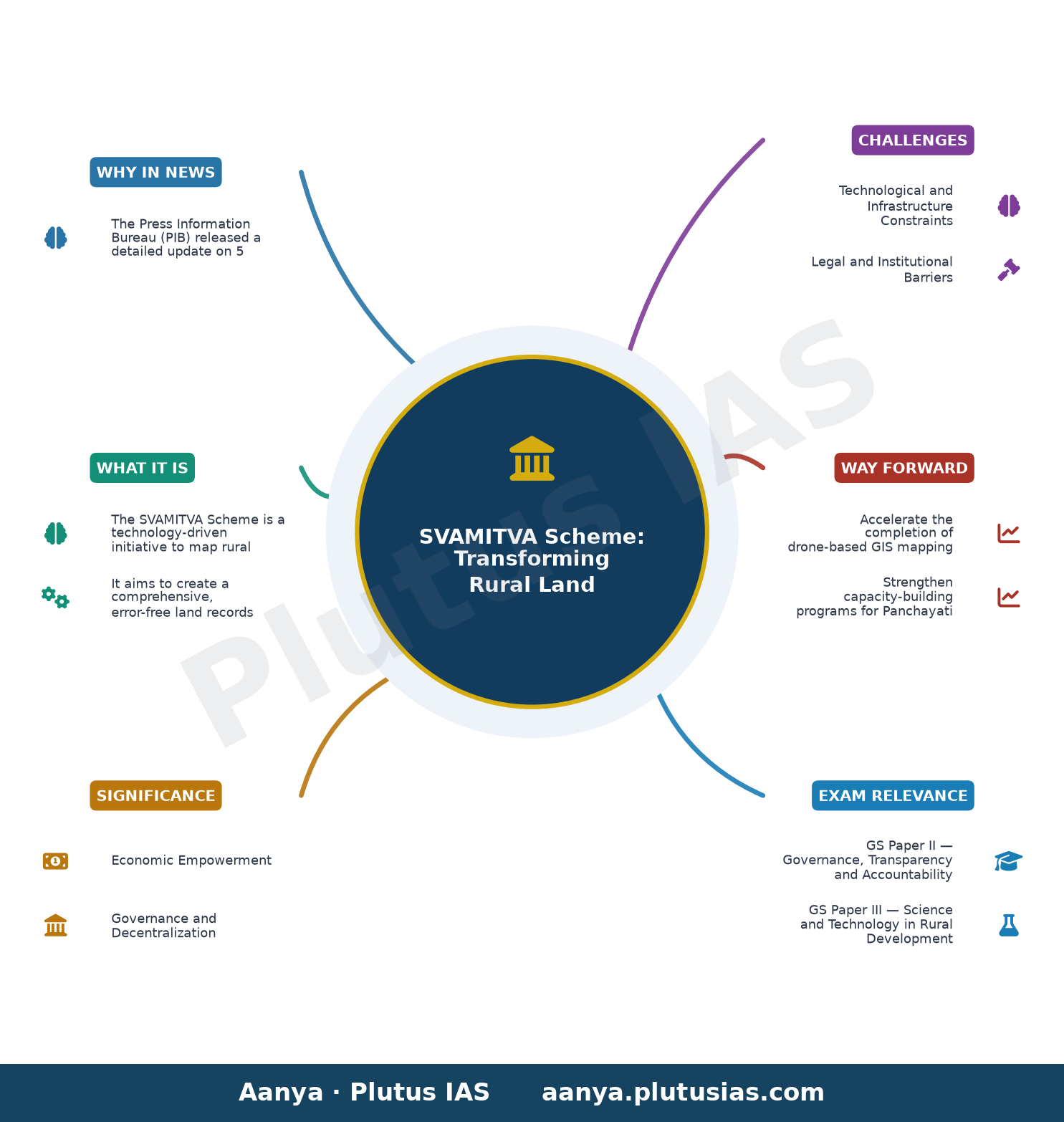
The Press Information Bureau (PIB) released a detailed update on 5 August 2026 regarding the progress of the SVAMITVA Scheme, highlighting its role in mapping 3.30 lakh villages, facilitating ₹1,713 crore in loans through property cards, and enabling evidence-based planning for Gram Panchayats. This development underscores the scheme’s significance in addressing land disputes, enhancing rural credit access, and strengthening decentralised governance through geospatial technology.
Background
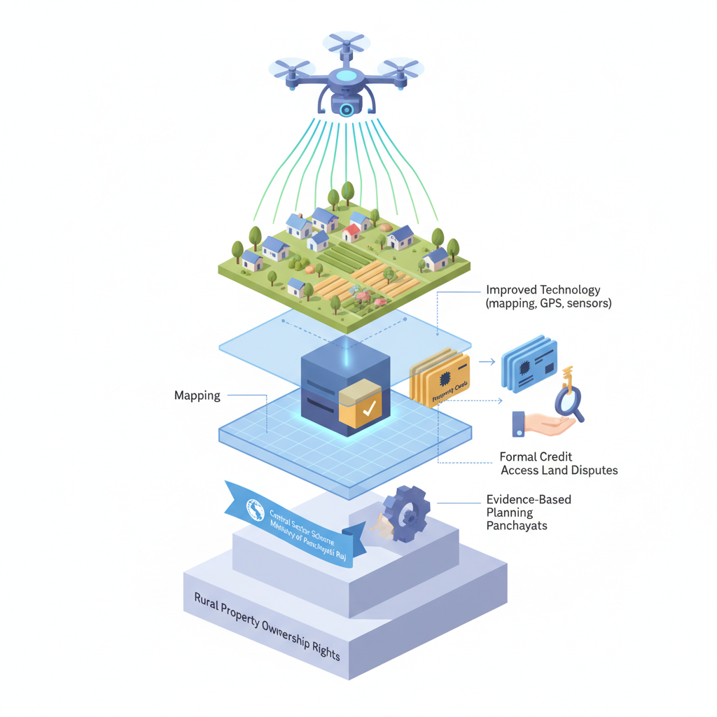
- The SVAMITVA (Survey of Villages and Mapping with Improvised Technology in Village Areas) Scheme was launched in April 2020 as a Central Sector Scheme under the Ministry of Panchayati Raj.
- The scheme aims to provide ‘Record of Rights’ to rural property owners, thereby reducing land disputes and facilitating formal credit access.
- It leverages cutting-edge technologies such as drone surveys, GIS mapping, and Continuously Operating Reference Stations (CORS) for high-precision land demarcation.
- The scheme is implemented in collaboration with the Survey of India, State Governments, and local Panchayati Raj Institutions.
- The Gram Panchayat Development Plan (GPDP) is a statutory requirement under the 73rd Constitutional Amendment Act, 1992, which mandates participatory planning at the grassroots level.
- Land disputes in rural India are a significant impediment to agricultural productivity, credit access, and socio-economic development.
What is the SVAMITVA Scheme?
- The SVAMITVA Scheme is a technology-driven initiative to map rural inhabited areas using drone surveys and GIS-based technologies, ensuring precise land demarcation and legal clarity of property rights.
- It aims to create a comprehensive, error-free land records system in rural India, reducing disputes and enabling property owners to avail formal credit facilities.
- The scheme utilises Continuously Operating Reference Stations (CORS) to enhance the accuracy of drone-based surveys, achieving sub-centimetre precision in land mapping.
- Under SVAMITVA, ‘Property Cards’ are issued to rural property owners, which serve as legal documents for land ownership and can be used as collateral for bank loans.
- As of August 2026, over 3.30 lakh villages have been surveyed, and property cards have facilitated loans worth ₹1,713 crore across 11,147 cases.
- The scheme integrates geospatial data with Gram Panchayat Development Plans (GPDPs), enabling evidence-based planning for rural infrastructure, resource allocation, and developmental priorities.
- SVAMITVA strengthens decentralised governance by empowering local bodies with accurate spatial data, thereby improving transparency, accountability, and participatory decision-making.
Key Features
| Feature | Significance |
|---|---|
| Drone-based GIS mapping with CORS technology | Enables high-precision demarcation of rural inhabited areas, reducing property disputes through accurate boundary delineation. |
| Transparent ground verification and dispute resolution | Ensures fairness and accuracy in property rights records by resolving disputes through a participatory process. |
| Issuance of Swamitva Property Cards | Facilitates formal recognition of rural property ownership, enabling access to credit and financial inclusion. |
| Integration with Gram Manchitra App | Provides village-level geospatial data for evidence-based planning, infrastructure monitoring, and resource allocation in Gram Panchayats. |
| Collaborative implementation by MoPR, Survey of India, and state governments | Ensures technical standardization, inter-state coordination, and efficient resource utilization for nationwide coverage. |
Why it Matters
Economic Empowerment
- Formal property rights enable rural landowners to access institutional credit, as evidenced by ₹1,713 crore in loans disbursed against Swamitva Property Cards.
- Reduction in property disputes enhances market efficiency by lowering transaction costs and legal uncertainties.
- Facilitates rural asset monetization, supporting agricultural productivity and non-farm economic activities.
Governance and Decentralization
- Strengthens Gram Panchayats through evidence-based planning using geospatial data for Gram Panchayat Development Plans (GPDP).
- Enhances transparency in rural resource management by mapping public infrastructure, natural resources, and community assets.
- Supports convergence of multiple welfare schemes by providing a unified spatial data platform for resource allocation.
Legal and Administrative Reforms
- Establishes a clear legal framework for rural property rights, reducing ambiguity in land records.
- Promotes digital governance by integrating GIS-based mapping with Panchayati Raj institutions.
- Facilitates dispute resolution through standardized procedures, reducing litigation burden on courts.
Technological Advancement
- Leverages cutting-edge technologies (drone surveys, CORS, GIS) for high-precision rural mapping.
- Enables real-time monitoring of rural development projects and infrastructure gaps.
- Creates a scalable model for digital land governance that can be replicated in urban and peri-urban areas.
Challenges
1. Technological and Infrastructure Constraints
- High dependence on advanced technologies (drones, CORS) may limit implementation in remote or inaccessible rural areas.
- Ensuring consistent internet connectivity for real-time data processing and dispute resolution remains a challenge.
- Training and capacity-building for local officials and survey teams require sustained investment.
UPSC Link: GS3: Science and Tech; GS2: Governance
2. Legal and Institutional Barriers
- Overlapping land records and conflicting claims may delay the issuance of Swamitva Property Cards.
- Coordination among multiple stakeholders (MoPR, Survey of India, state governments) necessitates robust inter-departmental mechanisms.
- Ensuring legal sanctity of digitally generated property records requires amendments to existing land laws.
UPSC Link: GS2: Federalism; GS2: Judiciary
3. Financial and Resource Allocation Challenges
- Large-scale implementation demands significant financial resources for technology procurement, training, and monitoring.
- Sustainable funding models for maintenance and updates of geospatial databases need to be institutionalized.
- Equitable distribution of benefits across states requires targeted resource allocation based on need.
UPSC Link: GS3: Resource Mobilization
4. Social and Cultural Resistance
- Traditional land ownership systems may resist formalization due to cultural or customary practices.
- Lack of awareness among rural populations about the benefits of Swamitva Property Cards could hinder adoption.
- Ensuring gender-inclusive land rights requires proactive measures to address patriarchal landholding norms.
UPSC Link: GS1: Social Justice; GS2: Governance
Challenges — UPSC Perspective
| Issue | Concern |
|---|---|
| Dispute Resolution Delays | Conflicting land claims and inadequate documentation may prolong the issuance of property cards. |
| Technological Accessibility | Remote areas may lack the infrastructure to support drone surveys and real-time GIS mapping. |
| Data Privacy and Security | Geospatial data sharing raises concerns about unauthorized access and misuse of sensitive land records. |
| Inter-State Coordination | Differences in land records formats and legal frameworks across states complicate nationwide implementation. |
| Financial Sustainability | Long-term funding for maintenance and updates of geospatial databases remains uncertain. |
| Awareness and Participation | Low awareness among rural communities about the Swamitva scheme may limit its effectiveness. |
Way Forward
- Accelerate the completion of drone-based GIS mapping in remaining villages through targeted state-level interventions.
- Strengthen capacity-building programs for Panchayati Raj officials and survey teams to ensure accurate data collection and dispute resolution.
- Establish a dedicated fund for the maintenance and periodic updating of geospatial databases to ensure data integrity.
- Promote awareness campaigns in rural areas to educate landowners about the benefits of Swamitva Property Cards and the dispute resolution process.
- Develop standardized legal frameworks to recognize digitally generated property records and resolve overlapping claims.
- Enhance inter-state coordination mechanisms to ensure uniformity in land records and seamless data sharing.
- Integrate Swamitva data with other digital governance platforms (e.g., PM-KISAN, MGNREGA) for convergence and efficiency.
- Conduct periodic audits of the Swamitva scheme to assess its impact on rural credit access, dispute reduction, and infrastructure development.
UPSC Value Addition
Keywords for Mains Answer-Writing
SVAMITVA Scheme · Drone-based land mapping · Continuously Operating Reference Station (CORS) · GIS-based spatial planning · Property rights in rural India · Gram Panchayat Development Plans (GPDP) · Digital property records · Land disputes resolution · Financial inclusion through land records · Panchayati Raj Institutions (PRIs) · Geospatial data governance · Rural infrastructure planning
Constitutional & Policy Linkages
- Article 243G: Powers, authority and responsibilities of Panchayats (decentralized planning and governance).
- Article 243W: Functions of Municipalities (analogous decentralization for rural areas).
Concept Flow
Rural land ownership ambiguity → Disputes and lack of formal records → Swamitva Scheme launched for property rights formalization → Drone-based GIS mapping with CORS technology → High-precision rural land demarcation → Accurate property records → Transparent ground verification and dispute resolution → Fair and legally recognized Swamitva Property Cards → Issuance of Property Cards → Access to institutional credit and financial inclusion for rural landowners → Integration with Gram Manchitra App → Geospatial data for evidence-based Gram Panchayat Development Plans (GPDP) → Enhanced governance and resource allocation → Reduced disputes, improved infrastructure, and sustainable rural development
Prelims Practice Questions
Q1. Consider the following statements regarding the SVAMITVA Scheme:
1. It aims to provide property rights records to rural landowners using drone-based mapping.
2. The scheme uses Continuously Operating Reference Station (CORS) technology for high-precision GIS mapping.
3. The scheme is implemented solely by the Ministry of Rural Development without any state government involvement.
4. The Gram Manchitra app integrates spatial data for evidence-based Gram Panchayat Development Plans (GPDP).
How many of the above statements are correct?
- Only one
- Only two
- Only three
- All
Answer: Only three — Statements 1, 2, and 4 are correct. Statement 3 is incorrect as the scheme is implemented in collaboration with state governments and the Survey of India.
Q2. Assertion (A): The SVAMITVA Scheme facilitates financial inclusion by enabling banks to extend loans against property cards.
Reason (R): The scheme provides legally verifiable property records, reducing disputes and enhancing asset valuation.
Options:
A. Both A and R are true, and R is the correct explanation of A.
B. Both A and R are true, but R is not the correct explanation of A.
C. A is true, but R is false.
D. A is false, but R is true.
- A
- B
- C
- D
Answer: A — Both the assertion and reason are true. The scheme’s property cards serve as legally verifiable records, enabling banks to assess collateral value accurately, thus facilitating loan disbursal.
Q3. Match the following technologies/tools with their respective roles in the SVAMITVA Scheme:
Column I
1. Drone-based mapping
2. CORS technology
3. Gram Manchitra app
4. GIS-based spatial planning
Column II
A. High-precision land boundary demarcation
B. Real-time correction of GPS data for accuracy
C. Integration and visualization of village-level spatial data
D. Evidence-based planning of rural infrastructure
Options:
1-A, 2-B, 3-C, 4-D
1-B, 2-A, 3-D, 4-C
1-A, 2-B, 3-D, 4-C
1-D, 2-C, 3-A, 4-B
- 1-A, 2-B, 3-C, 4-D
- 1-B, 2-A, 3-D, 4-C
- 1-A, 2-B, 3-D, 4-C
- 1-D, 2-C, 3-A, 4-B
Answer: 1-A, 2-B, 3-C, 4-D — 1-A: Drones capture high-resolution images for boundary demarcation. 2-B: CORS corrects GPS signals in real-time for precision. 3-C: Gram Manchitra visualizes village-level spatial data. 4-D: GIS-based planning supports infrastructure development.
Mains Practice Question
✍ ‘The SVAMITVA Scheme represents a paradigm shift in rural governance by integrating geospatial technology with decentralized planning.’ Critically examine this statement with reference to the scheme’s objectives, technological components, and its impact on rural development. Also, assess the challenges in its implementation and suggest measures to enhance its effectiveness. (15 Marks)
Approach: MODEL-ANSWER SKELETON:
1. Introduction (2 marks):
– Define SVAMITVA Scheme and its primary objective: providing property rights records to rural landowners.
– Mention the scheme’s launch year (2020), implementing agencies (Ministry of Panchayati Raj, Survey of India, state governments), and technological pillars (drone-based mapping, CORS, GIS).
2. Objectives and Technological Integration (4 marks):
– Primary objective: reducing property disputes, enabling financial inclusion via property cards, and empowering PRIs.
– Technological components:
a. Drone-based mapping for high-precision land records.
b. CORS technology for real-time GPS correction and accuracy.
c. GIS-based spatial planning for evidence-based GPDP preparation.
– Role of Gram Manchitra app in integrating spatial data for decentralized planning.
3. Impact on Rural Development (4 marks):
– Financial inclusion: Disbursal of ₹1,713 crore loans against 11,147 property cards (data as of August 2026).
– Reduction in land disputes through transparent record-keeping.
– Empowerment of PRIs: Enabling evidence-based planning of rural infrastructure (roads, public amenities, water bodies).
– Strengthening of Gram Sabhas and participatory governance.
4. Challenges in Implementation (3 marks):
– Technological barriers: Limited access to CORS infrastructure in remote areas.
– Institutional capacity: Variability in state government participation and PRI capabilities.
– Socio-economic hurdles: Resistance from local elites or communities due to entrenched property disputes.
– Data privacy concerns: Safeguarding geospatial data from misuse.
5. Measures to Enhance Effectiveness (2 marks):
– Strengthening CORS network coverage, especially in hilly and tribal regions.
– Capacity-building programs for PRIs and state officials on GIS and drone technology.
– Community sensitization campaigns to ensure acceptance and participation.
– Legal reforms to streamline dispute resolution mechanisms.
Conclusion (2 marks):
– Reiterate the scheme’s transformative potential in rural governance and development.
– Emphasize the need for sustained technological and institutional support to realize its full benefits.
Source: PIB (Press Information Bureau)
Generated by AanyaAi for educational purpose.

- विशेष अभियान 6: रेलवे में लंबित मामलों के निपटान और स्वच्छता को संस्थागत रूप देने की तैयारी शुरू, जानिए पूरी योजना - September 21, 2026
- Railway Special Campaign 6: Key Focus Areas for UPSC & State PCS 2026 - September 21, 2026
- UPSC Civil Services (Main) Examination 2026 — Sanskrit Literature Paper II: Question Paper | Plutus IAS - September 21, 2026

No Comments