


28 Sep UPSC Alert: Government Cracks Down on Patwaris for SVAMITVA Scheme Refusals
✎ SVAMITVA Scheme is a drone-based land titling initiative under the Ministry of Panchayati Raj, aimed at providing property rights to rural households through digital land records and reducing land disputes.
Subject Relevance — Where This Topic Fits
- GS Paper II — Governance, Transparency and Accountability | GS Paper III — Land Reforms and Rural Development
- Prelims: SVAMITVA Scheme, Digital Land Records, Patwari System, Land Titling, Revenue Administration
- Essay: Land Ownership and Rural Development: Balancing Efficiency and Equity
Quick Revision: SVAMITVA Scheme is a drone-based land titling initiative under the Ministry of Panchayati Raj, aimed at providing property rights to rural households through digital land records and reducing land disputes.
Why is this in the news?
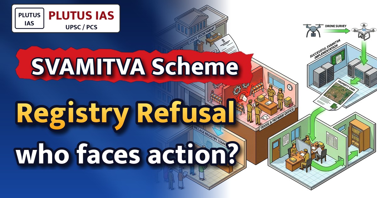
The Government of Madhya Pradesh has directed district collectors to enforce the registration process under the SVAMITVA (Survey of Villages and Mapping with Improvised Technology in Village Areas) Scheme, following resistance from patwaris (village revenue officials) in executing land registries. This directive underscores the administrative challenges in implementing land titling reforms and the government’s commitment to resolving procedural bottlenecks to ensure timely completion of the scheme.
Background
- The scheme seeks to demarcate property boundaries, create a comprehensive land record system, and reduce disputes over land ownership.
- Patwaris, as revenue officials, play a pivotal role in maintaining land records and facilitating registries under the scheme.
- Delays in registration have been attributed to administrative inertia, lack of awareness among patwaris, and resistance to adopting digital tools.
- The scheme is implemented through a multi-departmental coordination framework, with the Revenue Department as the nodal agency.
- Madhya Pradesh, one of the states with significant rural landholdings, has faced challenges in operationalising the scheme uniformly.
What is the SVAMITVA Scheme?
- The scheme leverages drone-based aerial surveys, satellite imagery, and GIS technology to map rural habitation and prepare accurate land records.
- Its primary objective is to create a ‘Record of Rights’ for village households, thereby conferring ownership rights and reducing land disputes.
- The scheme is implemented in phases, covering all rural inhabited areas across the country, with a target to cover approximately 6.62 lakh villages.
- Under SVAMITVA, property cards are issued to rural landowners, which can be used for availing bank loans, facilitating land transactions, and resolving ownership disputes.
- The scheme aligns with the Digital India Land Records Modernisation Programme (DILRMP) and complements efforts to digitise land records nationwide.
- Technological interventions include the use of Continuously Operating Reference Stations (CORS) for high-precision mapping and the ‘Sampada’ app for digital land record management.
Key Features
| Feature | Significance |
|---|---|
| Nodal Agency Designation (Revenue Department) | Centralises coordination, implementation, and monitoring of SVAMITVA to ensure uniformity and accountability in rural land records digitisation. |
| Role of Collectors | Empowers district magistrates to enforce directives, resolve bottlenecks, and ensure timely completion of registration processes under SVAMITVA. |
| Patwari Responsibilities | Mandates field-level execution of registration duties as per government directives, with penalties for non-compliance to prevent procedural delays. |
| Technical Support (Science & Technology Dept.) | Facilitates digital infrastructure, GIS mapping, and drone-based survey technologies essential for accurate property delineation. |
| Coordination Mechanism (Commercial Tax Dept.) | Ensures seamless integration of revenue records with land registration systems to maintain data integrity and inter-departmental synergy. |
Why it Matters
Economic
- Enhances rural asset monetisation by providing clear land titles, enabling access to formal credit and reducing disputes over land ownership.
- Supports agricultural productivity through unambiguous land records, facilitating better land-use planning and investment in rural infrastructure.
- Stimulates local economies by reducing transaction costs and legal uncertainties in land transactions, particularly in peri-urban areas.
Legal-Administrative
- Strengthens the credibility of land records by integrating drone surveys, GIS mapping, and digital registration under a unified framework.
- Reduces litigation over land disputes by establishing verifiable, tamper-proof records, thereby improving governance efficiency.
- Clarifies institutional roles (Revenue Dept., Collectors, Patwaris) to eliminate jurisdictional ambiguities and streamline implementation.
Social
- Empowers rural landowners, especially women and marginalised communities, by providing legal recognition of land rights and reducing gender-based disparities in land ownership.
- Promotes financial inclusion by enabling landowners to use property as collateral for loans, thereby expanding access to formal banking services.
- Fosters rural development by creating a transparent land market, attracting private investment in agriculture and allied sectors.
Technological
- Leverages emerging technologies (drones, GIS, e-governance portals) to modernise land records, ensuring scalability and real-time updation.
- Facilitates inter-departmental data sharing, reducing duplication of efforts and improving the accuracy of land-related records.
- Enhances transparency and reduces corruption by digitising land records and automating registration processes.
Challenges
1. Implementation Bottlenecks
- Resistance from ground-level functionaries (Patwaris) due to perceived loss of discretionary powers or additional workload without adequate incentives.
- Inadequate training and capacity-building for revenue officials on digital tools (e.g., SVAMITVA app, GIS mapping) leading to operational inefficiencies.
- Delays in drone surveys and data processing due to weather constraints, terrain challenges, or logistical constraints in remote areas.
UPSC Link: GS-II: Governance, GS-III: Technology & Rural Development
2. Data Integrity and Verification
- Risk of inaccuracies in drone-based surveys due to vegetation cover, cloud cover, or outdated base maps, requiring ground-truthing mechanisms.
- Potential for disputes arising from overlapping claims or historical encroachments, necessitating robust grievance redressal systems.
- Ensuring seamless integration of legacy records with digital systems without eroding the legal validity of existing land titles.
UPSC Link: GS-II: Governance, GS-III: Land Reforms
3. Institutional Coordination
- Fragmented roles among departments (Revenue, Science & Technology, Panchayati Raj) may lead to coordination gaps and delays in implementation.
- Lack of standardised protocols for inter-departmental data sharing, risking inconsistencies in land records across jurisdictions.
- Need for continuous monitoring and feedback loops to address grievances and ensure timely resolution of disputes.
UPSC Link: GS-II: Governance, GS-IV: Ethics in Governance
4. Public Awareness and Participation
- Low awareness among rural landowners about the benefits of SVAMITVA, leading to passive resistance or non-participation in the registration process.
- Skepticism about the government’s commitment to sustaining the programme, particularly in regions with a history of failed land reforms.
- Ensuring inclusive participation, especially of women, Scheduled Castes, and Scheduled Tribes, to prevent exclusion from the benefits of land titling.
UPSC Link: GS-II: Governance, GS-IV: Social Justice
5. Legal and Policy Framework
- Ambiguities in existing land laws (e.g., tenancy laws, inheritance rights) may hinder the recognition of land titles under SVAMITVA.
- Need for clear guidelines on the legal sanctity of drone-based surveys and digital records to prevent future litigation.
- Ensuring alignment with state-specific land revenue codes and constitutional provisions (e.g., Article 243G) to avoid conflicts.
UPSC Link: GS-II: Governance, GS-II: Constitution
Challenges — UPSC Perspective
| Issue | Concern |
|---|---|
| Patwari Resistance | Non-compliance with registration directives due to perceived loss of authority or workload concerns. |
| Digital Literacy Gaps | Inadequate training of revenue officials on SVAMITVA app and GIS tools, leading to operational inefficiencies. |
| Data Accuracy Risks | Potential inaccuracies in drone surveys due to vegetation cover or outdated base maps, requiring ground-truthing. |
| Inter-Departmental Coordination | Fragmented roles among departments may lead to delays or inconsistencies in implementation. |
| Public Awareness Deficit | Low participation from rural landowners due to lack of awareness about the benefits of land titling. |
| Legal Ambiguities | Unclear provisions in existing land laws may hinder the recognition of digital land records under SVAMITVA. |
Government Initiatives — Must-Memorise for Prelims
- SVAMITVA (Survey of Villages and Mapping with Improvised Technology in Village Areas)
Way Forward
- Conduct targeted capacity-building programmes for Patwaris and revenue officials on SVAMITVA protocols, digital tools, and grievance redressal mechanisms.
- Establish a dedicated grievance redressal cell at the district level to address disputes arising from drone surveys or overlapping claims.
- Accelerate drone surveys in remote and hilly regions by leveraging seasonal weather windows and deploying additional survey teams.
- Launch a multi-channel awareness campaign in local languages to educate rural landowners about the benefits of land titling and the registration process.
- Strengthen inter-departmental coordination by formalising standard operating procedures (SOPs) for data sharing and role delineation.
- Pilot a performance-linked incentive system for revenue officials to ensure timely completion of registration processes.
- Integrate SVAMITVA records with land revenue databases to ensure seamless updation and reduce duplication of efforts.
- Conduct periodic audits of drone survey data to validate accuracy and address discrepancies through ground-truthing.
UPSC Value Addition
Keywords for Mains Answer-Writing
SVAMITVA Scheme · Property rights in rural areas · Patwari system and land records · Digital land records · Land titling and registration · Revenue administration reforms · Role of Collectors in land governance · E-governance in land records · Land disputes and resolution · Nodal agencies in governance · Constitutional provisions on land records · Land Revenue Code · Property rights and socio-economic development
Constitutional & Policy Linkages
- Article 243G (Powers, authority and responsibilities of Panchayats) – Empowers local bodies to manage land records and rural development.
- Article 300A (Right to Property) – Ensures that land titles issued under SVAMITVA are legally recognised and protected.
Concept Flow
Government directive mandating Patwaris to execute SVAMITVA registration under Revenue Department oversight. → Role delineation among departments (Revenue, Science & Technology, Panchayati Raj) to streamline implementation. → Ground-level execution by Patwaris using digital tools (SVAMITVA app, GIS mapping) for land surveys and registration. → Data integration and verification through drone surveys and inter-departmental coordination. → Issuance of land titles to rural landowners, enabling access to formal credit and reducing disputes. → Monitoring and grievance redressal to ensure accuracy, transparency, and public participation in the process.
Prelims Practice Questions
Q1. Consider the following statements regarding the SVAMITVA Scheme:
1. It aims to provide ‘Record of Rights’ to village household owners in rural inhabited areas.
2. The scheme is implemented by the Ministry of Panchayati Raj.
3. The scheme uses drone technology for surveying and mapping.
4. The scheme is applicable only to revenue villages in hilly regions.
How many of the above statements are correct?
- A. Only one
- B. Only two
- C. Only three
- D. All four
Answer: C. Only three — Statements 1, 2, and 3 are correct. The SVAMITVA Scheme aims to provide property rights to rural household owners, is implemented by the Ministry of Panchayati Raj, and uses drone technology for surveying. Statement 4 is incorrect as the scheme is applicable to all revenue villages, not just hilly regions.
Q2. Assertion (A): The Patwari system in India is a legacy of the colonial administration and is primarily responsible for maintaining land records.
Reason (R): The Patwari system has been modernized under the SVAMITVA Scheme to integrate digital land records and reduce disputes.
Options:
A. Both A and R are true, and R is the correct explanation of A.
B. Both A and R are true, but R is not the correct explanation of A.
C. A is true, but R is false.
D. A is false, but R is true.
- A
- B
- C
- D
Answer: C — Assertion (A) is true as the Patwari system is a colonial legacy and responsible for land records. Reason (R) is also true, but it does not directly explain the assertion; rather, it describes a modern reform. Hence, both are true, but R is not the correct explanation of A.
Q3. Match the following columns with reference to the SVAMITVA Scheme:
Column I (Agency/Department) | Column II (Role in the Scheme)
1. Ministry of Panchayati Raj | A. Nodal agency for overall coordination and implementation
2. Ministry of Rural Development | B. Technical support for drone-based surveying
3. Department of Science & Technology | C. Local-level implementation and coordination
4. State Revenue Department | D. Provision of financial resources and monitoring
Options:
A. 1-A, 2-D, 3-B, 4-C
B. 1-C, 2-D, 3-B, 4-A
C. 1-A, 2-B, 3-D, 4-C
D. 1-D, 2-A, 3-C, 4-B
- A
- B
- C
- D
Answer: A — 1-A (Ministry of Panchayati Raj is the nodal agency), 2-D (Ministry of Rural Development provides financial resources), 3-B (Department of Science & Technology provides technical support), 4-C (State Revenue Department handles local-level coordination).
Mains Practice Question
✍ The SVAMITVA Scheme represents a transformative approach to land governance in rural India by leveraging technology and administrative reforms. Critically examine the scheme’s objectives, institutional framework, and challenges in implementation. Also, analyse how the scheme addresses the long-standing issue of land disputes and property rights in rural areas. (15 Marks)
Approach: MODEL-ANSWER SKELETON:
1. **Objectives of SVAMITVA Scheme**:
– Provide ‘Record of Rights’ to village household owners in rural inhabited areas (Section 109 of the Land Revenue Code).
– Reduce property disputes and litigation by creating a clear, verifiable land record system.
– Facilitate bank loans and economic development by enabling property as collateral.
– Integrate drone technology for accurate surveying and mapping (Survey of India guidelines).
2. **Institutional Framework**:
– Nodal Agency: Ministry of Panchayati Raj (as per the scheme’s operational guidelines).
– Technical Support: Department of Science & Technology (for drone-based surveying and GIS mapping).
– Financial Support: Ministry of Rural Development (for funding and monitoring).
– State-Level Coordination: Revenue Department (implementation and dispute resolution).
– Local-Level Execution: Collectors, Patwaris, and Panchayati Raj Institutions (as per the Land Revenue Code and Panchayati Raj Acts).
3. **Challenges in Implementation**:
– **Administrative Resistance**: Patwaris’ reluctance to adapt to digital records (as highlighted in the news).
– **Technological Barriers**: Limited access to drones and GIS tools in remote areas.
– **Legal Hurdles**: Overlapping land records and disputes over customary rights (e.g., forest rights under FRA 2006).
– **Capacity Gaps**: Inadequate training of revenue officials in digital record-keeping.
– **Socio-Cultural Factors**: Resistance from local elites or communities with vested interests in land disputes.
4. **Addressing Land Disputes and Property Rights**:
– **Dispute Resolution Mechanism**: Establishment of Revenue Courts under the Land Revenue Code for quick resolution.
– **Digital Land Records**: Integration with the ‘Bhu-Naksha’ portal for real-time record updates (as per the Digital India Land Records Modernization Programme).
– **Public Awareness**: Campaigns to educate rural communities on the benefits of property rights and dispute resolution.
– **Constitutional Safeguards**: Alignment with Articles 300A (right to property) and Directive Principles of State Policy (Article 39(b) and (c)).
5. **Critical Analysis**:
– **Strengths**: Technological leapfrogging, reduction in litigation costs, and empowerment of rural households.
– **Limitations**: Over-reliance on administrative will, potential exclusion of marginalized communities, and lack of a unified legal framework for customary rights.
6. **Conclusion**:
– The SVAMITVA Scheme is a progressive step toward modernizing land governance, but its success hinges on overcoming administrative, technological, and socio-legal challenges. A multi-stakeholder approach involving communities, technology providers, and legal institutions is essential for sustainable implementation.
Source: amarujala.com
Generated by AanyaAi for educational purpose.
Related guides on our sites
- Best PSIR optional coaching for upsc
- Best PSIR optional teacher for upsc
- Best teacher of PSIR optional for upsc
- Best PSIR optional coaching in delhi for UPSC

- Rajasthan Panchayati Raj Elections: New Rules, Fines & Disqualification - September 28, 2026
- सेना प्रमुख का बड़ा बयान: जीत जमीन से ही तय होती है, तकनीक नहीं बदल सकती युद्ध की प्रकृति - September 28, 2026
- UPSC Alert: Government Cracks Down on Patwaris for SVAMITVA Scheme Refusals - September 28, 2026

No Comments