


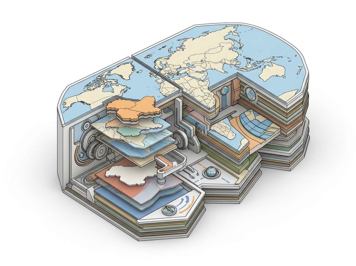
06 Sep UN Resolution on World Map: India Demands Accurate Depiction of J&K, Ladakh
✎ Cartographic sovereignty is a state’s exclusive right to define and represent its territorial boundaries in official maps, and any UN-backed resolution on global cartography must align with this sovereign authority without…
Subject Relevance — Where This Topic Fits
- GS Paper II — International Relations: Sovereignty, Territorial Integrity, and UN System | GS Paper II — International Organisations: Role of the United Nations General Assembly
- Prelims: UN General Assembly resolution on cartographic representation, Equal-area map projections, Union Territories of Jammu & Kashmir and Ladakh, Sovereignty and territorial integrity, Cartographic sovereignty
- Essay: The interplay between sovereignty, diplomacy, and scientific representation in international relations, The role of the United Nations in shaping global norms and standards
Quick Revision: Cartographic sovereignty is a state’s exclusive right to define and represent its territorial boundaries in official maps, and any UN-backed resolution on global cartography must align with this sovereign authority without endorsing specific political boundaries.
Why is this in the news?
The Ministry of External Affairs (MEA) has asserted India’s sovereign right to demand that any United Nations-backed world map must depict the Union Territories of Jammu & Kashmir and Ladakh in strict accordance with India’s official cartographic representation. This statement follows India’s vote in favour of a UN General Assembly resolution (A/78/L.11) titled ‘Correct the Map: Rebalancing Global Cartographic Representation and Promoting Equitable Representation of the World’s Regions, Particularly Africa,’ adopted on 4 September 2026. The resolution, while promoting the use of equal-area projections to preserve continental landmass proportions, does not endorse specific political boundaries, thereby necessitating India’s clarification to safeguard its territorial integrity.
Background
- The United Nations has historically played a role in standardising cartographic practices through resolutions and technical committees, though these have rarely addressed political boundaries directly.
- India’s official map of Jammu & Kashmir and Ladakh reflects the 2019 constitutional changes that reorganised the erstwhile state into two Union Territories, a move contested by Pakistan but recognised by India as a sovereign domestic matter.
- Cartographic sovereignty refers to a state’s authority to define and represent its territorial boundaries in official and public documents, including maps, without external interference.
- The UN resolution, sponsored by Togo, aims to address perceived distortions in Mercator projections, which exaggerate the size of landmasses near the poles and minimise those near the equator, particularly affecting African and other Global South regions.
- India’s vote in favour of the resolution was accompanied by an ‘Explanation of Vote’ (EoV) to clarify that the resolution does not constitute an endorsement of any specific map or boundary depiction, including disputed territories.
- The abstentions from Estonia, Georgia, Lithuania, Moldova, Serbia, and Ukraine, and the lone ‘No’ vote from the United States, underscore the resolution’s technical rather than political nature, though its adoption reflects evolving norms in global cartography.
What is cartographic sovereignty and how does it intersect with international law?
- Cartographic sovereignty is the exclusive right of a state to determine the official representation of its territorial boundaries in maps, atlases, and digital cartographic tools, grounded in the principle of territorial integrity under international law (e.g., UN Charter, Article 2(4)).
- States exercise cartographic sovereignty through national mapping agencies (e.g., Survey of India) that produce official maps, which serve as legal and administrative references for governance, defence, and diplomacy.
- The United Nations Group of Experts on Geographical Names (UNGEGN) and the International Cartographic Association (ICA) provide technical standards for map projections and toponymy, but these do not supersede a state’s sovereign right to define its boundaries.
- Disputes over cartographic representation often arise when international organisations or foreign entities depict disputed or sensitive territories differently from a state’s official stance (e.g., Jammu & Kashmir, Arunachal Pradesh, or Aksai Chin in the case of India).
- The 1949 Geneva Conventions and their Additional Protocols require states to respect the territorial integrity of other states, indirectly reinforcing the importance of accurate cartographic representation in conflict zones.
- Equal-area projections, such as the Gall-Peters or Mollweide, are promoted in the UN resolution to reduce Eurocentric distortions in global maps, but their adoption does not alter the legal status of territorial boundaries.
- India’s 2019 reorganisation of Jammu & Kashmir into two Union Territories was accompanied by updated official maps, which are now the sole authoritative references for India’s representation of these regions.
- The UN’s role in cartography is primarily technical and standard-setting, not adjudicatory; disputes over boundary representation are resolved through bilateral negotiations or international legal mechanisms (e.g., ICJ, ITLOS).
Key Features
| Feature | Significance |
|---|---|
| UN Resolution on Cartographic Representation | Aims to promote equal-area map projections to preserve the relative sizes of continental landmasses, addressing historical distortions in global cartography. |
| India’s Official Stance on Territorial Integrity | Reaffirms India’s sovereign claim over Union Territories of Jammu & Kashmir and Ladakh, rejecting any inaccurate or misleading depictions in global maps. |
| Explanation of Vote at UNGA | India clarified that the resolution does not endorse any specific map or boundary depiction, emphasizing the principle of equal-area cartographic representation. |
| Voting Pattern in UNGA | 164 nations voted in favour, 6 abstained, and 1 (United States) voted against, indicating broad consensus with selective reservations. |
| MEA Spokesperson’s Clarification | Underscored that the resolution is technical and apolitical, not addressing political cartography, disputed territories, or place names. |
Why it Matters
Geopolitical Implications
- Reinforces India’s firm position on territorial sovereignty, particularly in the context of J&K and Ladakh, aligning with constitutional and legal frameworks.
- Highlights India’s proactive diplomacy in multilateral forums to safeguard national interests without engaging in partisan rhetoric.
- Demonstrates India’s willingness to support global initiatives that promote scientific accuracy in cartography, provided they do not infringe on sovereign concerns.
- Exposes the limitations of UN resolutions in addressing boundary disputes, as the resolution explicitly excludes political cartography.
Cartographic and Scientific Relevance
- Equal-area projections are critical for accurate representation of landmasses, reducing distortions that historically favoured Western cartographic norms.
- The resolution’s focus on Africa underscores the need for decolonizing global cartographic practices and promoting equitable representation.
- Technical standards in map projections can influence geospatial data applications, including navigation, climate studies, and resource management.
- India’s emphasis on official maps aligns with the global trend of using standardized geospatial data for administrative and strategic purposes.
Diplomatic and Institutional Lessons
- India’s nuanced approach—supporting the resolution while clarifying its non-endorsement of specific maps—demonstrates diplomatic dexterity in multilateral engagements.
- The abstentions and dissenting vote (US) reflect underlying geopolitical sensitivities, particularly regarding territorial disputes and cartographic sovereignty.
- The episode underscores the importance of clear communication in international forums to prevent misinterpretation of national positions.
- Institutional mechanisms like the UNGA provide platforms for states to assert sovereign positions without resorting to coercive measures.
Challenges
1. Cartographic Sovereignty vs. Global Standards
- Balancing the adoption of global cartographic standards with the protection of sovereign territorial claims remains a persistent challenge for states.
- The risk of misrepresentation in global maps can lead to diplomatic friction, as inaccurate depictions may be perceived as challenges to sovereignty.
- Ensuring that technical resolutions do not inadvertently legitimize disputed territorial claims requires careful drafting and explanation of vote.
- The lack of binding enforcement mechanisms in UN resolutions complicates the implementation of cartographic standards.
UPSC Link: GS II: International Relations – Role of UN and its organs
2. Decolonization of Cartographic Practices
- Historical cartographic distortions, often favouring Western perspectives, continue to influence global map representations, necessitating systemic reforms.
- Promoting equal-area projections requires overcoming entrenched institutional biases in global mapping agencies and educational curricula.
- The resolution’s focus on Africa highlights the need for inclusive approaches to cartographic representation, addressing long-standing marginalization.
- Resistance from certain states (e.g., US vote against) may stem from reluctance to cede control over cartographic narratives.
UPSC Link: GS I: Globalization and its impact on society
3. Technical vs. Political Cartography
- Distinguishing between technical cartographic standards and political boundary disputes is essential to prevent misinterpretation of resolutions.
- The resolution’s exclusion of political cartography may limit its effectiveness in addressing disputes, as boundary issues often drive geopolitical tensions.
- States may exploit technical resolutions to advance political agendas, necessitating robust safeguards in drafting and implementation.
- The episode underscores the need for clearer definitions of ‘cartographic representation’ in international legal frameworks.
UPSC Link: GS II: Bilateral, Regional and Global Groupings and Agreements
4. Multilateral Diplomacy and National Interests
- Navigating multilateral forums to protect national interests without alienating allies or partners requires strategic foresight and diplomatic skill.
- The episode highlights the importance of proactive engagement in international institutions to shape agendas and prevent adverse outcomes.
- India’s approach—supporting the resolution while clarifying its stance—demonstrates a balanced strategy in multilateral diplomacy.
- The abstentions and dissenting vote reflect the complexities of aligning national interests with global consensus.
UPSC Link: GS II: Effect of Policies and Politics of Developed and Developing Countries
Challenges — UPSC Perspective
| Issue | Concern |
|---|---|
| Inaccurate Depictions in Global Maps | Risk of misrepresentation undermining sovereign claims over territories like J&K and Ladakh. |
| Decolonizing Cartographic Practices | Overcoming historical biases in global mapping that favour Western perspectives. |
| Technical vs. Political Cartography | Ensuring resolutions do not inadvertently address or legitimize political disputes. |
| Implementation of Equal-Area Projections | Challenges in adopting and enforcing new cartographic standards globally. |
| Diplomatic Friction from Misinterpretation | Risk of resolutions being misread as endorsements of specific territorial claims. |
| Lack of Binding Enforcement Mechanisms | Limited ability to ensure compliance with cartographic standards in the absence of legal obligations. |
Way Forward
- Conduct bilateral consultations with key stakeholders to clarify the resolution’s technical scope and India’s sovereign concerns.
- Engage with international cartographic bodies (e.g., UN Geospatial Information Section) to advocate for standardized equal-area projections.
- Strengthen domestic cartographic infrastructure to ensure alignment between official maps and global representations.
- Promote research and development in geospatial technologies to enhance the accuracy and accessibility of official maps.
- Facilitate public awareness campaigns to educate citizens on the importance of accurate cartographic representation.
- Collaborate with educational institutions to integrate modern cartographic standards into curricula, addressing historical distortions.
- Monitor global implementation of the resolution to identify and address any unintended political implications.
- Advocate for the inclusion of clearer definitions of ‘cartographic representation’ in future UN resolutions to avoid ambiguity.
UPSC Value Addition
Keywords for Mains Answer-Writing
United Nations · cartographic representation · territorial integrity · sovereignty · Union Territories of Jammu and Kashmir and Ladakh · UN General Assembly · equal-area map projections · political cartography · international boundaries · sovereign territory · UN resolution · External Affairs Ministry · geopolitical representation · UN member states · territorial disputes · geopolitical equity · UN cartographic initiatives · sovereign map depiction · UNGA voting pattern · geopolitical neutrality
Concept Flow
India’s official map reflects constitutional and legal sovereignty over J&K and Ladakh → UNGA resolution promotes equal-area cartographic representation → India supports resolution while clarifying non-endorsement of specific maps → Risk of misrepresentation in global maps → Potential diplomatic friction over territorial integrity → Need for proactive diplomacy to safeguard sovereign claims → Strengthening domestic cartographic standards and international advocacy.
Prelims Practice Questions
Q1. Consider the following statements regarding the UN resolution titled ‘Correct the Map: Rebalancing Global Cartographic Representation and Promoting Equitable Representation of the World’s Regions, Particularly Africa’:
1. The resolution was adopted by the UN General Assembly on September 4, 2026.
2. The resolution endorses a specific world map projection.
3. The resolution aims to promote equal-area cartographic representation.
4. The resolution addresses political cartography, including international boundaries and disputed territories.
How many of the above statements are correct?
- Only one
- Only two
- Only three
- All four
Answer: Only three — Statements 1 and 3 are correct. Statement 2 is incorrect as the resolution does not endorse any specific map projection. Statement 4 is incorrect as the resolution explicitly excludes political cartography, including international boundaries and disputed territories.
Q2. Assertion (A): India voted in favour of the UN resolution ‘Correct the Map’ while simultaneously asserting that its sovereign territory, including Union Territories of Jammu and Kashmir and Ladakh, must be depicted as per India’s official map.
Reason (R): The resolution encourages the use of equal-area map projections but does not authenticate or adopt any particular world map or address political cartography.
- Both A and R are true, and R is the correct explanation of A
- Both A and R are true, but R is not the correct explanation of A
- A is true, but R is false
- A is false, but R is true
Answer: Both A and R are true, but R is not the correct explanation of A — Both the assertion and reason are true. The resolution promotes equal-area projections but does not adopt or authenticate specific maps or address political boundaries, which aligns with India’s position on cartographic accuracy.
Q3. Match the following columns regarding the UN resolution ‘Correct the Map’:
Column I
A. Sponsor of the resolution
B. Objective of the resolution
C. India’s stance on the resolution
D. Countries that abstained from voting
Column II
1. Togo
2. Promote equal-area cartographic representation
3. Sovereign territory depiction as per official map
4. Estonia, Georgia, Lithuania, Moldova, Serbia, Ukraine
Answer: ? — A-1, B-2, C-3, D-4. The resolution was sponsored by Togo, aims to promote equal-area cartographic representation, India’s stance was to ensure sovereign territory depiction as per its official map, and the abstaining countries were Estonia, Georgia, Lithuania, Moldova, Serbia, and Ukraine.
Mains Practice Question
✍ The United Nations’ initiative to correct global cartographic representation through the resolution ‘Correct the Map’ seeks to promote equitable and accurate depiction of continental landmasses. In this context, critically examine the implications of such initiatives for the principles of sovereignty and territorial integrity in international relations. Also, evaluate how these initiatives align with India’s constitutional and diplomatic stance on the depiction of its Union Territories of Jammu and Kashmir and Ladakh. (15 Marks)
Approach: 1. **Introduction**: Define cartographic representation in international relations and its significance for sovereignty and territorial integrity. Mention the UNGA resolution and its objective of promoting equal-area projections.
2. **Sovereignty and Territorial Integrity**:
– Explain the principle of sovereignty as enshrined in the UN Charter (Article 2(1), Article 2(4)).
– Discuss territorial integrity as a corollary of sovereignty, citing the 1970 UN Declaration on Principles of International Law (Friendly Relations Declaration).
– Highlight how accurate cartographic representation reinforces these principles by preventing misrepresentation or disputes.
3. **UN Initiative and Its Implications**:
– Analyse the resolution’s focus on equal-area projections and its intent to address global cartographic inequities.
– Discuss the resolution’s exclusion of political cartography (boundaries, disputed territories) and its neutrality on national claims.
– Evaluate the potential benefits of such initiatives in promoting geopolitical equity and reducing cartographic biases.
4. **India’s Stance and Constitutional Framework**:
– Explain India’s official map depicting Union Territories of Jammu and Kashmir and Ladakh, grounded in the Jammu and Kashmir Reorganisation Act, 2019.
– Discuss the role of the External Affairs Ministry in asserting India’s position on cartographic accuracy.
– Highlight India’s consistent diplomatic stance on sovereignty and territorial integrity, citing Article 1(3) of the Constitution (territorial integrity) and the 1971 Simla Agreement.
5. **Alignment and Challenges**:
– Assess how the UN initiative aligns with India’s diplomatic and constitutional stance on sovereignty and territorial integrity.
– Discuss potential challenges: balancing global cartographic equity with national claims, avoiding politicisation of maps, and ensuring compliance among UN member states.
6. **Conclusion**: Summarise the importance of accurate cartographic representation in upholding sovereignty and territorial integrity, and the need for balanced approaches that respect both global equity and national sovereignty.
Source: orissapost.com
Jammu & Kashmir PCS (JKPSC (KAS)) — State PCS Practice
Prelims: Recently, the Ministry of External Affairs (MEA) emphasized that the UN-backed proposed world map must depict Jammu & Kashmir and Ladakh as per India’s official map. This assertion aligns with India’s stance on which of the following principles?
- A. Territorial integrity and sovereignty
- B. Non-alignment policy
- C. Economic integration with neighboring countries
- D. Cultural and religious homogeneity
Answer: A. Territorial integrity and sovereignty — India’s insistence on depicting Jammu & Kashmir and Ladakh as per its official map underscores its commitment to territorial integrity and sovereignty.
Mains: Critically analyze the significance of India’s recent diplomatic push at the UN to ensure that the proposed world map accurately reflects Jammu & Kashmir and Ladakh as integral parts of India. How does this stance reinforce India’s foreign policy objectives in the context of territorial disputes?
Generated by AanyaAi for educational purpose.
Related guides on our sites
- Anthropology VS PSIR
- Best PSIR optional coaching
- Best PSIR optional coaching online
- Best PSIR optional teacher

- UNEP Report 2026 Warns: Paris 1.5°C Target Slipping Away - October 23, 2026
- पूर्व आईएएस अधिकारी हत्या मामले में आईएएस एसोसिएशन की मुख्यमंत्री से मुलाकात - October 23, 2026
- UPSC Exam: Rare Glimpse of Ritwik Ghatak’s Cinematic Legacy at 4-Day Festival - October 23, 2026

No Comments